Old Maps of Rutherford County, Tennessee for Genealogy
Trace your family roots with 144 historic maps of Rutherford County. These high-res maps reveal old neighborhoods, homesites, landmarks, and streets — helping you uncover where your ancestors lived and how the area evolved over time.
- Explore historic neighborhoods: Identify where your relatives may have lived in the 1800s or 1900s.
- Compare maps over time: Trace the changes in streets, buildings, and landmarks for multi-generational research.
- Perfect for genealogy & ancestry research: Used by family historians and researchers to map out lineage and migration.
These maps are an incredible resource for exploring your personal connection to Rutherford County's past.
Rutherford County, TN maps
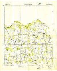
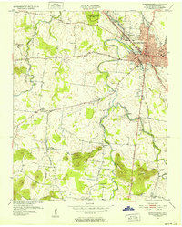
(144)- 1903 Map of Nashville
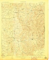
 1903 Nashville1903 Print · USGSTennessee's capital region is captured at the dawn of the 1900s, when iron pikes and river locks dominated local commerce. Trace ancestral routes along Stewarts Ferry Pike, find rural landmarks like Curry Mill, or locate historical sites like The Hermitage.4 unique versions available
 - 1908 Map of Woodbury
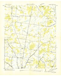
 1908 Woodbury1908 Print · USGSThe hill country of central Tennessee at the start of the century is documented here with incredible precision. Genealogists and historians can trace the foundations of communities like Woodbury and Readyville or locate landmarks like Hoovers Mill and Twelve Corners Church.2 unique versions available
 - 1913 Map of Hollow Springs
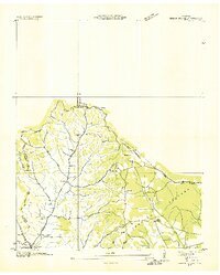
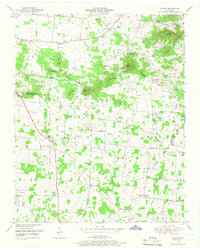
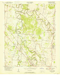
 1913 Hollow Springs1913 Print · USGSThe Tennessee highland plateau meets the Central Basin in the years before the Great War, showing a landscape of family-run stores and district schools. Genealogists can trace ancestral homes near Hollow Springs, Patmos Chapel, and the McMahan School district.4 unique versions available
 - 1916 Map of Murfreesboro
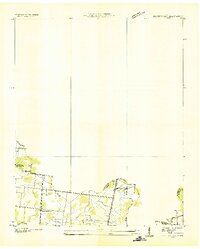
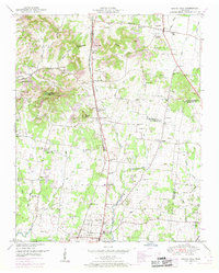
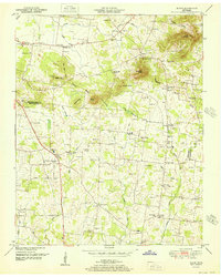
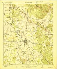 1916 Murfreesboro1916 Print · USGSMurfreesboro and the surrounding Rutherford County hills are captured here just before the era of modern highway expansion. Genealogists and historians can trace the grounds of the Stone River Battlefield, locate vanished rural stops like Salem Overall PO, and find family-named landmarks such as Vaughters Knob.2 unique versions available
 - 1932 Map of Hermitage
 1932 Hermitage1932 Print · USGSGreater Nashville and its rural eastern reaches come alive in the early 1930s, documenting the river-bend communities and pike roads before modern sprawl. Genealogists can trace family roots through dozens of local landmarks like Woodbine P O, Clover Bottom, and the Andrew Jackson Sch.3 unique versions available
 - 1936 Map of Webbs Jungle
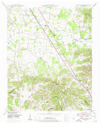
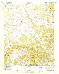
 1936 Webbs Jungle1936 Print · USGSRutherford and Bedford Counties are captured in the mid-1930s, showing a rural landscape defined by the Tennessee Basin Divide. Genealogists and local historians can trace family locations near Webbs Jungle, the Beechwood Ch, and along Wartrace Creek.
 - 1936 Map of Chapel Hill
 1936 Chapel Hill1936 Print · USGSMiddle Tennessee’s rural landscape is captured here in the mid-1930s as the regional electrical grid was expanding. Researchers can locate vanished landmarks like the Holtland PO, trace family roots at LESTER CEM, or find the old Edwards Grove Ch.
 - 1936 Map of Rover
 1936 Rover1936 Print · USGSMiddle Tennessee farmland at the Rutherford and Bedford county line is meticulously captured in the mid-thirties. Family historians can trace dozens of burial sites and community centers like Rover, Kingdom Ch, and the Vernon Corner Sch.
 - 1936 Map of Deason
 1936 Deason1936 Print · USGSNorthern Bedford County at the peak of the New Deal era reveals a landscape of rural academies and family-named landmarks. Trace ancestral connections at Possumtrot Ch, Harts Chapel, and the historic grounds of Coops Academy.
 - 1936 Map of Beech Grove
 1936 Beech Grove1936 Print · USGSCoffee County rural life in the mid-1930s is detailed here along the winding Garrison Fork and Duck River. Researchers can trace family ties at the Barnes Store, Union Ch, and numerous burial grounds like the Arnold Cem.
 - 1936 Map of Fosterville
 1936 Fosterville1936 Print · USGSThe Rutherford and Bedford county line comes into focus in the mid-1930s as the Tennessee Valley Authority mapped the region's watersheds. Researchers can locate family landmarks such as Woodfin Cem or trace the early paths of U S Highway No 241 and the N C & St L railroad.
 - 1942 Map of Statesville
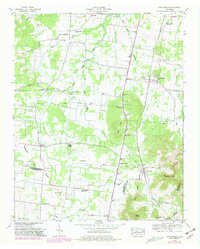
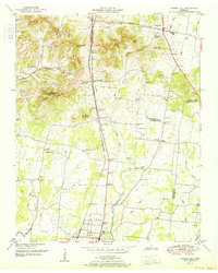
 1942 Statesville1942 Print · USGSMid-century Tennessee comes alive in this survey of the river valleys and rail lines east of Nashville. Researchers can trace the path of the Tennessee Central Railway and locate historic points like Denny Seminary and Tuckers Crossroads.
 - 1942 Map of Lebanon, 1944 Print
 1942 Lebanon1944 Print · USGSMiddle Tennessee at the start of the war years reveals a landscape of historic homesteads and burgeoning military infrastructure. Genealogists and historians can trace family locations near The Hermitage, follow the Tennessee Central rail lines, or locate the newly established Smyrna Air Base.
 - 1943 Map of Mc Minnville, 1944 Print
 1943 Mc Minnville1944 Print · USGSMid-Tennessee is captured here during the mobilization of the early 1940s, showing the vast Camp Forrest Military Reservation and thriving rail towns. Trace the N C & ST L line through Mcminnville or locate smaller rural hubs like Morrison and Hickerson Station.
 - 1944 Map of Shelbyville
 1944 Shelbyville1944 Print · USGSMid-century Middle Tennessee is captured here during the wartime mobilization of the 1940s. Genealogists and researchers can trace family lands near Bugscuffle, Shelbyville Mills, and the expansive Camp Forrest Military Res.
 - 1949 Map of Rover, 1966 Print
 1949 Rover1966 Print · USGSIn the late 1940s, the rural border between Rutherford and Bedford counties remained a landscape of family farms and country crossroads. Researchers can trace ancestral locations like Puckett Store, the Vernon Corner School, and family-named landmarks like Putman Well.3 unique versions available
 - 1949 Map of Chapel Hill, 1966 Print
 1949 Chapel Hill1966 Print · USGSMid-century Middle Tennessee comes to life here as the rail-and-road network connects rural Marshall and Rutherford counties. Genealogists can trace family landmarks across dozens of sites like Riggs Chapel, Holtland (PO), and the Marrs Hill Cem.2 unique versions available
 - 1949 Map of Webbs Jungle, 1975 Print
 1949 Webbs Jungle1975 Print · USGSRutherford and Bedford Counties appear in the late 1940s as a landscape of river-bottom farms and ridge-top hollows. Genealogists can locate family landmarks such as the Preter Cem, Buchanan School, and the Millersburg Church.3 unique versions available
 - 1949 Map of Fosterville, 1980 Print
 1949 Fosterville1980 Print · USGSRutherford and Bedford Counties are captured in the late 1940s just as infrastructure was modernizing along the Tennessee Valley Divide. Researchers can trace family roots through numerous landmarks like Guy Gap Sch, Alexander Cem, and Brandon Chapel.2 unique versions available
 - 1950 Map of Walterhill
 1950 Walterhill1950 Print · USGSMid-century Rutherford County comes to life through the winding forks of the river and the hallowed grounds of the Stones River National Military Park. Researchers can trace the old paths of Old Jefferson or locate family roots near Hickory Grove Ch and Burleson Cem.5 unique versions available
 - 1950 Map of Murfreesboro, 1952 Print
 1950 Murfreesboro1952 Print · USGSMurfreesboro and the surrounding Rutherford County countryside are captured here just after the war. Local historians can trace the NASHVILLE CHATTANOOGA AND ST LOUIS RR corridor and locate historic sites like Stones River National Military Park or the Washington Cemetery.5 unique versions available
 - 1951 Map of Rover
 1951 Rover1951 Print · USGSBedford and Rutherford Counties were still largely defined by dispersed farmsteads and family-named ridges in the years following World War II. Genealogists can trace dozens of rural burial sites and landmarks like Puckett Store, Kingdom Ch, and the Woodson Cem.
 - 1951 Map of Chapel Hill
 1951 Chapel Hill1951 Print · USGSMid-century Middle Tennessee is captured here as a landscape of family farms and railroad hamlets along the Louisville and Nashville line. Genealogists can trace hundreds of family names through sites like Riggs Crossroads, Edwards Grove Ch, and Marrs Hill Cem.
 - 1951 Map of Webbs Jungle
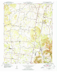
 1951 Webbs Jungle1951 Print · USGSRutherford and Bedford Counties are shown here in the early 1950s, centered on the strategic crossing at Hoovers Gap. Family researchers can locate many rural landmarks including Buchanan School, the Millersburg Cem, and New Hope Church.2 unique versions available
 - 1951 Map of Fosterville
 1951 Fosterville1951 Print · USGSIn the early 1950s, this portion of Middle Tennessee remained a landscape of rural schoolhouses and family cemeteries along the railroad. Genealogists and local historians can trace the foundations of Christiana and Fosterville or locate family sites like Alexander Cem and Blankenship Ch.2 unique versions available
Showing maps 1-25 of 144
Top cities of Rutherford County
- Murfreesboro historical maps
- Smyrna historical maps
- La Vergne historical maps
- Eagleville historical maps
Frequently asked questions
- What are the different types of historical maps available for Rutherford County?
- What is the oldest map of Rutherford County?
- Where can I purchase historical maps of Rutherford County for my home or office?
- Where can I download high-res historical maps of Rutherford County?
- Are there historical topographic maps available for Rutherford County?
- Is there historical aerial imagery available for Rutherford County?
- Where are historical maps of Rutherford County sourced from?