2000s (21st Century) Maps of Camp Tom Howard, Tennessee
Explore 6 historic maps of Camp Tom Howard from the 2000s (21st Century). These maps offer a rare glimpse into what life looked like during the 2000s — showing old roads, neighborhoods, homes, and landmarks that have changed or disappeared over time.
Whether you're researching your family's past, planning a metal detecting trip, or studying how Camp Tom Howard's landscape evolved across the 2000s, these high-resolution maps are a powerful tool for exploring the history of this region.
- Focus on a specific era: All maps on this page are from the 2000s, giving you a focused view of this time period.
- See what’s changed: Compare century-old streets, trails, and buildings to today's modern landscape using overlays and satellite layers.
- Research with precision: Use these maps for genealogy, historical research, land use analysis, or educational projects.
- View, download, or print: Maps are fully viewable online in high resolution, and can be downloaded or printed for your own records.
Start exploring Camp Tom Howard's history through authentic maps from the 2000s. This is your window into the past.
Camp Tom Howard, TN maps
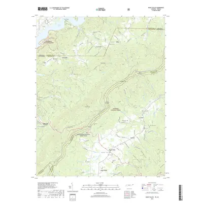
(6)- 2003 Map of Shady Valley, 2004 Print
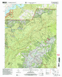 2003 Shady Valley2004 Print · USGSSullivan and Johnson counties in the early 2000s show a mountain landscape defined by national forests and the South Holston Lake shoreline. Genealogists can locate family burial grounds like Potter Cem and Wyatt Cem alongside the historic Appalachian Trail.
 - 2011 Map of Shady Valley, 2011 Print
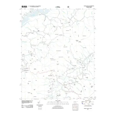 2011 Shady Valley2011 Print · USGSCovers Camp Tom Howard, including Offset, Crandull, and other nearby areas
 - 2013 Map of Shady Valley, 2013 Print
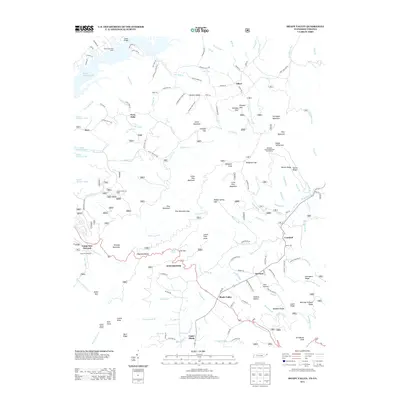 2013 Shady Valley2013 Print · USGSCovers Camp Tom Howard, including Offset, Crandull, and other nearby areas
 - 2016 Map of Shady Valley, 2016 Print
 2016 Shady Valley2016 Print · USGSCovers Camp Tom Howard, including Offset, Crandull, and other nearby areas
 - 2019 Map of Shady Valley, 2019 Print
 2019 Shady Valley2019 Print · USGSCovers Camp Tom Howard, including Offset, Crandull, and other nearby areas
 - 2022 Map of Shady Valley, 2022 Print
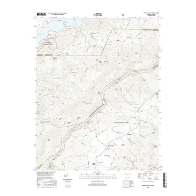
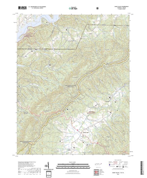 2022 Shady Valley2022 Print · USGSThe high mountain basin of Shady Valley is shown here in its modern context, where the Appalachian National Scenic Trail meets deep-rooted family history. Researchers can trace dozens of legacy family sites such as Wyatt Cem, Potter Cem, and the old settlement at Crandull.
End of results
Showing maps 1-6 of 6
Top cities near Camp Tom Howard
- Bristol historical maps
- Bristol historical maps
- Elizabethton historical maps
- Abingdon historical maps
- Mountain City historical maps
- Damascus historical maps
See more
Frequently asked questions
- What are the different types of historical maps available for Camp Tom Howard?
- What is the oldest map of Camp Tom Howard?
- Where can I purchase historical maps of Camp Tom Howard for my home or office?
- Where can I download high-res historical maps of Camp Tom Howard?
- Are there historical topographic maps available for Camp Tom Howard?
- Is there historical aerial imagery available for Camp Tom Howard?
- Where are historical maps of Camp Tom Howard sourced from?