Old Maps of Wilson County, Tennessee for Metal Detecting
Plan your next treasure hunt with 134 historic maps of Wilson County. Find old homesites, ghost towns, trails, and gathering spots that may be lost to time — perfect for identifying promising metal detecting locations.
- Locate forgotten sites: Uncover places like long-lost settlements, abandoned rail lines, or gathering spots.
- Plan better hunts: Use map overlays combined with LiDAR or satellite views to narrow in on historically rich areas.
- Made for detectorists: Thousands of hobbyists use these maps to discover relics, coins, and hidden history.
Use these historic maps to boost your research and find new opportunities beneath the surface of Wilson County.
Wilson County, TN maps
(134)- 1903 Map of Nashville
 1903 Nashville1903 Print · USGSTennessee's capital region is captured at the dawn of the 1900s, when iron pikes and river locks dominated local commerce. Trace ancestral routes along Stewarts Ferry Pike, find rural landmarks like Curry Mill, or locate historical sites like The Hermitage.4 unique versions available
 - 1908 Map of Woodbury
 1908 Woodbury1908 Print · USGSThe hill country of central Tennessee at the start of the century is documented here with incredible precision. Genealogists and historians can trace the foundations of communities like Woodbury and Readyville or locate landmarks like Hoovers Mill and Twelve Corners Church.2 unique versions available
 - 1916 Map of Murfreesboro
 1916 Murfreesboro1916 Print · USGSMurfreesboro and the surrounding Rutherford County hills are captured here just before the era of modern highway expansion. Genealogists and historians can trace the grounds of the Stone River Battlefield, locate vanished rural stops like Salem Overall PO, and find family-named landmarks such as Vaughters Knob.2 unique versions available
 - 1932 Map of Hermitage
 1932 Hermitage1932 Print · USGSGreater Nashville and its rural eastern reaches come alive in the early 1930s, documenting the river-bend communities and pike roads before modern sprawl. Genealogists can trace family roots through dozens of local landmarks like Woodbine P O, Clover Bottom, and the Andrew Jackson Sch.3 unique versions available
 - 1942 Map of Statesville
 1942 Statesville1942 Print · USGSMid-century Tennessee comes alive in this survey of the river valleys and rail lines east of Nashville. Researchers can trace the path of the Tennessee Central Railway and locate historic points like Denny Seminary and Tuckers Crossroads.
 - 1942 Map of Gallatin
 1942 Gallatin1942 Print · USGSThe Tennessee-Kentucky borderlands were a crossroads of river and rail during the early war years. Genealogists and historians can trace family roots through dozens of named settlements like Bethpage, Prices Mill, and Mitchellville, or locate historic river crossings such as Kirkpatricks Ferry.
 - 1942 Map of Lebanon, 1944 Print
 1942 Lebanon1944 Print · USGSMiddle Tennessee at the start of the war years reveals a landscape of historic homesteads and burgeoning military infrastructure. Genealogists and historians can trace family locations near The Hermitage, follow the Tennessee Central rail lines, or locate the newly established Smyrna Air Base.
 - 1951 Map of Lebanon, 1952 Print
 1951 Lebanon1952 Print · USGSMid-century Lebanon and its surrounding Wilson County landscape are captured here just as the post-war era transformed this rail-hub community. Researchers can locate ancestral sites like Bethlehem Ch, the Castle Heights Military Academy, and numerous family burial grounds including Ligon Cem and Greenwood Cem.4 unique versions available
 - 1951 Map of Martha, 1952 Print
 1951 Martha1952 Print · USGSIn the early 1950s, this area of Wilson County was defined by its railroad hamlets and a robust network of community schools. Genealogists and historians can trace family locations through numerous rural landmarks like Beckwith Sch, Rutland Cem, and Old Union Ch.4 unique versions available
 - 1952 Map of Hendersonville, 1953 Print
 1952 Hendersonville1953 Print · USGSSumner County is captured here in the early fifties, before the rapid suburban expansion of the Nashville region. Genealogists can locate family landmarks such as Shackle Island, Stark Knob Ch, and the winding Walton Ferry Road along the river.
 - 1952 Map of Hermitage, 1954 Print
 1952 Hermitage1954 Print · USGSDavidson and Wilson counties are captured in the early fifties, showing the rural landscapes around the Cumberland River before significant suburban growth. Trace family roots at The Hermitage, Bakers Grove Ch, and the Confederate Memorial Cem.
 - 1952 Map of La Vergne, 1954 Print
 1952 La Vergne1954 Print · USGSThe rural border of Davidson and Rutherford counties is documented here in the early fifties, showing a landscape defined by the winding Stones River. Genealogists and historians can locate numerous small burial sites like Eskridge Cem and the Slave Cem, alongside landmarks such as Sewart Air Force Base.2 unique versions available
 - 1955 Map of Laguardo, 1956 Print
 1955 Laguardo1956 Print · USGSThe Cumberland River valley transitioned into a modern utility corridor in the mid-fifties as the reservoir waters rose. Genealogists and historians can trace local landmarks like the Odoms Bend Sch, Franklin Chapel, and the Drive-in Theatre near Laguardo.5 unique versions available
 - 1955 Map of Hunters Point, 1956 Print
 1955 Hunters Point1956 Print · USGSNorth of Lebanon in the mid-1950s, the rising waters of the Old Hickory Reservoir began to transform these historic river bends. Researchers can locate family landmarks like Ebenezer Cem and trace the paths of Coles Ferry Road and Cedar Pike.4 unique versions available
 - 1956 Map of Vine, 1957 Print
 1956 Vine1957 Print · USGSWilson County's cedar glades and crossroad hamlets are preserved here during the mid-fifties. Genealogists and historians can trace family locations near Bairds Mill, Adams Grove Ch, and the winding path of Hurricane Creek.2 unique versions available
 - 1956 Map of Gladeville, 1957 Print
 1956 Gladeville1957 Print · USGSMid-century Tennessee is captured here as rural crossroads like Gladeville meet military growth at Stewart Air Force Base. Genealogists can trace family landmarks like Browns Cem and the John Colemon Sch among the timber of the Cedars of Lebanon State Forest.5 unique versions available
 - 1956 Map of Columbia, 1960 Print
 1956 Columbia1960 Print · USGSMiddle Tennessee in the mid-fifties presents a landscape of established river towns and critical rail hubs before the arrival of the modern interstate system. Researchers can trace the routes of the Louisville and Nashville railroad or locate historic landmarks like Stones River National Military Park and the Tennessee National Wildlife Refuge.6 unique versions available
 - 1956 Map of Nashville, 1971 Print
 1956 Nashville1971 Print · USGSThe Tennessee-Kentucky borderlands come into focus in the mid-1960s as major reservoir projects transformed the Cumberland and Tennessee river valleys. Researchers can trace the rail networks of the Louisville and Nashville and visit sites like Fort Campbell and Fort Donelson National Military Park.2 unique versions available
 - 1957 Map of Lascassas, 1958 Print
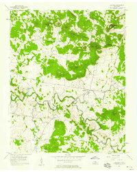 1957 Lascassas1958 Print · USGSRutherford County in the late fifties is captured here as a landscape of river-valley farms and high knobs. Genealogists can trace family roots through numerous sites like Patterson Cem, Walnut Grove Ch, and the community of Lascassas.3 unique versions available
 - 1957 Map of Hendersonville, 1959 Print
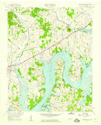 1957 Hendersonville1959 Print · USGSSumner County underwent a massive geographical shift in the late fifties as the rising Cumberland River filled the new reservoir. Researchers can trace the mid-century shoreline of Old Hickory Lake and locate old rural landmarks like Rehoboth Ch and Beech Sch.
 - 1957 Map of Hermitage, 1959 Print
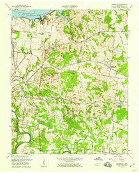 1957 Hermitage1959 Print · USGSNear Nashville in the late fifties, the landscape around The Hermitage reflects a mix of historic estates and new river reservoirs. Genealogists can trace family landmarks like the Confederate Memorial Cem, Hays Cem, and the rural Bakers Grove Ch.
 - 1958 Map of New Middleton
 1958 New Middleton1958 Print · USGSSmith and Wilson counties in the late fifties show a landscape of steep knobs and winding creek bottoms. Genealogists and historians can trace family locations through numerous sites like Bethlehem Cem, the Tennessee Central rail line, and New Middleton.4 unique versions available
 - 1958 Map of Bellwood, 1959 Print
 1958 Bellwood1959 Print · USGSWilson County in the late fifties shows a rural landscape shaped by the winding Cumberland River and the newer waters of Old Hickory Lake. Genealogists can locate family landmarks like Tomlinson Cem, Wier Cem, and the Conway Sch in the hills near Centerville.3 unique versions available
 - 1958 Map of Watertown, 1959 Print
 1958 Watertown1959 Print · USGSWatertown and the rural valleys of Wilson County are captured here in the late fifties at a height of rail and road connectivity. Genealogists and historians can trace old homesteads near Norene, find the Norene School, and locate rural landmarks like Fall Creek Church or Mt Defiance.2 unique versions available
 - 1958 Map of Dixon Springs, 1959 Print
 1958 Dixon Springs1959 Print · USGSThe Cumberland River valley in north-central Tennessee is captured here during the 1950s as the river began its transformation into a reservoir. Local historians can trace old community hubs like Dixon Springs, Rome, and schools such as Union Heights Sch and Cox-Davis Sch.4 unique versions available
Showing maps 1-25 of 134
Top cities of Wilson County
Frequently asked questions
- What are the different types of historical maps available for Wilson County?
- What is the oldest map of Wilson County?
- Where can I purchase historical maps of Wilson County for my home or office?
- Where can I download high-res historical maps of Wilson County?
- Are there historical topographic maps available for Wilson County?
- Is there historical aerial imagery available for Wilson County?
- Where are historical maps of Wilson County sourced from?