1950s Maps of Austin County, Texas
Explore 12 historic maps of Austin County from the 1950s. These maps offer a rare glimpse into what life looked like during the 1950s — showing old roads, neighborhoods, homes, and landmarks that have changed or disappeared over time.
Whether you're researching your family's past, planning a metal detecting trip, or studying how Austin County's landscape evolved across the 1950s, these high-resolution maps are a powerful tool for exploring the history of this region.
- Focus on a specific era: All maps on this page are from the 1950s, giving you a focused view of this time period.
- See what’s changed: Compare century-old streets, trails, and buildings to today's modern landscape using overlays and satellite layers.
- Research with precision: Use these maps for genealogy, historical research, land use analysis, or educational projects.
- View, download, or print: Maps are fully viewable online in high resolution, and can be downloaded or printed for your own records.
Start exploring Austin County's history through authentic maps from the 1950s. This is your window into the past.
Austin County, TX maps
(12)- 1953 Map of Seguin, 1965 Print
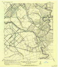
 1953 Seguin1965 Print · USGSSouth Texas in the early fifties shows a thriving river-and-rail economy across the Guadalupe and Colorado basins. Genealogists and historians can trace rail routes like the Southern Pacific through Seguin, locate oil wells, or find the Gary AAF near San Marcos.4 unique versions available
 - 1954 Map of Austin, 1964 Print
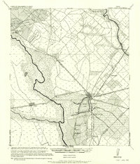
 1954 Austin1964 Print · USGSCentral Texas is captured during a period of steady growth as the capital city and its neighboring farm towns began to modernize. Researchers can trace historic rail corridors like the Southern Pacific RR or locate landmarks such as Bergstrom Air Force Base and Pilot Knob.4 unique versions available
 - 1956 Map of Bellville
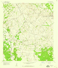
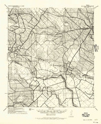 1956 Bellville1956 Print · USGSTexas farming life in the mid-fifties is captured here as small communities and rural school districts thrive along the San Bernard River. Genealogists can trace early homesteads near Industry, New Ulm, and the Cat Springs Sch.
 - 1956 Map of Sealy
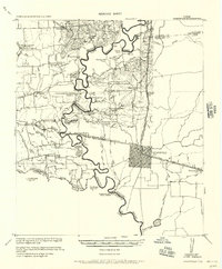
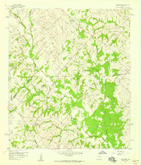
 1956 Sealy1956 Print · USGSThe Brazos River valley between Austin and Waller counties is shown here as it transitioned through the early twentieth century. Researchers can locate early post offices at Burleigh PO and Browntown, trace ferry crossings, or find the Cotton Gin and Wesley Chapel.
 - 1956 Map of Hempstead
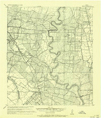
 1956 Hempstead1956 Print · USGSSoutheast Texas river country comes alive in this survey of the Brazos valley at the dawn of the motorized age. Genealogists and historians can trace the foundations of local society through schools like Pauls School, post offices at Howth P.O., and the path of the Houston and Texas Central Railroad.
 - 1956 Map of Brenham
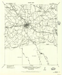 1956 Brenham1956 Print · USGSWashington County during the early twentieth century was a landscape of rail-connected towns and rural parish life. Genealogists can trace family locations near landmarks like Harrison Spring Church, Polaski School, and the County Farm.
 - 1956 Map of Wallis
 1956 Wallis1956 Print · USGSThe Brazos and San Bernard rivers dominate this coastal prairie landscape during the early twentieth century. Trace family roots and vanished rail stops through Wallis, Chesterville, and Lissie along the Gulf Colorado and Santa Fe Railway.
 - 1957 Map of Eagle Lake
 1957 Eagle Lake1957 Print · USGSTexas coastal prairie life in the early twentieth century is defined here by the convergence of major rail lines and the namesake Eagle Lake. Genealogists and historians can trace the development of localized junctions and settlements like Alleyton, Altair, and Rice Land.
 - 1958 Map of Seguin
 1958 Seguin1958 Print · USGSSouth Texas in the late fifties was a network of river-valley settlements and active oilfields tied together by major rail lines. Genealogists and historians can trace family-named sites across Rabb Prairie, locate the Behring Store, or follow the Southern Pacific through Schulenburg.
 - 1958 Map of Industry, 1959 Print
 1958 Industry1959 Print · USGSThe Austin and Fayette county lines intersect in the late fifties, revealing a rural landscape of German settlements and family farms. Trace local heritage at Industry, New Ulm, and Cherry Chapel, or follow the MISSOURI KANSAS TEXAS rail line.
 - 1958 Map of Greenvine, 1959 Print
 1958 Greenvine1959 Print · USGSThe rural Texas borderlands of Washington and Austin counties come into focus in the late fifties. Genealogists can trace family heritage through numerous pioneer burial sites and small settlements like Latium, Wesley, and the David Shelby Grave.2 unique versions available
 - 1958 Map of Bernardo, 1959 Print
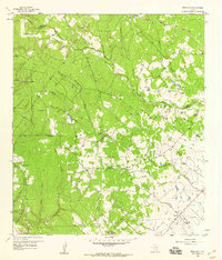 1958 Bernardo1959 Print · USGSThe rural borderlands of Colorado and Austin counties come alive in this late fifties survey of the San Bernard River valley. Genealogists can trace family heritage through a remarkable number of local burial sites like Hinsley Cem and Gadecke Cem, or locate the historic Bernardo Sch.2 unique versions available
End of results
Showing maps 1-12 of 12
Top cities of Austin County
- Sealy historical maps
- Bellville historical maps
- Wallis historical maps
- San Felipe historical maps
- Industry historical maps
- Brazos Country historical maps
Frequently asked questions
- What are the different types of historical maps available for Austin County?
- What is the oldest map of Austin County?
- Where can I purchase historical maps of Austin County for my home or office?
- Where can I download high-res historical maps of Austin County?
- Are there historical topographic maps available for Austin County?
- Is there historical aerial imagery available for Austin County?
- Where are historical maps of Austin County sourced from?