Old Maps of Bailey County, Texas for Metal Detecting
Plan your next treasure hunt with 159 historic maps of Bailey County. Find old homesites, ghost towns, trails, and gathering spots that may be lost to time — perfect for identifying promising metal detecting locations.
- Locate forgotten sites: Uncover places like long-lost settlements, abandoned rail lines, or gathering spots.
- Plan better hunts: Use map overlays combined with LiDAR or satellite views to narrow in on historically rich areas.
- Made for detectorists: Thousands of hobbyists use these maps to discover relics, coins, and hidden history.
Use these historic maps to boost your research and find new opportunities beneath the surface of Bailey County.
Bailey County, TX maps
(159)- 1954 Map of Clovis, 1966 Print
 1954 Clovis1966 Print · USGSThe High Plains of the Texas-New Mexico borderland come alive in this mid-century survey as the region's agricultural and rail networks reached their peak. Trace family roots and local history through features like Cannon AFB, the massive Sand Hills, and busy rail towns such as Friona and Littlefield.4 unique versions available
 - 1954 Map of Brownfield, 1975 Print
 1954 Brownfield1975 Print · USGSThe High Plains of the Texas-New Mexico border are captured here in the mid-twentieth century, as ranching and oil extraction shaped the Llano Estacado. Genealogists and historians can trace small rural centers like Lums Chapel, Hillburn City, and the Friendship Sch amid a landscape of windmills.2 unique versions available
 - 1957 Map of Clovis, 1958 Print
 1957 Clovis1958 Print · USGSThe High Plains railroad hub of Clovis is captured here in the mid-fifties at the peak of its rail-era importance. Genealogists and researchers can trace the growth of the border towns of Texico and Farwell or locate landmarks like Lawn Haven Cem.3 unique versions available
 - 1957 Map of Arch, 1958 Print
 1957 Arch1958 Print · USGSRoosevelt County ranching culture is captured here in the late fifties, showing the high plains landscape along the state line. Genealogists can locate Arch and family landmarks like Coldwater Ranch, Phillips Ranch, and the Eiland Cem.3 unique versions available
 - 1958 Map of Brownfield
 1958 Brownfield1958 Print · USGSThe High Plains of the Texas-New Mexico border are captured here during a mid-century oil boom. Genealogists and historians can trace old community sites like Lums Chapel and Tokio alongside the vast Levelland and Slaughter Oil and Gas Field.
 - 1958 Map of Clovis
 1958 Clovis1958 Print · USGSThe High Plains of the New Mexico-Texas borderlands are captured here in the late fifties, during a period of significant military and agricultural expansion. Genealogists and historians can trace the rail-side growth of Clovis, the operations at Clovis Air Force Base, and the rural layout of communities like Muleshoe and Hereford.
 - 1962 Map of Brownfield
 1962 Brownfield1962 Print · USGSThe High Plains of Texas and New Mexico are captured in the early sixties as a thriving hub of oil production and ranching. Researchers can trace the industrial footprint of the Levelland and Slaughter Oil and Gas Field or locate smaller towns like Sundown and Littlefield.
 - 1962 Map of Muleshoe, 1965 Print
 1962 Muleshoe1965 Print · USGSMuleshoe and the surrounding Bailey County ranch lands come into focus in the early sixties as the local agricultural economy matured. Researchers can trace the town's development through landmarks like Richland Hills Sch, Warren Airfield, and the Drive-in Theater.2 unique versions available
 - 1962 Map of Needmore, 1965 Print
 1962 Needmore1965 Print · USGSThe High Plains of Bailey County are captured here in the early sixties, showing a landscape shaped by rural ranching and water management. Researchers can locate the small communities of Needmore and Circle Back or trace mid-century property divisions marked by documented fence lines.
 - 1962 Map of Stegall, 1965 Print
 1962 Stegall1965 Print · USGSThe High Plains of Bailey County come into focus during the early sixties, showing a landscape of ranching tracts and basin lakes. Genealogists and researchers can locate the settlement of Stegall and trace the contours of Coyote Lake or several local wells.2 unique versions available
 - 1962 Map of Birdwell Ranch, 1965 Print
 1962 Birdwell Ranch1965 Print · USGSThe Texas Panhandle comes into focus during the early 1960s, showing a landscape defined by ranching and aquifer-fed agriculture. Genealogists and local historians can trace the grounds of Birdwell Ranch, the winding Blackwater Draw, and numerous rural wells.2 unique versions available
 - 1962 Map of Baileyboro NE, 1965 Print
 1962 Baileyboro NE1965 Print · USGSThe High Plains of Bailey County are captured here in the early sixties, showing an agricultural landscape shaped by extensive well-drilling. Trace family land or local history through sites like Wasson Camp or the Panhandle and Santa Fe rail line.2 unique versions available
 - 1962 Map of Baileyboro, 1965 Print
 1962 Baileyboro1965 Print · USGSBailey County during the early 1960s reveals a specialized agricultural landscape defined by wind-pumped water and saline lake basins. Genealogists and local historians can trace the rural layout around Baileyboro, locating the Longview Ch and the community Cem.
 - 1962 Map of Sudan, 1965 Print
 1962 Sudan1965 Print · USGSLamb County and the neighboring Bailey County line are captured during the early 1960s when the irrigation economy of the South Plains was in full swing. Genealogists and local researchers can trace the town of Sudan, its nearby Sudan Airfield, and the Mt Olive Ch.2 unique versions available
 - 1962 Map of Muleshoe NE, 1965 Print
 1962 Muleshoe NE1965 Print · USGSHigh plains agriculture and heavy irrigation define the Lamb County landscape in the early sixties. Genealogists and researchers can trace the Panhandle and Santa Fe railroad, the Nickels Gin, and the Pleasant Valley Community House.2 unique versions available
 - 1963 Map of Lariat, 1965 Print
 1963 Lariat1965 Print · USGSThe Texas Panhandle comes into focus in the early sixties, showing the agricultural landscape surrounding Lariat and West Camp. Researchers can trace early railroad history along the Panhandle and Santa Fe or locate family plots at Lariat Cem.2 unique versions available
 - 1963 Map of Lazbuddie SW, 1965 Print
 1963 Lazbuddie SW1965 Print · USGSHigh Plains agriculture and the county line between Parmer Co and Bailey Co define this mid-sixties survey. Researchers can trace irrigation history through numerous numbered wells and local community hubs like the Y-L Ch and a rural Substation.
 - 1963 Map of Progress, 1965 Print
 1963 Progress1965 Print · USGSTexas High Plains farming and rail transit define this mid-sixties survey of the Bailey and Parmer county line. Researchers can trace the PANHANDLE AND SANTA FE railroad and locate family burial sites at Muleshoe Cem or the Progress settlement.
 - 1963 Map of Lazbuddie SE, 1965 Print
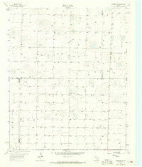 1963 Lazbuddie SE1965 Print · USGSThe High Plains at the intersection of Lamb and Parmer counties were defined by groundwater development in the early sixties. Researchers can trace the agricultural footprint of the era through Pleasant Valley, a remote Airstrip, and dozens of numbered water wells like Well 3912.
 - 1964 Map of Pep, 1966 Print
 1964 Pep1966 Print · USGSThe rural community of Pep sits at the four-county junction of the High Plains during the mid-sixties. Local researchers can trace family landmarks like St Philips Cem, find numerous Wells, and follow the seasonal path of Yellow House Draw.
 - 1964 Map of Beck, 1966 Print
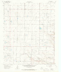 1964 Beck1966 Print · USGSLamb County's agricultural and industrial landscape comes into focus in the mid-sixties, centered on the Bailey and Lamb County border. Genealogists and local historians can locate the small settlements of Friendship and Beck while tracing the course of Bull Draw.
 - 1968 Map of Bula, 1970 Print
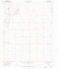 1968 Bula1970 Print · USGSBailey County at the end of the 1960s showcases a landscape of groundwater-dependent farming and protected wetlands. Researchers can trace the layout of Bula and the natural basins of the Muleshoe National Wildlife Refuge, including Lower Pauls Lake.3 unique versions available
 - 1968 Map of Three Way School, 1971 Print
 1968 Three Way School1971 Print · USGSHigh plains farming life in Bailey County during the late sixties is visible in this detailed topographic record. Researchers can trace the layout of rural infrastructure including Three Way Sch, the Hicks Chapel church, and an early Landing Strip.
 - 1968 Map of Upper White Lake, 1971 Print
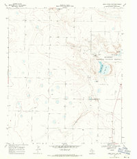 1968 Upper White Lake1971 Print · USGSBailey County's high plains landscape is captured in the late sixties, centered on the protected waters and depressions of the Muleshoe National Wildlife Refuge. Researchers can locate the settlement of Enochs, the Refuge Headquarters, and remote landmarks like the Landing Strip.3 unique versions available
 - 1969 Map of Maple, 1971 Print
 1969 Maple1971 Print · USGSThe High Plains of West Texas are captured here in the late sixties, showing a landscape defined by systematic ranching and the search for water. Researchers can locate the settlement of Maple, a remote Landing Strip, and the Bailey and Cochran County line.
Showing maps 1-25 of 159
Top cities of Bailey County
Frequently asked questions
- What are the different types of historical maps available for Bailey County?
- What is the oldest map of Bailey County?
- Where can I purchase historical maps of Bailey County for my home or office?
- Where can I download high-res historical maps of Bailey County?
- Are there historical topographic maps available for Bailey County?
- Is there historical aerial imagery available for Bailey County?
- Where are historical maps of Bailey County sourced from?