1900s (20th Century) Maps of Midway, Texas
Explore 6 historic maps of Midway from the 1900s (20th Century). These maps offer a rare glimpse into what life looked like during the 1900s — showing old roads, neighborhoods, homes, and landmarks that have changed or disappeared over time.
Whether you're researching your family's past, planning a metal detecting trip, or studying how Midway's landscape evolved across the 1900s, these high-resolution maps are a powerful tool for exploring the history of this region.
- Focus on a specific era: All maps on this page are from the 1900s, giving you a focused view of this time period.
- See what’s changed: Compare century-old streets, trails, and buildings to today's modern landscape using overlays and satellite layers.
- Research with precision: Use these maps for genealogy, historical research, land use analysis, or educational projects.
- View, download, or print: Maps are fully viewable online in high resolution, and can be downloaded or printed for your own records.
Start exploring Midway's history through authentic maps from the 1900s. This is your window into the past.
Midway, TX maps
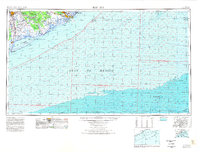
(6)- 1943 Map of Freeport
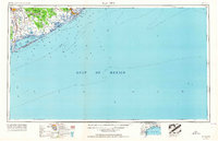
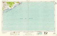
 1943 Freeport1943 Print · USGSThe Texas coast near the mouth of the Brazos River comes into sharp focus during the early 1940s as industry and navigation expand. Researchers can trace the layout of Freeport, locate the Brazos River Lighthouse, and find the historic Quintana Cem along the gulf shore.2 unique versions available
 - 1951 Map of Bay City
 1951 Bay City1951 Print · USGSThe mid-century Texas Gulf Coast comes to life in this survey of the delta region where the Brazos and Colorado Rivers meet the sea. Researchers can trace the industrial footprint of Freeport or locate family-named spots like Mangun and Hawkinsville.
 - 1956 Map of Bay City, 1964 Print
 1956 Bay City1964 Print · USGSThe Texas Gulf Coast comes into focus in the mid-1950s, showing the intricate bayous and coastal settlements from Bay City to Freeport. Researchers can trace the legacy of shoreline communities like Sargent, Matagorda Beach, and Hawkinsville before modern coastal changes.2 unique versions available
 - 1958 Map of Bay City
 1958 Bay City1958 Print · USGSThe Texas Gulf Coast in the late fifties shows a landscape of growing petrochemical plants and intricate wetlands. Genealogists and historians can trace the paths of the Missouri Pacific railroad through Bay City or locate old settlements like Hinkle Ferry and Hawkinsville.
 - 1964 Map of Freeport, 1966 Print
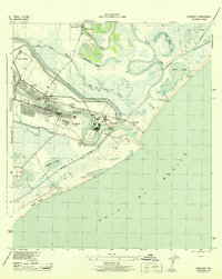
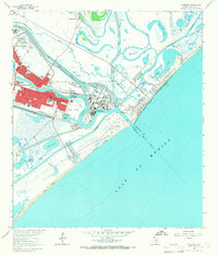 1964 Freeport1966 Print · USGSThe Texas Gulf Coast comes alive in the mid-1960s as Freeport expands its industrial reach at the mouth of the Brazos. Trace family roots and local history at Velasco Heights, West End Ch, or the Jane Long Sch.5 unique versions available
 - 1974 Map of Bay City, 1978 Print
 1974 Bay City1978 Print · USGSThe Texas Gulf Coast in the mid-seventies reveals a landscape of sprawling wetlands and coastal transit hubs. Genealogists and historians can trace the rail corridors of the Missouri Pacific or locate early settlements like Wadsworth and Matagorda.
End of results
Showing maps 1-6 of 6
Top cities near Midway
- Galveston historical maps
- Lake Jackson historical maps
- Alvin historical maps
- Angleton historical maps
- Freeport historical maps
- Clute historical maps
See more
Frequently asked questions
- What are the different types of historical maps available for Midway?
- What is the oldest map of Midway?
- Where can I purchase historical maps of Midway for my home or office?
- Where can I download high-res historical maps of Midway?
- Are there historical topographic maps available for Midway?
- Is there historical aerial imagery available for Midway?
- Where are historical maps of Midway sourced from?