Old Maps of Lake Brownwood, Texas for Genealogy
Trace your family roots with 12 historic maps of Lake Brownwood. These high-res maps reveal old neighborhoods, homesites, landmarks, and streets — helping you uncover where your ancestors lived and how the area evolved over time.
- Explore historic neighborhoods: Identify where your relatives may have lived in the 1800s or 1900s.
- Compare maps over time: Trace the changes in streets, buildings, and landmarks for multi-generational research.
- Perfect for genealogy & ancestry research: Used by family historians and researchers to map out lineage and migration.
These maps are an incredible resource for exploring your personal connection to Lake Brownwood's past.
Lake Brownwood, TX maps
(12)- 1887 Map of Coleman, 1889 Print
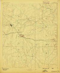 1887 Coleman1889 Print · USGSCentral Texas was undergoing a rapid transformation into a rail-connected ranching hub in the late 1880s. Local researchers can trace the early layout of Coleman and locate frontier landmarks like Camp Colorado, Byrds Store, and the Santa Anna Mountains.2 unique versions available
 - 1889 Map of Coleman, 1905 Print
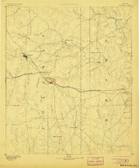 1889 Coleman1905 Print · USGSCentral Texas is captured in the late nineteenth century as the railroad began transforming the frontier into a network of cattle and farming towns. Genealogists can trace early homesteading hubs and remote outposts like Camp Colorado, Byrds Store, and Trickham.4 unique versions available
 - 1924 Map of Brownwood Reservoir Site
 1924 Brownwood Reservoir Site1924 Print · USGSThe river valleys of Brown County are captured here in the mid-1920s during the planning of a major reservoir project. Researchers can trace the original landscape of Pecan Bayou and locate vanished landmarks like Rocky Church and Frys Ford before the waters rose.
 - 1927 Map of Grosvenor
 1927 Grosvenor1927 Print · USGSIn the mid-1920s, the rural landscapes of Brown and Coleman Counties were connected by winding wagon roads and creek fords. Genealogists can trace the early community hubs of Grosvenor and Thrifty alongside schools like Macedonia School and Buffalo School.2 unique versions available
 - 1954 Map of Brownwood, 1955 Print
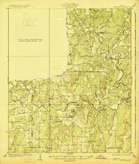
 1954 Brownwood1955 Print · USGSCentral Texas in the early fifties shows a landscape of rail-linked cattle towns and winding river valleys before modern highway expansion. Genealogists and historians can trace family-named peaks and vanished rail stops like Trickham, Santa Anna, and the Brady Mountains.3 unique versions available
 - 1969 Map of Lake Brownwood, 1972 Print
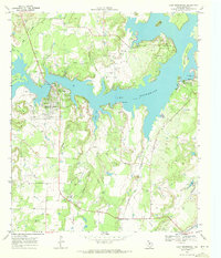 1969 Lake Brownwood1972 Print · USGSLake Brownwood's sprawling shoreline is captured here in the late sixties, showing a transition toward recreation and residential development. Trace family roots at Macedonia Cem or explore the early footprints of Shamrock Shores and Lake Shore.3 unique versions available
 - 1985 Map of Coleman
 1985 Coleman1985 Print · USGSCentral Texas ranching and rail country comes to life in the 1980s as the Atchison Topeka and Santa Fe line cuts through Coleman. Researchers can trace old settlements and topography from Robinson Peak to the waters of Lake Brownwood State Park.2 unique versions available
 - 2010 Map of Lake Brownwood, 2010 Print
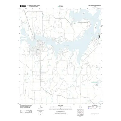 2010 Lake Brownwood2010 Print · USGSCovers Lake Brownwood, including Lake Shore, Shamrock Shores, and other nearby areas
 - 2013 Map of Lake Brownwood, 2013 Print
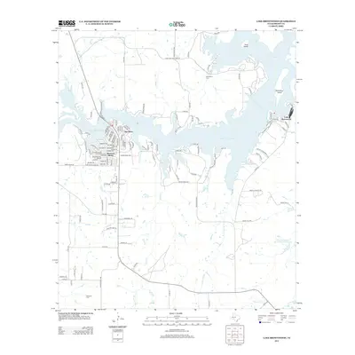 2013 Lake Brownwood2013 Print · USGSCovers Lake Brownwood, including Lake Shore, Shamrock Shores, and other nearby areas
 - 2016 Map of Lake Brownwood, 2016 Print
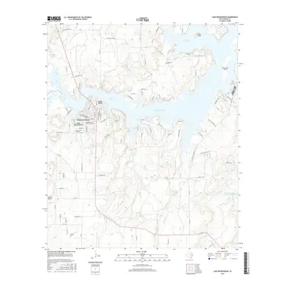 2016 Lake Brownwood2016 Print · USGSCovers Lake Brownwood, including Lake Shore, Shamrock Shores, and other nearby areas
 - 2019 Map of Lake Brownwood, 2019 Print
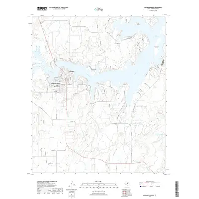 2019 Lake Brownwood2019 Print · USGSCovers Lake Brownwood, including Lake Shore, Shamrock Shores, and other nearby areas
 - 2022 Map of Lake Brownwood, 2022 Print
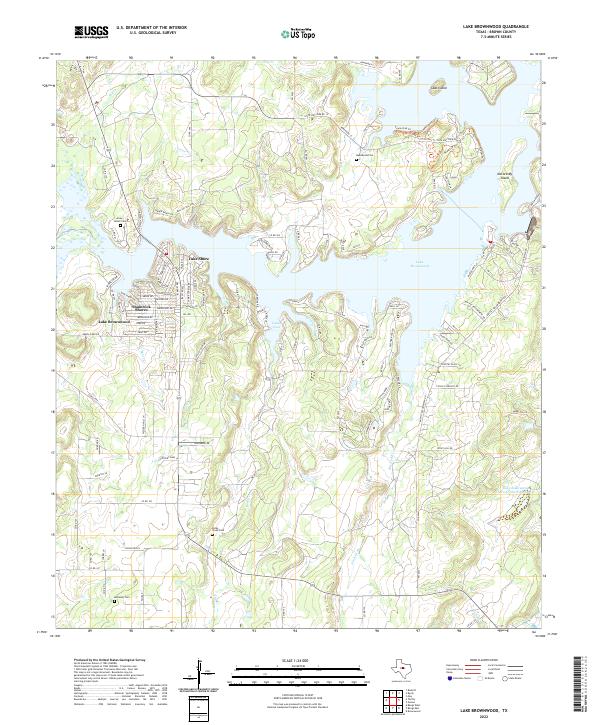 2022 Lake Brownwood2022 Print · USGSThe Lake Brownwood area in the early twenty-first century shows a fascinating mix of lakeside development and old Texas rural roots. Researchers can trace family history at Macedonia Cem or explore the inlets around Cason Cove and Goat Island.
End of results
Showing maps 1-12 of 12
Top cities near Lake Brownwood
Frequently asked questions
- What are the different types of historical maps available for Lake Brownwood?
- What is the oldest map of Lake Brownwood?
- Where can I purchase historical maps of Lake Brownwood for my home or office?
- Where can I download high-res historical maps of Lake Brownwood?
- Are there historical topographic maps available for Lake Brownwood?
- Is there historical aerial imagery available for Lake Brownwood?
- Where are historical maps of Lake Brownwood sourced from?