Old Maps of Harlingen, Texas for Hiking & Exploration
Hike through history with 46 historic maps of Harlingen. Explore old trails, ghost towns, and forgotten backroads — perfect for outdoor adventurers and local explorers.
- Rediscover forgotten places: Map out old mining camps, roads, and footpaths that no longer exist on modern maps.
- Layer with modern tools: Combine with LiDAR or satellite views to plan hikes through historical terrain.
- Made for exploration: Popular among hikers, overlanders, and local history lovers.
Use these maps to find adventure and explore the hidden past of Harlingen.
Harlingen, TX maps
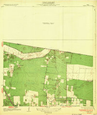
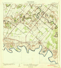
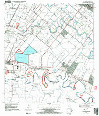
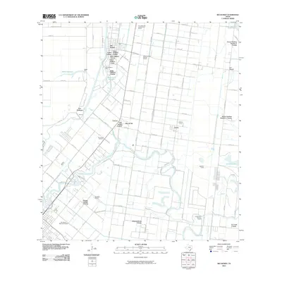
(46)- 1929 Map of Rio Hondo
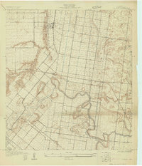 1929 Rio Hondo1929 Print · USGSCoastal South Texas is captured here in the late twenties, showing the intricate water systems and rail lines of the Lower Rio Grande Valley. Genealogists and historians can trace local landmarks like Rio Hondo, the Mexican Christian Ch, and the San Jose Sch.
 - 1929 Map of Harlingen
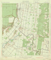
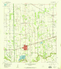
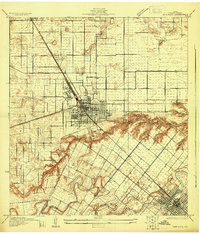 1929 Harlingen1929 Print · USGSHarlingen and San Benito appear as thriving rail centers in the late 1920s as the Rio Grande Valley’s citrus industry took hold. Trace family roots and early farmsteads near Lake Harlingen, the Palmetal Sch, and the winding Arroyo Colorado.
 - 1929 Map of La Feria
 1929 La Feria1929 Print · USGSThe Rio Grande Valley near the Hidalgo and Cameron County line is captured in the late twenties as a thriving rail and agricultural corridor. Genealogists can trace family roots near La Feria, Bixby, and rural schools like Wilson Sch.
 - 1929 Map of La Paloma
 1929 La Paloma1929 Print · USGSCoastal South Texas is depicted here in the late twenties as the agricultural valley relied on the irrigation of the old river resacas. Genealogists and historians can trace the early rail stops and schools like Rangerville Sch, Carricitos Siding, and the riverside village of La Paloma.
 - 1932 Map of Combes
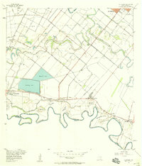
 1932 Combes1932 Print · USGSThe lower Rio Grande Valley comes into focus in the early 1930s, showing a landscape of family ranches and new flood control infrastructure. Genealogists and historians can trace the Missouri Pacific No 96 rail line through Combes and find rural landmarks like Briggs Coleman Sch and La India Ranch.2 unique versions available
 - 1932 Map of Rio Hondo
 1932 Rio Hondo1932 Print · USGSCoastal Texas ranching and rail commerce meet in the early 1930s as irrigation begins to reshape the landscape around Rio Hondo. Genealogists and historians can trace family-named landmarks and rural hubs like Las Yescas Ranch, Lozano, and the Mexican Christian Ch.3 unique versions available
 - 1932 Map of Harlingen
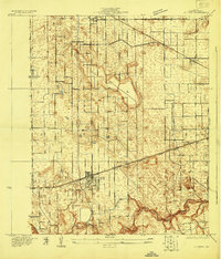
 1932 Harlingen1932 Print · USGSThe Rio Grande Valley comes into focus as a bustling agricultural and rail hub in the early thirties. Trace family roots and old property lines near Harlingen, San Benito, and the Palmetal Sch along the Arroyo Colorado.3 unique versions available
 - 1936 Map of La Feria
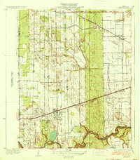 1936 La Feria1936 Print · USGSThe lower Rio Grande Valley comes to life in this mid-1930s survey of the irrigated farmlands and rail towns of Cameron County. Genealogists and local historians can trace the early streets and family farms near La Feria, Bixby, and the Wilson Sch country school site.3 unique versions available
 - 1936 Map of La Paloma
 1936 La Paloma1936 Print · USGSThe Lower Rio Grande Valley comes into focus during the mid-1930s as irrigation and rail lines transformed the borderlands. Genealogists and researchers can trace family landmarks and early school sites like Highland Sch, the Missouri Pacific rail stops, and the river benches at Capote Banco No 13.2 unique versions available
 - 1953 Map of Brownsville
 1953 Brownsville1953 Print · USGSSouth Texas ranchlands and the Lower Rio Grande Valley are captured here in the early fifties as the region's irrigation and shipping networks expanded. Genealogists and historians can trace family landholdings like Tecolote Ranch or follow the route of the St Louis Brownsville and Mexico rail line through Sebastian and Yturria.
 - 1956 Map of Rio Hondo
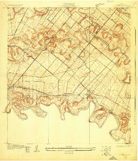
 1956 Rio Hondo1956 Print · USGSCoastal South Texas is shown here at mid-century, where complex irrigation networks and rail lines defined the landscape near the Gulf. Genealogists and historians can trace the foundations of San Benito and Rio Hondo, or find local landmarks like the Monte Meta Cemetery and Las Yescas Sch.3 unique versions available
 - 1956 Map of La Paloma, 1958 Print
 1956 La Paloma1958 Print · USGSThe Lower Rio Grande Valley in the mid-fifties shows a landscape of intricate irrigation and river-border settlements. Genealogists can trace family footprints near Rangerville, El Calaboz, and the river bends at Esparza-Vera Bend.3 unique versions available
 - 1956 Map of Willamar SW, 1958 Print
 1956 Willamar SW1958 Print · USGSMid-century Cameron County was a landscape defined by industrial irrigation and agricultural labor just as the region’s modern infrastructure took shape. Trace local family history at the Noyola Cem and Bracero Camp or follow the path of the Missouri Pacific rail line.3 unique versions available
 - 1956 Map of La Feria, 1959 Print
 1956 La Feria1959 Print · USGSThe Lower Rio Grande Valley comes alive in the mid-fifties as an intricate web of canals and rail lines connects La Feria and Santa Rosa. Researchers can trace local heritage through the San Francisco Cemeteries and family-named landmarks along the Arroyo Colorado.2 unique versions available
 - 1956 Map of Harlingen, 1959 Print
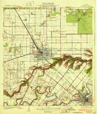
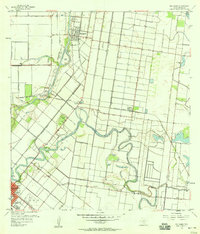
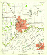 1956 Harlingen1959 Print · USGSHarlingen and the lower Rio Grande Valley are shown during a period of rapid mid-century growth and military importance. Genealogists and historians can trace the development of neighborhood schools like Alamo Sch, the extensive Harlingen Air Force Base, and the winding Arroyo Colorado.3 unique versions available
 - 1956 Map of Brownsville, 1969 Print
 1956 Brownsville1969 Print · USGSThe Texas-Mexico borderlands and the Gulf coast come alive in this mid-century survey of the Rio Grande Valley. Genealogists and historians can trace the reach of the Missouri Pacific rail lines through citrus country to schools like Las Yescas and Palm Grove.2 unique versions available
 - 1956 Map of Port Isabel, 1983 Print
 1956 Port Isabel1983 Print · USGSCoastal Texas and the Rio Grande Valley are shown here in the mid-twentieth century as the region balanced intensive agriculture with maritime trade. Researchers can trace historic rail lines like the SOUTHERN PACIFIC and locate rural landmarks such as Las Yescas Sch or the Armstrong Ranch.
 - 1962 Map of Brownsville
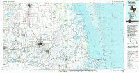
 1962 Brownsville1962 Print · USGSThe Lower Rio Grande Valley in the early sixties was a landscape of coastal wildlands, booming oil fields, and international border commerce. Trace the development of this frontier region through landmarks like Harlingen Air Force Base, Boca Chica Island, and the Willamar Oil Field.
 - 1992 Map of Harlingen
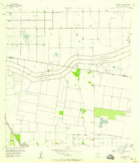
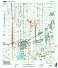
 1992 Harlingen1992 Print · USGSSouth Texas in the early nineties shows a landscape defined by industrial growth and coastal conservation along the Rio Grande. Trace the rail lines of the Missouri Pacific through Raymondville or locate the historic Palo Alto Battlefield near Port Isabel.
 - 2002 Map of La Feria, 2003 Print
 2002 La Feria2003 Print · USGSThe Lower Rio Grande Valley's agricultural and conservation lands are captured here at the turn of the millennium. Researchers can locate specific family landmarks like Tiocano Lake Cem or trace the early development of La Feria and Primera.
 - 2002 Map of La Paloma, 2003 Print
 2002 La Paloma2003 Print · USGSThe Lower Rio Grande Valley at the turn of the millennium shows a landscape defined by international borders and river meanders. Genealogists can trace family footprints near La Paloma, Rangerville, and local landmarks like the La Encantada School.
 - 2010 Map of La Feria, 2010 Print
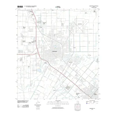
 2010 La Feria2010 Print · USGSCovers Harlingen, including Mercedes, La Feria, and other nearby areas
 - 2010 Map of Willamar SW, 2010 Print
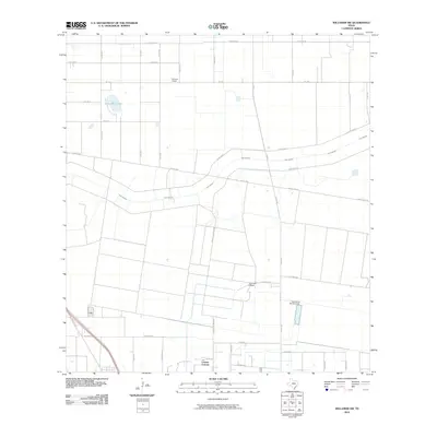 2010 Willamar SW2010 Print · USGSCovers Harlingen, including Combes, Lasana, and other nearby areas
 - 2010 Map of Harlingen, 2010 Print
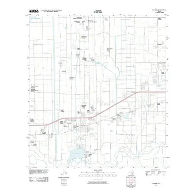
 2010 Harlingen2010 Print · USGSCovers Harlingen, including San Benito, Primera, and other nearby areas
 - 2010 Map of Rio Hondo, 2010 Print
 2010 Rio Hondo2010 Print · USGSCovers Harlingen, including Brownsville, San Benito, and other nearby areas
Showing maps 1-25 of 46
Top cities near Harlingen
- Brownsville historical maps
- Weslaco historical maps
- San Benito historical maps
- Mercedes historical maps
- La Feria historical maps
- Los Fresnos historical maps
See more
Top neighborhoods of Harlingen
- Stuart Place historical maps
- Country Estates historical maps
- Summerfield Estates historical maps
- Estrellita Subdivision historical maps
- Fountain View Village historical maps
- Fox Run Subdivision historical maps
See more
Frequently asked questions
- What are the different types of historical maps available for Harlingen?
- What is the oldest map of Harlingen?
- Where can I purchase historical maps of Harlingen for my home or office?
- Where can I download high-res historical maps of Harlingen?
- Are there historical topographic maps available for Harlingen?
- Is there historical aerial imagery available for Harlingen?
- Where are historical maps of Harlingen sourced from?