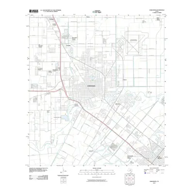
2010 Map of Harlingen
USGS Topo · Published 2010About this map
Harlingen and its surrounding colonias define the landscape of the Rio Grande Valley in this 2010 survey. The city's residential and commercial grid is bisected by the winding Arroyo Colorado, which serves as both a drainage artery and a focal point for local landmarks like the Harlingen Municipal Golf Course and the City of Harlingen Dam. North of the city center, the Rio Grande Valley International Airport occupies a significant footprint, while the surrounding rural-urban fringe is dotted with distinct settlements such as Combes Colonia, Las Palmas Colonia, and Avondale.
Find a feature on this map
62 named features on this map. Tap any name to fly to it.
Don’t see what you’re looking for? This feature index may not catch every label — zoom into the map to look around manually.
Map Details
Editions of this 2010 Harlingen Map
This is the sole edition of this map. No revisions or reprints were ever made.
Other maps of this area

1929 · Rio Hondo
USGS Topo · 1:24,000

1929 · Harlingen
USGS Topo · 1:24,000

1929 · Santa Rosa
USGS Topo · 1:24,000

1929 · Santa Maria
USGS Topo · 1:24,000

1929 · La Feria
USGS Topo · 1:24,000

1929 · La Paloma
USGS Topo · 1:24,000

1930 · Barreda
USGS Topo · 1:24,000

1932 · Combes
USGS Topo · 1:31,680

1932 · Rio Hondo
USGS Topo · 1:31,680

1932 · Harlingen
USGS Topo · 1:31,680