Old Maps of Clay County, Texas for Hiking & Exploration
Hike through history with 229 historic maps of Clay County. Explore old trails, ghost towns, and forgotten backroads — perfect for outdoor adventurers and local explorers.
- Rediscover forgotten places: Map out old mining camps, roads, and footpaths that no longer exist on modern maps.
- Layer with modern tools: Combine with LiDAR or satellite views to plan hikes through historical terrain.
- Made for exploration: Popular among hikers, overlanders, and local history lovers.
Use these maps to find adventure and explore the hidden past of Clay County.
Clay County, TX maps
(229)- 1901 Map of Addington
 1901 Addington1901 Print · USGSThe Chickasaw Nation at the turn of the century shows a landscape transitioning from cattle trails to rail commerce. Local historians can trace the Chisholm Trail and the Chicago Rock Island and Pacific rail line through Duncan, Comanche, and Addington.6 unique versions available
 - 1905 Map of Montague
 1905 Montague1905 Print · USGSMontague County and the bordering Chickasaw Nation are captured here in the early twentieth century as the frontier transitioned into a settled rail corridor. Genealogists and local researchers can locate numerous rural schools like Eagle Pt. School and trace river crossings such as Owings Ferry.3 unique versions available
 - 1954 Map of Sherman, 1964 Print
 1954 Sherman1964 Print · USGSThe Red River valley and North Texas plains are captured here in the mid-fifties, showing the region as new reservoirs like Lake Texoma and Lavon Reservoir reshaped the land. Genealogists can trace family roots through specific local landmarks like Courtney P O, Pilot Grove Sch, and New Hope Ch.2 unique versions available
 - 1954 Map of Wichita Falls, 1966 Print
 1954 Wichita Falls1966 Print · USGSNorth Texas in the mid-fifties is captured here as a landscape of expanding oil fields and vital rail corridors. Genealogists and historians can trace family roots through rural landmarks like Bacon Chapel and the rail-side growth of Seymour and Archer City.3 unique versions available
 - 1955 Map of Lawton, 1958 Print
 1955 Lawton1958 Print · USGSSouthwestern Oklahoma and North Texas are shown here in the mid-fifties, dominated by the Wichita Mountains and the vital Red River watershed. Genealogists and historians can trace the foundations of Lawton alongside rural landmarks like Rainy Mountain Church and Pleasant Hill School.5 unique versions available
 - 1956 Map of Sloop Creek, 1957 Print
 1956 Sloop Creek1957 Print · USGSThis mid-fifties survey of the Archer and Wichita County line shows the intersection of the burgeoning oil industry and traditional ranching. Genealogists and historians can trace family properties like Vogtsberger Ranch or locate the North Star School and Kickapoo Airport.3 unique versions available
 - 1956 Map of Henrietta, 1957 Print
 1956 Henrietta1957 Print · USGSClay County at the mid-century mark reveals a landscape defined by the intersection of cattle ranching, oil production, and major rail lines. Genealogists and historians can trace family locations near Hapgood Ranch, the community of Hurnville, or the grounds of Cambridge Cemetery.
 - 1957 Map of Hastings
 1957 Hastings1957 Print · USGSThe Red River frontier in the mid-fifties shows a landscape defined by the Chicago Rock Island and Pacific railroad and the booming oil industry. Genealogists and historians can trace family locations near Hastings, Byers, and the Petrolia Oil Field.2 unique versions available
 - 1957 Map of Randlett, 1958 Print
 1957 Randlett1958 Print · USGSThe Red River borderlands of Oklahoma and Texas come alive in this mid-century survey of the local oil fields and river bottoms. Researchers can trace rural lineages through sites like Randlett Cem, the Linville Sch (Aban'd), and the historical Perkins Reservation.2 unique versions available
 - 1957 Map of Wichita Falls East, 1958 Print
 1957 Wichita Falls East1958 Print · USGSNorth Texas in the late fifties was a landscape of expanding military aviation and established oil fields. Genealogists and historians can trace family-named properties like Vogtsberger Ranch alongside landmarks like White Hill Ch and the Kempner Cem.
 - 1957 Map of Wichita Falls East, 1958 Print
 1957 Wichita Falls East1958 Print · USGSMid-century Wichita Falls shows a landscape of military expansion and ranching heritage along the meanders of the Wichita River. Researchers can trace the development of Sheppard Air Force Base and find family-named properties like 77 Ranch and Hammon Ranch.
 - 1957 Map of Ardmore, 1968 Print
 1957 Ardmore1968 Print · USGSSouth-central Oklahoma in the late fifties was a landscape of rising reservoir waters and expanding rail lines. Genealogists and historians can trace the foundations of Ardmore and Duncan or locate early recreation sites at Platt National Park and Lake Murray State Park.3 unique versions available
 - 1958 Map of Wichita Falls
 1958 Wichita Falls1958 Print · USGSNorth Texas during the late fifties reveals a landscape defined by the booming petroleum industry and established rail hubs. Researchers can trace the development of Wichita Falls and discover rural landmarks like Barton's Chapel or the Hull-Silk Oil Field.
 - 1958 Map of Sherman, 1959 Print
 1958 Sherman1959 Print · USGSNorth Texas and Southern Oklahoma were undergoing significant development in the late fifties as the Red River Valley transit networks matured. Researchers can trace historic family-named locations such as Saddler Bend, the grounds of Perrin AFB, and early shoreline developments at Lake Texoma.
 - 1961 Map of Stoneburg, 1963 Print
 1961 Stoneburg1963 Print · USGSMontague County's cattle and oil country is frozen in time just after the mid-century, centered on the railroad hub of Stoneburg. Local historians can trace family ties at Adora Cem or follow the old tracks of the Chicago Rock Island and Pacific.2 unique versions available
 - 1961 Map of Brushy Mound, 1963 Print
 1961 Brushy Mound1963 Print · USGSMontague County and Clay County are captured in the early sixties as the landscape shifted toward oil production and reservoir development. Genealogists and researchers can locate McDonald Cem and trace the rail lines of the Fort Worth and Denver near the expanding Lake Amon G. Carter.2 unique versions available
 - 1961 Map of Selma, 1963 Print
 1961 Selma1963 Print · USGSThe rural borderlands of North Texas are captured here in the early sixties as the waters of Lake Amon G Carter reach their modern levels. Researchers can trace family roots at Selma Cem or Crafton Cem and locate industrial landmarks like the Bowie SW Oil Field.2 unique versions available
 - 1962 Map of Windthorst, 1964 Print
 1962 Windthorst1964 Print · USGSWindthorst and the surrounding Archer County ranch lands are captured here in the early sixties, showing a landscape defined by cattle and crude oil. Trace family roots at St Mary Ch or locate mid-century industrial markers like the Transcontinental Pipeline and Bridwell Ranch.
 - 1962 Map of Ryan, 1964 Print
 1962 Ryan1964 Print · USGSJefferson County in the early 1960s was a landscape shaped by the rail-and-creek economy of southern Oklahoma. Researchers can trace family history at the Addington Cem or locate industrial sites like the Tank Farm and several Gravel Pits along the Chicago Rock Island and Pacific line.2 unique versions available
 - 1962 Map of Antelope Creek NE, 1982 Print
 1962 Antelope Creek NE1982 Print · USGSThis North Central Texas landscape on the Baylor and Throckmorton county line captures the region's mid-century petroleum and water development. Researchers can trace the expansion of the Millers Creek Reservoir and identify early Oil Wells along Marys Creek.
 - 1963 Map of Ardmore
 1963 Ardmore1963 Print · USGSSouthern Oklahoma during the early sixties shows a landscape defined by the Arbuckle Mountains and a booming energy economy. Genealogists and historians can trace family-named sites across the Ardmore Oil Field, find old schools like Southeastern State College, or locate historic markers such as Boggy Depot State Park.2 unique versions available
 - 1963 Map of Deer Creek, 1964 Print
 1963 Deer Creek1964 Print · USGSClay County's rural landscape is captured here in the early sixties as a thriving center of petroleum production and ranching. Researchers can locate family landmarks like Halsell Cem, trace the meandering Little Wichita River, and map the extensive Acme Oil Field.2 unique versions available
 - 1963 Map of Scotland, 1964 Print
 1963 Scotland1964 Print · USGSScotland and the Archer County ranchlands are captured here in the early sixties, showing a landscape shaped by petroleum and old rail lines. Trace the Old Railroad Grade and find historic sites like Lake Creek Ch and the Bridwell Ranch.2 unique versions available
 - 1963 Map of Vashti, 1967 Print
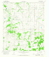 1963 Vashti1967 Print · USGSClay County at the dawn of the sixties shows a landscape of traditional ranching interspersed with growing energy infrastructure. Genealogists and historians can trace the rural community of Vashti, the location of Liberty Cem, and numerous Oil Wells.
 - 1964 Map of Darnell Branch, 1967 Print
 1964 Darnell Branch1967 Print · USGSIn the early 1960s, the North Texas prairie here was a landscape of ranching and oil extraction at the meeting of four counties. Researchers can trace the winding West Fork Trinity River and locate energy landmarks like Burns-Jones Field or Spy Knob.
Showing maps 1-25 of 229
Top cities of Clay County
- Henrietta historical maps
- Petrolia historical maps
- Byers historical maps
- Bellevue historical maps
- Dean historical maps
- Jolly historical maps
Frequently asked questions
- What are the different types of historical maps available for Clay County?
- What is the oldest map of Clay County?
- Where can I purchase historical maps of Clay County for my home or office?
- Where can I download high-res historical maps of Clay County?
- Are there historical topographic maps available for Clay County?
- Is there historical aerial imagery available for Clay County?
- Where are historical maps of Clay County sourced from?