1950s Maps of Collin County, Texas
Explore 10 historic maps of Collin County from the 1950s. These maps offer a rare glimpse into what life looked like during the 1950s — showing old roads, neighborhoods, homes, and landmarks that have changed or disappeared over time.
Whether you're researching your family's past, planning a metal detecting trip, or studying how Collin County's landscape evolved across the 1950s, these high-resolution maps are a powerful tool for exploring the history of this region.
- Focus on a specific era: All maps on this page are from the 1950s, giving you a focused view of this time period.
- See what’s changed: Compare century-old streets, trails, and buildings to today's modern landscape using overlays and satellite layers.
- Research with precision: Use these maps for genealogy, historical research, land use analysis, or educational projects.
- View, download, or print: Maps are fully viewable online in high resolution, and can be downloaded or printed for your own records.
Start exploring Collin County's history through authentic maps from the 1950s. This is your window into the past.
Collin County, TX maps
(10)- 1954 Map of Dallas, 1963 Print
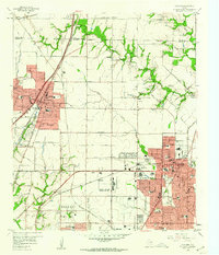
 1954 Dallas1963 Print · USGSNorth Texas in the mid-fifties and early sixties reveals a landscape of rapid urban growth and water management. Genealogists and historians can trace the evolution of the metroplex through landmarks like Hensley Field, Boles Orphan Home, and the Texas & Pacific RR.4 unique versions available
 - 1954 Map of Sherman, 1964 Print
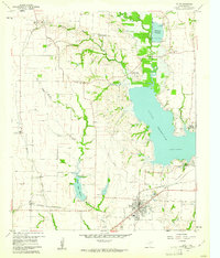
 1954 Sherman1964 Print · USGSThe Red River valley and North Texas plains are captured here in the mid-fifties, showing the region as new reservoirs like Lake Texoma and Lavon Reservoir reshaped the land. Genealogists can trace family roots through specific local landmarks like Courtney P O, Pilot Grove Sch, and New Hope Ch.2 unique versions available
 - 1958 Map of Dallas
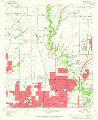
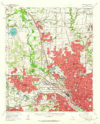
 1958 Dallas1958 Print · USGSNorth Texas in the late fifties shows the dramatic expansion of the Metroplex as it absorbs surrounding farm towns. Genealogists and historians can trace old rail lines like the Missouri-Kansas-Texas and locate early lakefront developments at Eagle Mountain Lake and Lake Worth Village.
 - 1958 Map of Sherman, 1959 Print
 1958 Sherman1959 Print · USGSNorth Texas and Southern Oklahoma were undergoing significant development in the late fifties as the Red River Valley transit networks matured. Researchers can trace historic family-named locations such as Saddler Bend, the grounds of Perrin AFB, and early shoreline developments at Lake Texoma.
 - 1959 Map of Garland, 1960 Print
 1959 Garland1960 Print · USGSNortheast Dallas County is shown here in the late fifties, just as the postwar suburban boom began to reshape the countryside. Genealogists and historians can trace family-named sites like Blewett Cem and early communities such as Audelia and Shiloh.5 unique versions available
 - 1959 Map of Addison, 1960 Print
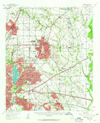
 1959 Addison1960 Print · USGSThe northern fringes of Dallas were transforming from rural farmsteads to suburban hubs during the late fifties. Genealogists and historians can trace the growth of local institutions like Ursuline Academy, the Addison Sch, and the historic White Rock Cem.6 unique versions available
 - 1959 Map of Rowlett, 1960 Print
 1959 Rowlett1960 Print · USGSThe Rowlett and Garland area of North Texas is captured here in the late fifties, showcasing a rural landscape before its rapid suburban transformation. Genealogists and historians can trace family-named sites like Watson Sch, McShan Cem, and the settlement of Dalrock.6 unique versions available
 - 1959 Map of Wylie, 1961 Print
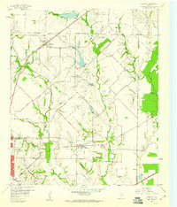
 1959 Wylie1961 Print · USGSCollin County during the late fifties shows the rising importance of water management and rail transit in North Texas. Genealogists and local historians can locate many family sites, from the St Paul Cem to the railroad junction at Wylie and the community of Winningkoff.4 unique versions available
 - 1959 Map of Garland, 1963 Print
 1959 Garland1963 Print · USGSEastern Dallas County is captured in the late fifties as small towns begin to merge into a growing suburban landscape. Genealogists and historians can trace local family roots at Blewett Cem and see the early footprints of Richardson, Sunnyvale, and the White Rock Airport.
 - 1959 Map of Carrollton, 1963 Print
 1959 Carrollton1963 Print · USGSNorth Dallas and its surrounding suburbs are captured during a period of massive suburban growth in the late fifties. Genealogists can trace family sites near Trinity Mills, while researchers can locate mid-century landmarks like Love Field Municipal Airport and Calvary Hill Cemetery.
End of results
Showing maps 1-10 of 10
Top cities of Collin County
- Plano historical maps
- McKinney historical maps
- Allen historical maps
- Wylie historical maps
- Murphy historical maps
- Anna historical maps
See more
Frequently asked questions
- What are the different types of historical maps available for Collin County?
- What is the oldest map of Collin County?
- Where can I purchase historical maps of Collin County for my home or office?
- Where can I download high-res historical maps of Collin County?
- Are there historical topographic maps available for Collin County?
- Is there historical aerial imagery available for Collin County?
- Where are historical maps of Collin County sourced from?