1960s Maps of Colorado County, Texas
Explore 16 historic maps of Colorado County from the 1960s. These maps offer a rare glimpse into what life looked like during the 1960s — showing old roads, neighborhoods, homes, and landmarks that have changed or disappeared over time.
Whether you're researching your family's past, planning a metal detecting trip, or studying how Colorado County's landscape evolved across the 1960s, these high-resolution maps are a powerful tool for exploring the history of this region.
- Focus on a specific era: All maps on this page are from the 1960s, giving you a focused view of this time period.
- See what’s changed: Compare century-old streets, trails, and buildings to today's modern landscape using overlays and satellite layers.
- Research with precision: Use these maps for genealogy, historical research, land use analysis, or educational projects.
- View, download, or print: Maps are fully viewable online in high resolution, and can be downloaded or printed for your own records.
Start exploring Colorado County's history through authentic maps from the 1960s. This is your window into the past.
Colorado County, TX maps
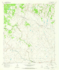
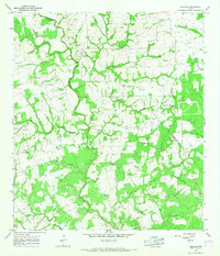
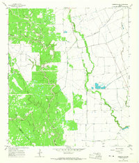
(16)- 1960 Map of Lissie, 1961 Print
 1960 Lissie1961 Print · USGSWharton County agricultural and industrial life is captured here in the early sixties, showing the expansion of oil and gas alongside traditional rice farming. Trace the rail-and-canal network between Lissie and Nottawa, or locate the Rice Mill and Chesterville Oil Field.2 unique versions available
 - 1960 Map of Rexville, 1961 Print
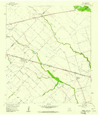
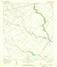
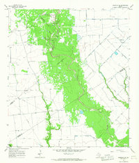
 1960 Rexville1961 Print · USGSThe rural borderlands of Austin and Wharton Counties are captured here in the early sixties as the oil and gas industry matured. Trace old rail lines like the Gulf Colorado and Santa Fe through Rexville or locate the Chesterville Oil Field.2 unique versions available
 - 1963 Map of New Ulm, 1965 Print
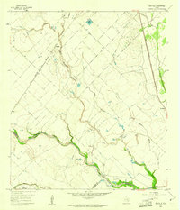
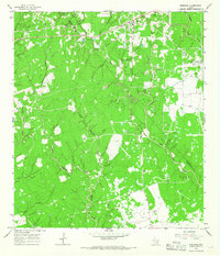
 1963 New Ulm1965 Print · USGSThe rolling hills of Austin County are captured here in the early sixties, showing a landscape of established farmsteads and rural hamlets. Genealogists can trace family lines through National Cemetery and Zettle Cemetery, or locate the old Missouri Kansas Texas rail line.2 unique versions available
 - 1963 Map of Eagle Lake, 1965 Print
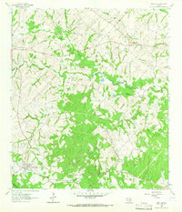
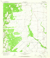
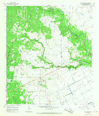
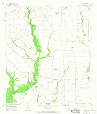
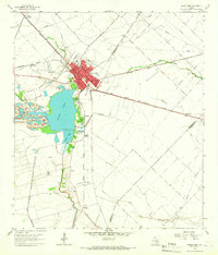 1963 Eagle Lake1965 Print · USGSThe Colorado County prairie comes alive in this early 1960s survey, centered on the rail hub of Eagle Lake. Genealogists can trace family sites at Mount Zion Cem or Lakeside Cem, while collectors can map the era's Strip Mine and oil field growth.2 unique versions available
 - 1963 Map of Cat Spring, 1966 Print
 1963 Cat Spring1966 Print · USGSThe rural landscape of Austin and Colorado counties is captured in the early sixties as it balanced rail commerce with traditional agriculture. Researchers can trace family plots at Schlopata Cem or follow the Missouri Kansas Texas line through Cat Spring.3 unique versions available
 - 1963 Map of Eagle Lake NE, 1966 Print
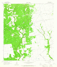
 1963 Eagle Lake NE1966 Print · USGSCoastal prairie life in the early 1960s centered on the riparian corridors of the San Bernard River and the local rail lines. Researchers can trace the heritage of small settlements like Bernardo and Lafitte or locate specific sites like the Chesterville Oil Field.2 unique versions available
 - 1964 Map of Cordele, 1966 Print
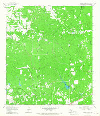
 1964 Cordele1966 Print · USGSIn the mid-1960s, the Jackson County prairie near the Lavaca line was a landscape of cattle, cotton, and the rising energy industry. Local historians can trace family burial sites at Gandy Cem and Flourney Cem or explore the early development of the Morales Gas Field.2 unique versions available
 - 1964 Map of Speaks, 1966 Print
 1964 Speaks1966 Print · USGSCoastal plains and petroleum fields define this pocket of Lavaca County in the 1960s. Researchers can trace the industrial layout of the Wilcox Refinery or locate remote burial sites like Bright Cem and the small settlement of Seclusion.2 unique versions available
 - 1965 Map of Oakland, 1967 Print
 1965 Oakland1967 Print · USGSCrossing the Colorado and Lavaca county line in the 1960s, this area is defined by the winding Navidad River and its rural farming outposts. Genealogists can trace family names through numerous local burial sites like Oakland Hill Cem, Shiloh Cem, and Bila Hora Cem.2 unique versions available
 - 1965 Map of Sawmill Branch, 1967 Print
 1965 Sawmill Branch1967 Print · USGSThe Colorado and Lavaca county line runs through this Texas creek-bottom landscape in the mid-1960s. Genealogists and historians can trace the rural drainage network from West Sandy Creek to Crooked Creek Lake and find old Gas Well and Gravel Pit sites.2 unique versions available
 - 1965 Map of Rock Island, 1967 Print
 1965 Rock Island1967 Print · USGSRock Island and the surrounding Colorado County ranchlands are captured here in the mid-1960s. Genealogists and local historians can trace the town's original footprint near Myrtle Cem and follow the path of the SOUTHERN PACIFIC rail line through Buzzard Prairie.2 unique versions available
 - 1965 Map of Weimar, 1967 Print
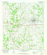 1965 Weimar1967 Print · USGSWeimar and its rural surroundings in the 1960s reveal a landscape defined by the Southern Pacific railroad and the East Navidad River. Researchers can trace the layout of Dubina, locate family plots at Hehr Cem, or identify historic church sites like St Cyril Ch.2 unique versions available
 - 1965 Map of Sheridan NE, 1967 Print
 1965 Sheridan NE1967 Print · USGSCoastal Texas oil and gas production is in full swing during the mid-1960s as this survey of the Colorado County line reveals. Researchers can trace the industrial footprint of the Sheridan Gas Field, locating scattered oil wells and the remote Landing Strip.2 unique versions available
 - 1965 Map of Sheridan SE, 1967 Print
 1965 Sheridan SE1967 Print · USGSCoastal Texas ranching and energy production intersect in the mid-1960s where three counties converge along Sandy Creek. Researchers can locate the Brownson Cem and trace early oil and gas development near the Whitegate Landing Strip.2 unique versions available
 - 1965 Map of Sheridan, 1967 Print
 1965 Sheridan1967 Print · USGSSheridan and the surrounding gas fields of Colorado and Lavaca Counties appear here at the height of the mid-century energy boom. Researchers can trace the industrial footprint of the Sheridan Field, locate the Cheetham Cem, and follow the old railroad grade.2 unique versions available
 - 1965 Map of Hahn, 1968 Print
 1965 Hahn1968 Print · USGSWharton County agriculture and the Texas energy boom intersect in the mid-1960s near the Colorado County line. Family historians can trace landmarks like the Hahn Cem and Mt Pilgrim Ch or the industrial footprint of the Raun Rice Dryer.2 unique versions available
End of results
Showing maps 1-16 of 16
Top cities of Colorado County
Frequently asked questions
- What are the different types of historical maps available for Colorado County?
- What is the oldest map of Colorado County?
- Where can I purchase historical maps of Colorado County for my home or office?
- Where can I download high-res historical maps of Colorado County?
- Are there historical topographic maps available for Colorado County?
- Is there historical aerial imagery available for Colorado County?
- Where are historical maps of Colorado County sourced from?