Old Maps of Colorado County, Texas for Genealogy
Trace your family roots with 179 historic maps of Colorado County. These high-res maps reveal old neighborhoods, homesites, landmarks, and streets — helping you uncover where your ancestors lived and how the area evolved over time.
- Explore historic neighborhoods: Identify where your relatives may have lived in the 1800s or 1900s.
- Compare maps over time: Trace the changes in streets, buildings, and landmarks for multi-generational research.
- Perfect for genealogy & ancestry research: Used by family historians and researchers to map out lineage and migration.
These maps are an incredible resource for exploring your personal connection to Colorado County's past.
Colorado County, TX maps
(179)- 1919 Map of Fayettsville
 1919 Fayettsville1919 Print · USGSFayette and Colorado counties are captured here in the years following the Great War, showing a landscape defined by the railroad and the river. Researchers can trace the routes of the Missouri Kansas and Texas Railway to historic hubs like Fayetteville and Ellinger.
 - 1919 Map of Schulenburg, 1956 Print
 1919 Schulenburg1956 Print · USGSTexas at the close of the Great War was a landscape of rail-connected towns and river crossings. Genealogists can trace family roots through the settlements of High Hill, Dubina, and St. Johns, while following the old fords across the Navidad River.
 - 1953 Map of Seguin, 1965 Print
 1953 Seguin1965 Print · USGSSouth Texas in the early fifties shows a thriving river-and-rail economy across the Guadalupe and Colorado basins. Genealogists and historians can trace rail routes like the Southern Pacific through Seguin, locate oil wells, or find the Gary AAF near San Marcos.4 unique versions available
 - 1956 Map of Bellville
 1956 Bellville1956 Print · USGSTexas farming life in the mid-fifties is captured here as small communities and rural school districts thrive along the San Bernard River. Genealogists can trace early homesteads near Industry, New Ulm, and the Cat Springs Sch.
 - 1956 Map of Glidden
 1956 Glidden1956 Print · USGSCoastal prairie and river bottomlands near the Colorado River are captured here during the mid-century, showing the rail-driven growth of Columbus. Genealogists can trace early homesteads and crossings near Rock Island, Borden, and the Skull Creek drainage.
 - 1956 Map of La Grange
 1956 La Grange1956 Print · USGSCentral Fayette County thrived as a rail and river hub at the start of the twentieth century, anchored by the crossroads of La Grange. Genealogists can trace family footprints through rural settlements like Swiss Alps, Ammansville, and Oldenburg.
 - 1956 Map of Wallis
 1956 Wallis1956 Print · USGSThe Brazos and San Bernard rivers dominate this coastal prairie landscape during the early twentieth century. Trace family roots and vanished rail stops through Wallis, Chesterville, and Lissie along the Gulf Colorado and Santa Fe Railway.
 - 1957 Map of Eagle Lake
 1957 Eagle Lake1957 Print · USGSTexas coastal prairie life in the early twentieth century is defined here by the convergence of major rail lines and the namesake Eagle Lake. Genealogists and historians can trace the development of localized junctions and settlements like Alleyton, Altair, and Rice Land.
 - 1957 Map of Ellinger, 1958 Print
 1957 Ellinger1958 Print · USGSFayette and Colorado Counties are captured here in the late fifties, centered on the town of Ellinger and the winding COLORADO RIVER. Genealogists can trace family names and local landmarks like Rocky Hill Sch, Shaws Bend Cem, and the OLD RAILROAD GRADE.2 unique versions available
 - 1957 Map of Altair, 1958 Print
 1957 Altair1958 Print · USGSMid-century Colorado County is defined here by the winding river and the growth of the local oil industry. Researchers can trace the path of the Old Spanish Trail and locate community sites like the Washington Carver Sch or Gaines Crossing.2 unique versions available
 - 1957 Map of Columbus, 1958 Print
 1957 Columbus1958 Print · USGSIn the late fifties, the bend of the Colorado River near Columbus was a hub of rail lines and early highways. Researchers can trace the Old Spanish Trail past the Columbus Oil Field or locate local landmarks like the City Cem and Glidden.2 unique versions available
 - 1957 Map of Borden, 1958 Print
 1957 Borden1958 Print · USGSBorden and Colorado County are captured here in the late fifties, showcasing a landscape of river-bottom farms and emerging oil interests. Researchers can trace family roots at St Johns Ch, Oak Grove Sch, and the Borden Cemetery.3 unique versions available
 - 1957 Map of Ammannsville, 1958 Print
 1957 Ammannsville1958 Print · USGSFayette County communities like Ammannsville and Holman are captured in the late fifties as they remained centered on local parishes and rural schools. Genealogists can trace family footprints at Bictner Cem, Hostyn Sch, and the St Wenceslaus Ch.2 unique versions available
 - 1958 Map of Seguin
 1958 Seguin1958 Print · USGSSouth Texas in the late fifties was a network of river-valley settlements and active oilfields tied together by major rail lines. Genealogists and historians can trace family-named sites across Rabb Prairie, locate the Behring Store, or follow the Southern Pacific through Schulenburg.
 - 1958 Map of Industry, 1959 Print
 1958 Industry1959 Print · USGSThe Austin and Fayette county lines intersect in the late fifties, revealing a rural landscape of German settlements and family farms. Trace local heritage at Industry, New Ulm, and Cherry Chapel, or follow the MISSOURI KANSAS TEXAS rail line.
 - 1958 Map of Frelsburg, 1959 Print
 1958 Frelsburg1959 Print · USGSFrelsburg and the surrounding Colorado County countryside are shown here in the late fifties as the local economy balanced ranching with oil production. Genealogists and researchers can locate family sites like Kaiser Cem, the St Peter and Paul Sch, and the Zimmerscheidt Community Center.3 unique versions available
 - 1958 Map of Bernardo, 1959 Print
 1958 Bernardo1959 Print · USGSThe rural borderlands of Colorado and Austin counties come alive in this late fifties survey of the San Bernard River valley. Genealogists can trace family heritage through a remarkable number of local burial sites like Hinsley Cem and Gadecke Cem, or locate the historic Bernardo Sch.2 unique versions available
 - 1958 Map of Fayetteville, 1959 Print
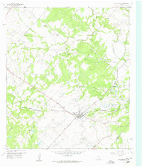 1958 Fayetteville1959 Print · USGSFayetteville and its surrounding farmsteads were recorded here in the late fifties as the local economy balanced rail transit and rural industry. Genealogists can trace family landmarks like the Halimecek Cem, Ross Prairie Ch, and the old rail siding at Tamberg.3 unique versions available
 - 1958 Map of Alleyton, 1959 Print
 1958 Alleyton1959 Print · USGSThe Colorado River valley near Alleyton comes alive in the late fifties, showcasing a landscape of river-bend settlements and deep-rooted Texas history. Researchers can locate the Atascosito Crossing, the Alley House, and early family plots like the Brindhack Obenchain Cem.3 unique versions available
 - 1959 Map of Garwood, 1960 Print
 1959 Garwood1960 Print · USGSThe Texas coastal prairie near the Colorado River comes to life here in the late fifties, showing a landscape defined by rice farming and oil exploration. Genealogists and historians can locate family sites at Nada Cem, St Mary Sch, and Garwood Cem.3 unique versions available
 - 1959 Map of Bonus, 1960 Print
 1959 Bonus1960 Print · USGSThe coastal plains of Wharton and Colorado counties are captured here in the late fifties as the local economy balanced rail transport and river resources. Genealogists can trace family landmarks like Frazer Cem, Elm Grove Ch, and the rail siding at Boedecker Junction.3 unique versions available
 - 1960 Map of Lissie, 1961 Print
 1960 Lissie1961 Print · USGSWharton County agricultural and industrial life is captured here in the early sixties, showing the expansion of oil and gas alongside traditional rice farming. Trace the rail-and-canal network between Lissie and Nottawa, or locate the Rice Mill and Chesterville Oil Field.2 unique versions available
 - 1960 Map of Rexville, 1961 Print
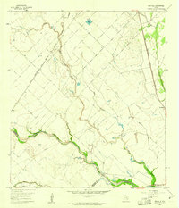 1960 Rexville1961 Print · USGSThe rural borderlands of Austin and Wharton Counties are captured here in the early sixties as the oil and gas industry matured. Trace old rail lines like the Gulf Colorado and Santa Fe through Rexville or locate the Chesterville Oil Field.2 unique versions available
 - 1963 Map of New Ulm, 1965 Print
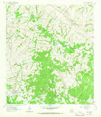 1963 New Ulm1965 Print · USGSThe rolling hills of Austin County are captured here in the early sixties, showing a landscape of established farmsteads and rural hamlets. Genealogists can trace family lines through National Cemetery and Zettle Cemetery, or locate the old Missouri Kansas Texas rail line.2 unique versions available
 - 1963 Map of Eagle Lake, 1965 Print
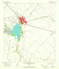 1963 Eagle Lake1965 Print · USGSThe Colorado County prairie comes alive in this early 1960s survey, centered on the rail hub of Eagle Lake. Genealogists can trace family sites at Mount Zion Cem or Lakeside Cem, while collectors can map the era's Strip Mine and oil field growth.2 unique versions available
Showing maps 1-25 of 179
Top cities of Colorado County
Frequently asked questions
- What are the different types of historical maps available for Colorado County?
- What is the oldest map of Colorado County?
- Where can I purchase historical maps of Colorado County for my home or office?
- Where can I download high-res historical maps of Colorado County?
- Are there historical topographic maps available for Colorado County?
- Is there historical aerial imagery available for Colorado County?
- Where are historical maps of Colorado County sourced from?