
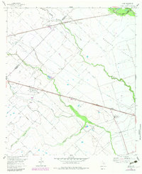
1960 Map of Lissie
USGS Topo · Published 1961About this map
The Bernard Prairie landscape of 1960 is defined by a sophisticated water management and industrial system, where the Chesterville Line Canal cuts across the flat terrain to support local agriculture. The Texas and New Orleans (Southern Pacific) railroad serves as the primary corridor for the region's economy, connecting small settlements like Lissie and Chesterville. At Lissie, the presence of a Rice Mill and Po indicates a functional agricultural hub, while the surrounding Lisse Field and Chesterville Oil Field reveal an active petroleum and gas industry. Natural drainage is provided by the winding courses of Middle Bernard Creek and West Bernard Creek, which contrast with the straight engineered lines of the irrigation canals and pipelines. Further east, the settlement of Nottawa sits near a prominent Radio Tower and Gas Plant, marking the intersection of rural life and industrial infrastructure during this era.
Find a feature on this map
21 named features on this map. Tap any name to fly to it.
Don’t see what you’re looking for? This feature index may not catch every label — zoom into the map to look around manually.
Map Details
Editions of this 1960 Lissie Map
2 editions found
Other maps of this area

1952 · Egypt
USGS Topo · 1:24,000

1953 · Hungerford
USGS Topo · 1:24,000

1953 · Seguin
USGS Topo · 1:250,000

1956 · Wallis
USGS Topo · 1:62,500

1957 · Eagle Lake
USGS Topo · 1:62,500

1958 · Seguin
USGS Topo · 1:250,000

1959 · Bonus
USGS Topo · 1:24,000

1960 · Wallis
USGS Topo · 1:24,000
1960 · East Bernard
USGS Topo · 1:24,000
1960 · Rexville
USGS Topo · 1:24,000