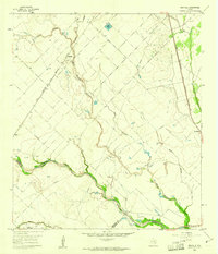
1960 Map of Rexville
USGS Topo · Published 1961About this map
San Bernard River bottomlands define the geography of this 1960 survey, marking the jurisdictional convergence of Austin, Colorado, and Wharton Counties. The landscape is a mix of agricultural fields and industrial activity, anchored by the Gulf Colorado and Santa Fe (AT & SF) railroad which services the small settlement at Rexville. Evidence of the region’s resource economy is visible in the Chesterville Oil Field and scattered oil wells and gas wells that punctuate the prairie.
Find a feature on this map
21 named features on this map. Tap any name to fly to it.
Don’t see what you’re looking for? This feature index may not catch every label — zoom into the map to look around manually.
Map Details
Editions of this 1960 Rexville Map
2 editions found
Other maps of this area

1953 · Seguin
USGS Topo · 1:250,000

1956 · Bellville
USGS Topo · 1:62,500

1956 · Sealy
USGS Topo · 1:62,500

1956 · Wallis
USGS Topo · 1:62,500

1957 · Eagle Lake
USGS Topo · 1:62,500

1958 · Seguin
USGS Topo · 1:250,000

1960 · Lissie
USGS Topo · 1:24,000

1960 · Wallis
USGS Topo · 1:24,000

1960 · San Felipe
USGS Topo · 1:24,000
1960 · East Bernard
USGS Topo · 1:24,000