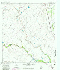
1960 Map of Rexville
USGS Topo · Published 1983About this map
Rexville and the surrounding coastal prairie landscape of Austin County are defined by a complex network of waterways and early industrial activity. The San Bernard River winds through the southern portion of the map, joined by various tributaries including Little Bernard Creek, East Bernard Creek, and Middle Bernard Creek. These drainage patterns shaped the placement of early settlements and agricultural boundaries. The Atchison Topeka and Santa Fe railroad cuts a straight diagonal across the terrain, passing through Rexville and near a local gravel pit.
Find a feature on this map
23 named features on this map. Tap any name to fly to it.
Don’t see what you’re looking for? This feature index may not catch every label — zoom into the map to look around manually.
Map Details
Editions of this 1960 Rexville Map
2 editions found
Other maps of this area

1953 · Seguin
USGS Topo · 1:250,000

1956 · Bellville
USGS Topo · 1:62,500

1956 · Sealy
USGS Topo · 1:62,500

1956 · Wallis
USGS Topo · 1:62,500

1957 · Eagle Lake
USGS Topo · 1:62,500

1958 · Seguin
USGS Topo · 1:250,000

1960 · Lissie
USGS Topo · 1:24,000

1960 · Wallis
USGS Topo · 1:24,000

1960 · San Felipe
USGS Topo · 1:24,000
1960 · East Bernard
USGS Topo · 1:24,000