2020s Maps of Crane County, Texas
Explore 25 historic maps of Crane County from the 2020s. These maps offer a rare glimpse into what life looked like during the 2020s — showing old roads, neighborhoods, homes, and landmarks that have changed or disappeared over time.
Whether you're researching your family's past, planning a metal detecting trip, or studying how Crane County's landscape evolved across the 2020s, these high-resolution maps are a powerful tool for exploring the history of this region.
- Focus on a specific era: All maps on this page are from the 2020s, giving you a focused view of this time period.
- See what’s changed: Compare century-old streets, trails, and buildings to today's modern landscape using overlays and satellite layers.
- Research with precision: Use these maps for genealogy, historical research, land use analysis, or educational projects.
- View, download, or print: Maps are fully viewable online in high resolution, and can be downloaded or printed for your own records.
Start exploring Crane County's history through authentic maps from the 2020s. This is your window into the past.
Crane County, TX maps
(25)- 2022 Map of Doodle Bug Well, 2022 Print
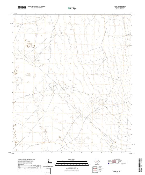
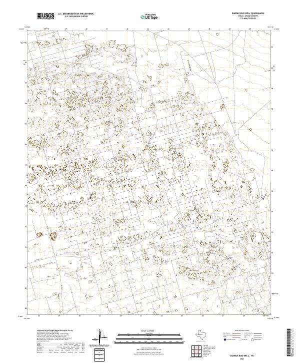 2022 Doodle Bug Well2022 Print · USGSCrane County at the start of the 2020s shows a landscape transformed by intensive industrial land use and resource management. Researchers can trace the development of the high desert grid via Phillips Water Rd, University Rd, and Landreth Draw.
 - 2022 Map of Imperial, 2022 Print
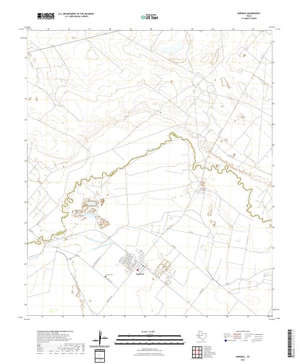 2022 Imperial2022 Print · USGSImperial sits at the heart of a complex irrigation network during the early 2020s, where the winding Pecos River defines the landscape. Genealogists and local historians can trace the town’s layout and find the Imperial Cem, the PO, and the paths of the Highline Canal and Imperial Canal.
 - 2022 Map of Penwell SW, 2022 Print
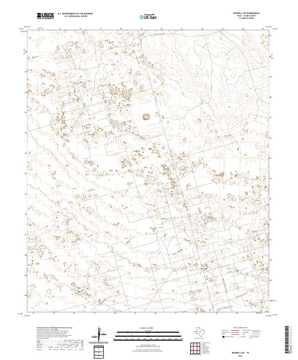 2022 Penwell SW2022 Print · USGSThe high plains of West Texas are revealed in this recent survey of Crane County, showing a landscape shaped by both ranching and industry. Researchers can trace land use through specialized routes like Sandhills Warren Plant Rd and Mcknight Ranch Rd.
 - 2022 Map of Castle Gap, 2022 Print
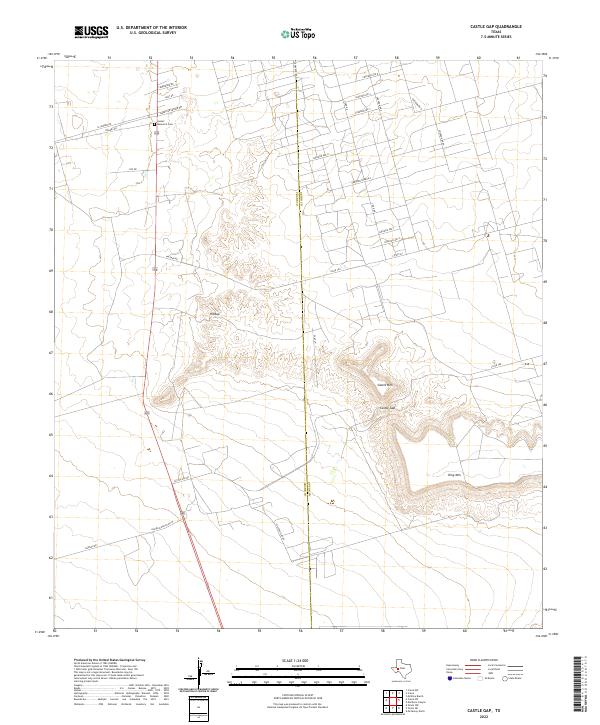 2022 Castle Gap2022 Print · USGSThe rugged terrain of the Permian Basin is captured here in the early 2020s, centered on the historic passage at Castle Gap. Researchers can trace old ranching routes like Handlin Ranch Rd W and locate burials at Sunset Memorial Cem.
 - 2022 Map of Penwell, 2022 Print
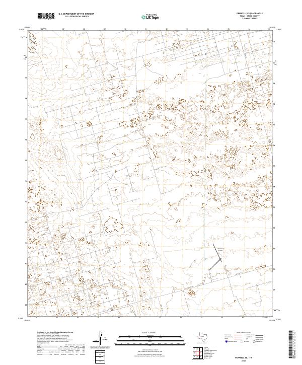
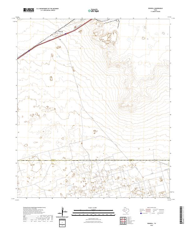 2022 Penwell2022 Print · USGSThe West Texas landscape around the town of Penwell is shown here in the early 2020s. Researchers can trace the layout of local streets like Ave J, locate the Rhodes Cem, and follow the boundary between Ector Co and Crane Co.
 - 2022 Map of Monahans SE, 2022 Print
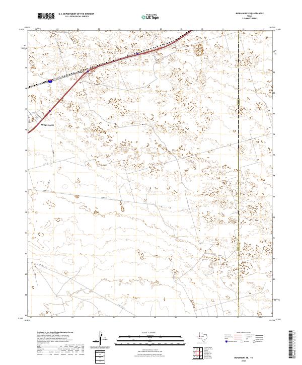 2022 Monahans SE2022 Print · USGSMonahans and the surrounding West Texas plains are captured in this recent survey during a period of active energy development. Researchers can trace the intersection of industry and infrastructure along Park Rd 41 and Ranch Rd 1233 near Altura Energy Ltd.
 - 2022 Map of Girvin NW, 2022 Print
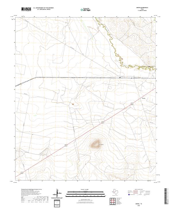
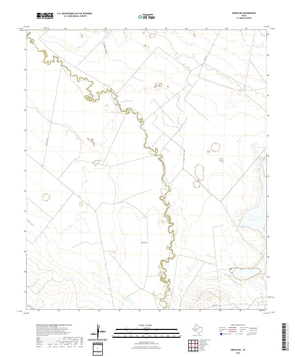 2022 Girvin NW2022 Print · USGSThe Pecos River valley at the Crane and Pecos county line shows a landscape of arid draws and salt basins. Researchers can trace the path of Horse Head Rd, the waters of Soda Lake, and the winding course of the Pecos River.
 - 2022 Map of Ozark Lake, 2022 Print
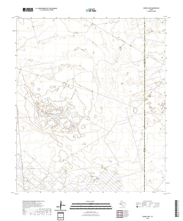 2022 Ozark Lake2022 Print · USGSThe Permian Basin plains of Ward and Crane counties are captured here in the early 2020s, showing a landscape defined by oil field infrastructure. Genealogists and historians can trace the boundary between Ward and Crane County and the road network surrounding Ozark Lake.
 - 2022 Map of Juan Cordona Lake, 2022 Print
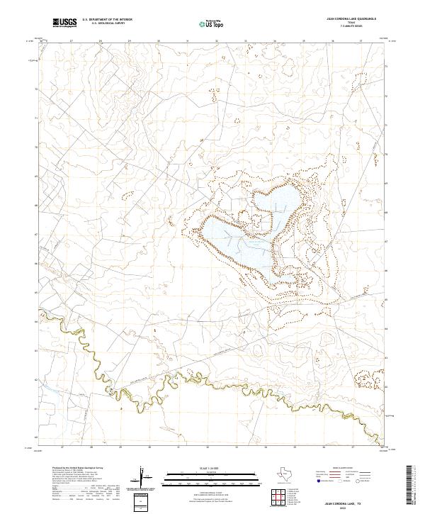 2022 Juan Cordona Lake2022 Print · USGSThe Crane and Pecos county line in the early 2020s shows a landscape of industrial transit and desert waterways. Genealogists and historians can trace routes like Old Crane Rd and Tiny Earp Rd as they converge near Juan Cordona Lake.
 - 2022 Map of Crane SW, 2022 Print
 2022 Crane SW2022 Print · USGSCrane County's ranching and oil landscapes are captured here in the early twenty-first century. Researchers can trace the path of Landreth Draw and follow local routes like Horsehead Rd and Juan Cardona Lake Rd.
 - 2022 Map of Grandfalls, 2022 Print
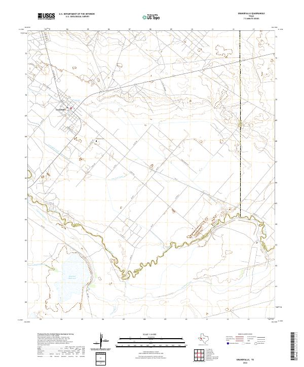 2022 Grandfalls2022 Print · USGSThe West Texas town of Grandfalls is centered in a landscape transformed by early twenty-first-century irrigation. You can trace the complex network of the Pecos River and its managed waterways, including the Imperial Canal and Grandfalls Canal.
 - 2022 Map of Buena Vista NE, 2022 Print
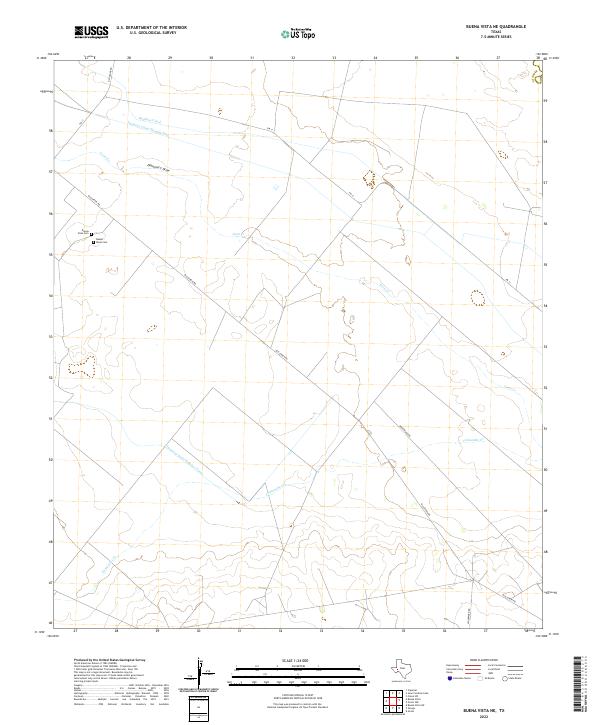 2022 Buena Vista NE2022 Print · USGSPecos County’s arid landscape and irrigation history are documented here in the early twenty-first century. Genealogists and local historians can locate the Buena Vista Cem and Baxter - Rixse Cem alongside the Highline Canal.
 - 2022 Map of Perkins Lake, 2022 Print
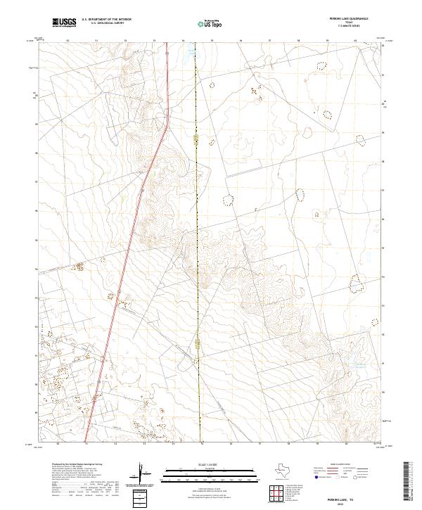 2022 Perkins Lake2022 Print · USGSCrane and Upton counties are mapped here in the early 2020s, showing a landscape of livestock ranching and water management. Researchers can trace land boundaries and access routes like Mc Elroy Ranch Rd, Mobile Rd, and Perkins Lake.
 - 2022 Map of Tubbs Corner, 2022 Print
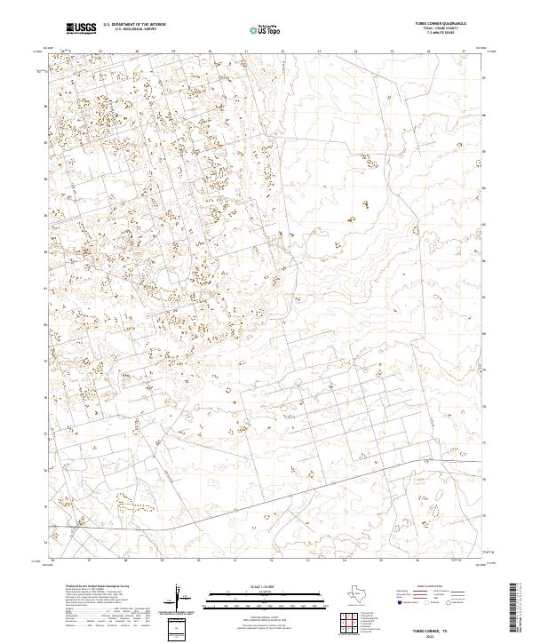 2022 Tubbs Corner2022 Print · USGSCrane County in the early 2020s shows the intricate industrial grid of the West Texas oil fields. Researchers can trace the extensive road network serving the energy sector, from family-named routes like Katie Lea Rd to industrial paths like Exxon Loop.
 - 2022 Map of Imperial NW, 2022 Print
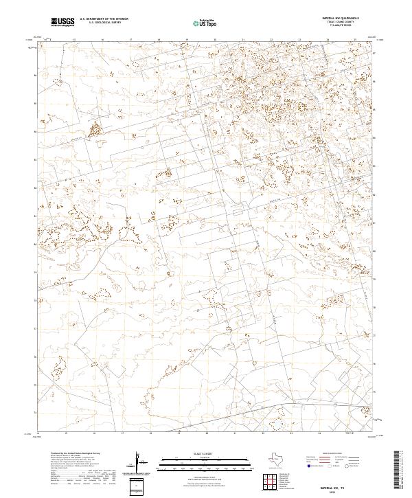 2022 Imperial NW2022 Print · USGSThe West Texas plains are captured here in recent years, showing a landscape defined by oil production and cattle ranching. Researchers can trace the industrial footprint and local property access via Pennzoil Loop, Exxon Loop, and Jim Tubbs Rd.
 - 2022 Map of Girvin NE, 2022 Print
 2022 Girvin NE2022 Print · USGSCrane and Upton counties meet in this arid West Texas landscape during the early 2020s. Researchers can trace the rugged escarpments of King Mtn and the isolated drainage of Soda Lake along local ranch routes like Letter B Rd.
 - 2022 Map of Crane NW, 2022 Print
 2022 Crane NW2022 Print · USGSThe Permian Basin oil fields north of Crane appear in 2022 with their intricate grid of industrial and service roads. Researchers can trace energy-sector landmarks like Arco Plant Rd and S Exxon Rd or follow the natural course of Landreth Draw.
 - 2022 Map of Girvin, 2022 Print
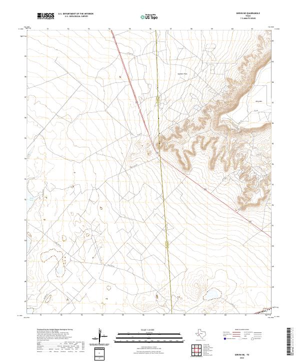
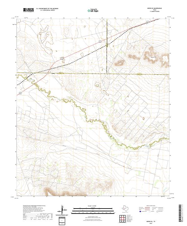
 2022 Girvin2022 Print · USGSThe West Texas ranching and oil country around Girvin is documented here at the convergence of three counties. Trace family history at Girvin Cem and follow the winding Pecos River as it passes landmarks like Girvin Butte.
 - 2022 Map of Girvin SE, 2022 Print
 2022 Girvin SE2022 Print · USGSThe West Texas desert landscape meets at the juncture of four counties in the early twenty-first century. Genealogists and local historians can trace property boundaries and road networks near the Pecos River, the Bobcat Hills, and Tunas Cr.
 - 2022 Map of Crane, 2022 Print
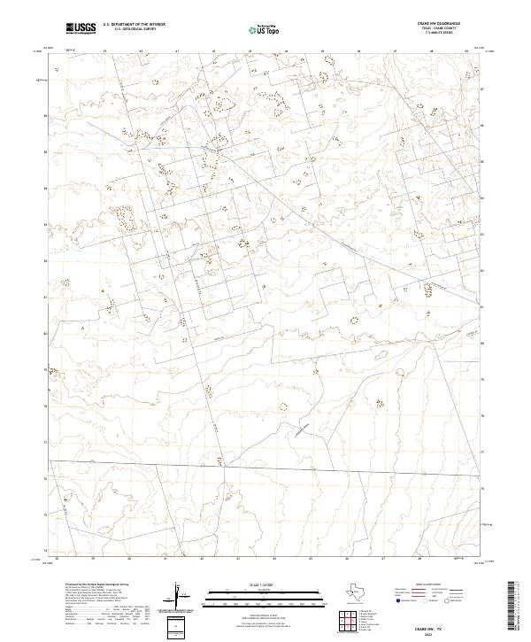
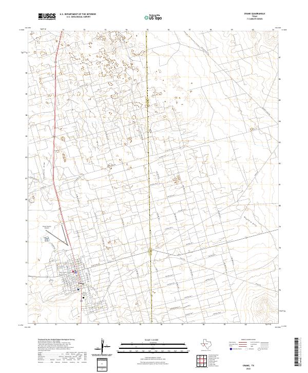 2022 Crane2022 Print · USGSThe West Texas town of Crane is shown here in the 2020s, highlighting its role as a county seat and energy hub. Genealogists and researchers can locate Crane Memorial Cem and the Crane County Courthouse amid a landscape marked by Landreth Draw.
 - 2022 Map of Clark Brothers Ranch, 2022 Print
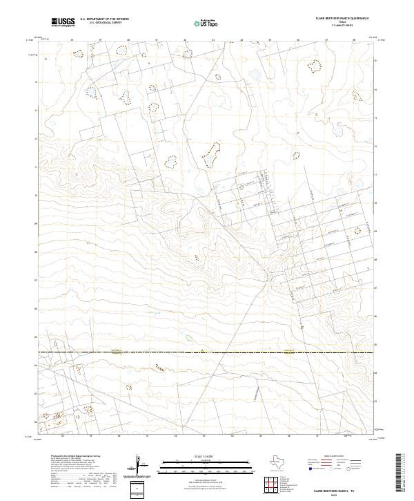 2022 Clark Brothers Ranch2022 Print · USGSEctor and Crane counties meet in this West Texas survey from the early 2020s, showing a landscape defined by ranching and new residential grids. Researchers can trace the layout of themed streets like S Klondyke Ave and W Avocado St near Simms Tank.
 - 2022 Map of Cowden Place, 2022 Print
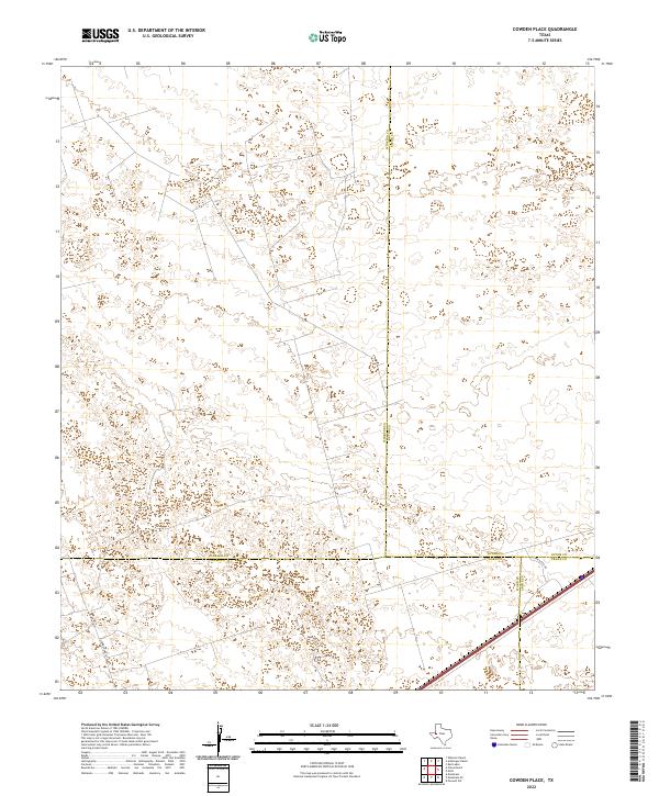 2022 Cowden Place2022 Print · USGSThe West Texas Permian Basin is captured here at the intersection of four counties during a period of modern energy development. Researchers can trace local infrastructure and property access via Park Rd 41, Glenn Allen Rd, and the footprint of Altura Energy Ltd.
 - 2022 Map of South Cowden Ranch, 2022 Print
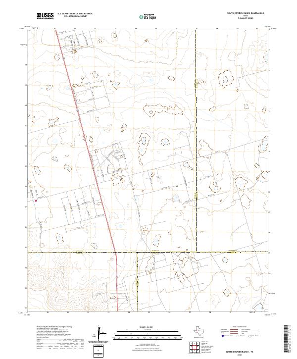 2022 South Cowden Ranch2022 Print · USGSWest Texas energy lands come into focus in this recent survey where Ector, Crane, Upton, and Midland counties meet. Researchers can trace local industrial routes like S Texaco Plant Rd and the small settlement of Michelle amidst the oil fields.
 - 2022 Map of Penwell SE, 2022 Print
 2022 Penwell SE2022 Print · USGSIn the open ranchlands of Crane County during the early 2020s, this area reflects the intersection of West Texas aviation and rural industry. Researchers can locate specific family and ranch landmarks such as the J-Bar Ranch Airport and trace the paths of Katie Lea Rd and Key Road 10.
 - 2022 Map of Metz, 2022 Print
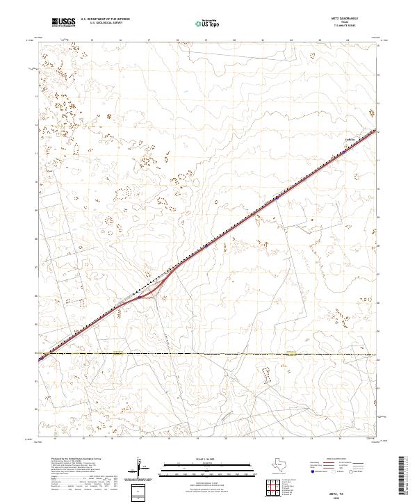 2022 Metz2022 Print · USGSThe West Texas plains at the turn of the decade show the essential transit links between Ector and Crane counties. Researchers can trace the layout of Judkins and the path of ranching roads like McKnight Rnch Rd and Ranch Rd 1053.
End of results
Showing maps 1-25 of 25
Top cities of Crane County
Frequently asked questions
- What are the different types of historical maps available for Crane County?
- What is the oldest map of Crane County?
- Where can I purchase historical maps of Crane County for my home or office?
- Where can I download high-res historical maps of Crane County?
- Are there historical topographic maps available for Crane County?
- Is there historical aerial imagery available for Crane County?
- Where are historical maps of Crane County sourced from?