Old Maps of Crane County, Texas for Hiking & Exploration
Hike through history with 155 historic maps of Crane County. Explore old trails, ghost towns, and forgotten backroads — perfect for outdoor adventurers and local explorers.
- Rediscover forgotten places: Map out old mining camps, roads, and footpaths that no longer exist on modern maps.
- Layer with modern tools: Combine with LiDAR or satellite views to plan hikes through historical terrain.
- Made for exploration: Popular among hikers, overlanders, and local history lovers.
Use these maps to find adventure and explore the hidden past of Crane County.
Crane County, TX maps
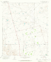
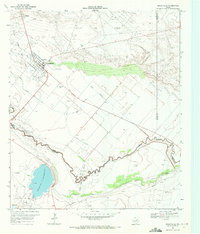
(155)- 1928 Map of Crane
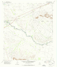
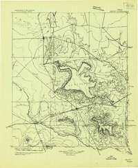 1928 Crane1928 Print · USGSWest Texas ranching and the early oil boom meet at the Pecos River during the late twenties. Trace the growth of new petroleum hubs at Crane and McCamey alongside family-named landmarks like McElroy and Cody Bell.
 - 1954 Map of Pecos, 1964 Print
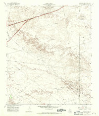
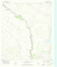
 1954 Pecos1964 Print · USGSMid-century West Texas reveals a landscape of expanding oil fields and cattle ranching along the winding Pecos River. Local historians can trace family ranch lands like Goodrich Ranch, follow the Texas and Pacific rails, or locate the historic Horsehead Crossing.3 unique versions available
 - 1957 Map of Pecos
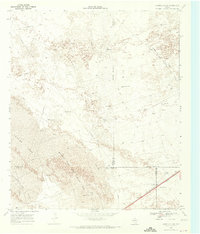
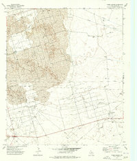
 1957 Pecos1957 Print · USGSWest Texas in the mid-fifties is a landscape of desert oil fields and vital rail corridors. Researchers can trace the sprawling Pyote Air Force Base, the historic Horsehead Crossing, and the rail stops at Mentone and Saragosa.
 - 1964 Map of Metz, 1967 Print
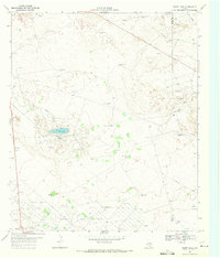
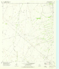
 1964 Metz1967 Print · USGSThe West Texas oil country of Ector and Crane counties is documented here during the mid-1960s. Genealogists and historians can trace the Texas and Pacific line through Metz and Judkins, or locate named water sources like the Old Headquarters Windmills.2 unique versions available
 - 1964 Map of Doodle Bug Well, 1967 Print
 1964 Doodle Bug Well1967 Print · USGSCrane County in the 1960s is defined by the booming petroleum industry and the shifting sands of West Texas. Researchers can locate specific drilling sites and landmarks like Doodle Bug Well, Landreth Draw, and the Waddell Oil Field.2 unique versions available
 - 1964 Map of Penwell SW, 1967 Print
 1964 Penwell SW1967 Print · USGSCrane County in the mid-1960s shows a landscape transformed by the energy industry among the Texas dunes. Researchers can trace the infrastructure of the Armer Oil Field, locating specific sites like the Warren Gas Plant and the Pumping Sta.
 - 1964 Map of Penwell, 1967 Print
 1964 Penwell1967 Print · USGSWest Texas ranching and oil production define this mid-sixties survey of the Penwell area as it developed along the Texas and Pacific line. Researchers can trace the layout of the local Refinery, find the C-Bar Ranch, and locate named water sources like Bradley Barn Well.2 unique versions available
 - 1964 Map of Penwell SE, 1967 Print
 1964 Penwell SE1967 Print · USGSCrane County oil production and ranching collide in the mid-1960s across this West Texas landscape. Researchers can trace the infrastructure of the Bar Oil Field and locate family-named landmarks like J Bar Ranch and Russell Well.
 - 1964 Map of Clark Brothers Ranch, 1967 Print
 1964 Clark Brothers Ranch1967 Print · USGSWest Texas ranching and petroleum production meet in the mid-1960s as this area of the Permian Basin expands. Trace the footprint of family operations and industry through the Clark Brothers Ranch, Simms Tank, and the sprawling South Cowden Oil Field.2 unique versions available
 - 1964 Map of Perkins Lake, 1967 Print
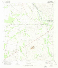
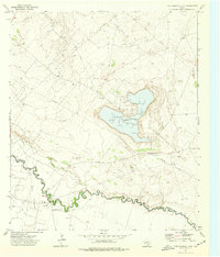
 1964 Perkins Lake1967 Print · USGSThe Permian Basin oil and ranching landscape of the 1960s is meticulously detailed at the Crane and Upton county line. Researchers can trace historic ranch properties like the Glass and Everitt Ranch and dozens of family-named landmarks including Denson Windmills and Pee Wee Windmill.
 - 1965 Map of South Cowden Ranch, 1967 Print
 1965 South Cowden Ranch1967 Print · USGSThe West Texas range meets the mid-century oil boom in the mid-1960s, where vast energy fields intersect with historic cattle operations. Genealogists and historians can trace ranch boundaries and water sources like South Cowden Ranch, Hillbilly Windmill, and Railway Ranch.2 unique versions available
 - 1968 Map of Monahans SE, 1970 Print
 1968 Monahans SE1970 Print · USGSThe West Texas dunes and oil fields of Ward County are captured here in the late sixties. Trace the intersection of energy and ranching through landmarks like the Janelle Oil Field, High Lonesome Windmill, and the Texas and Pacific rail line.
 - 1968 Map of Cowden Place, 1971 Print
 1968 Cowden Place1971 Print · USGSThe West Texas dunes and oil fields come into focus in the late sixties at the borders of Winkler, Ector, and Ward Counties. Researchers can trace the water and oil infrastructure of the era through sites like Cowden Place, Little Diamond Windmill, and Williams Ranch.
 - 1969 Map of Ozark Lake, 1971 Print
 1969 Ozark Lake1971 Print · USGSThe West Texas oil patches of Ward and Crane counties were in full production during the late sixties, marked by the massive Shipley Oil Field. Researchers can trace the development of the energy economy through sites like the Chemical Plant and the remote settlement of Royalty.2 unique versions available
 - 1969 Map of Grandfalls, 1971 Print
 1969 Grandfalls1971 Print · USGSIn the arid Permian Basin of the late sixties, the landscape of Ward and Pecos Counties was a network of irrigation and oil production. Trace the early layout of Grandfalls and Imperial, or locate family sites near Tamarisk Cem and the Imperial Reservoir.2 unique versions available
 - 1972 Map of Buena Vista NE, 1974 Print
 1972 Buena Vista NE1974 Print · USGSThe Pecos River valley in the early seventies shows a landscape defined by petroleum extraction and desert irrigation. Researchers can trace the development of the Abell Oil And Gas Field, the settlement of Buena, and the complex Imperial Canal No 5.
 - 1972 Map of Girvin NE, 1974 Print
 1972 Girvin NE1974 Print · USGSThe Texas Permian Basin is captured here in the early 1970s at the height of its mid-century energy production. Researchers can trace the extensive network of the Roberdeau Oil Field, the AT & SF railroad, and landmarks like Soda Lake.
 - 1972 Map of Girvin, 1975 Print
 1972 Girvin1975 Print · USGSWest Texas in the early 1970s reveals a rugged landscape defined by the Pecos River and the expanding reach of the petroleum industry. Researchers can trace the rail-and-oil economy through the Atchison Topeka and Santa Fe line, the small settlement of Girvin, and the Wentz Oil and Gas Field.
 - 1972 Map of Girvin SE, 1975 Print
 1972 Girvin SE1975 Print · USGSThe Pecos River valley in the early seventies shows a landscape deeply shaped by the oil industry and ranching. Genealogists and historians can trace family land at Johnson Ranch, find old transit points like Adobe Crossing, and follow the Atchison Topeka and Santa Fe railroad.
 - 1972 Map of Girvin NW, 1975 Print
 1972 Girvin NW1975 Print · USGSThe West Texas basin comes into focus during the early seventies, showing a landscape defined by petroleum extraction and river crossings. Trace the path of the Pecos River past Horsehead Crossing and the sprawling Bayview Oil Field.
 - 1974 Map of Tubbs Corner, 1976 Print
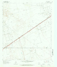
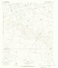
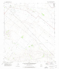
 1974 Tubbs Corner1976 Print · USGSCrane County's energy landscape is captured here in the 1970s, showcasing the intense industrialization of the Permian Basin. Researchers can trace the network of the Shifting Sand Hills Oil Field and locate rural landmarks like Lea Ranch and Tubbs Corner.
 - 1974 Map of Crane SW, 1977 Print
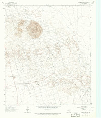
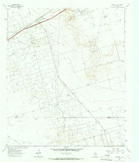
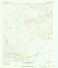
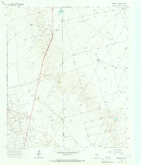
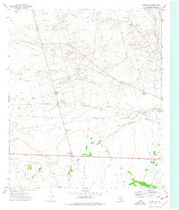
 1974 Crane SW1977 Print · USGSCrane County petroleum production is at its peak in the mid-1970s, as shown on this detailed survey of the Texas oil patch. Energy researchers and local historians can trace the extent of the Oil Field, locating specific Oil Wells, a Pumping Sta, and the course of Landreth Draw.
 - 1974 Map of Crane, 1977 Print
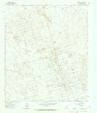
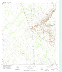
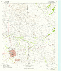 1974 Crane1977 Print · USGSThe Permian Basin oil economy is on full display in the mid-1970s as the McElroy Oil Field surrounds the town of Crane. Researchers can trace old pipelines, the County Airport, and schools like Crane-Bethune Sch.
 - 1974 Map of Juan Cordona Lake, 1977 Print
 1974 Juan Cordona Lake1977 Print · USGSThe Pecos River valley and the industrial landscape of Crane and Pecos counties are captured here in the mid-seventies. Researchers can trace the extensive Abell Oil and Gas Field, find numerous Oil Wells, and follow the banks of Juan Cordona Lake.
 - 1974 Map of Crane NW, 1977 Print
 1974 Crane NW1977 Print · USGSThe Permian Basin oil fields were in high production during the mid-seventies, showing a landscape defined by industrial extraction. Trace the energy infrastructure of Dune Oil Field and McElroy Field through Gas Plant and Pumping Sta sites.
Showing maps 1-25 of 155
Top cities of Crane County
Frequently asked questions
- What are the different types of historical maps available for Crane County?
- What is the oldest map of Crane County?
- Where can I purchase historical maps of Crane County for my home or office?
- Where can I download high-res historical maps of Crane County?
- Are there historical topographic maps available for Crane County?
- Is there historical aerial imagery available for Crane County?
- Where are historical maps of Crane County sourced from?