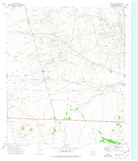
1974 Map of Crane NW
USGS Topo · Published 1977About this map
Industrial development in the Permian Basin defines this 1974 topographic record, which documents a landscape heavily shaped by energy extraction. Extensive oil and gas infrastructure dominates the terrain, particularly within the Dune Oil Field, McElroy Field, and the area designated as Block 31. The map reveals a dense network of extraction and transport features, including numerous Oil Wells, a Gas Plant, and a Pumping Sta. The natural topography of the desert is overlaid with a geometric grid of Pipeline corridors and an Aqueduct, while the intermittent drainage of Landreth Draw provides a rare natural landmark. Numerous Gravel Pit sites indicate local excavation efforts supporting the construction of the extensive road and well-pad network required for regional petroleum production.
Find a feature on this map
12 named features on this map. Tap any name to fly to it.
Don’t see what you’re looking for? This feature index may not catch every label — zoom into the map to look around manually.
Map Details
Editions of this 1974 Crane NW Map
This is the sole edition of this map. No revisions or reprints were ever made.
Other maps of this area

1928 · Crane
USGS Topo · 1:125,000

1954 · Pecos
USGS Topo · 1:250,000

1957 · Pecos
USGS Topo · 1:250,000

1964 · Doodle Bug Well
USGS Topo · 1:24,000

1964 · Penwell SE
USGS Topo · 1:24,000

1964 · Perkins Lake
USGS Topo · 1:24,000

1974 · Tubbs Corner
USGS Topo · 1:24,000

1974 · Crane SW
USGS Topo · 1:24,000
1974 · Crane
USGS Topo · 1:24,000

1974 · Juan Cordona Lake
USGS Topo · 1:24,000