1970s Maps of Texline, Texas
Explore 2 historic maps of Texline from the 1970s. These maps offer a rare glimpse into what life looked like during the 1970s — showing old roads, neighborhoods, homes, and landmarks that have changed or disappeared over time.
Whether you're researching your family's past, planning a metal detecting trip, or studying how Texline's landscape evolved across the 1970s, these high-resolution maps are a powerful tool for exploring the history of this region.
- Focus on a specific era: All maps on this page are from the 1970s, giving you a focused view of this time period.
- See what’s changed: Compare century-old streets, trails, and buildings to today's modern landscape using overlays and satellite layers.
- Research with precision: Use these maps for genealogy, historical research, land use analysis, or educational projects.
- View, download, or print: Maps are fully viewable online in high resolution, and can be downloaded or printed for your own records.
Start exploring Texline's history through authentic maps from the 1970s. This is your window into the past.
Texline, TX maps
(2)- 1970 Map of Texline South, 1973 Print
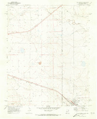
 1970 Texline South1973 Print · USGSThe high plains of the New Mexico and Texas border come alive in this early 1970s survey of the railroad town of Texline. Genealogists and researchers can trace rural infrastructure along the Fort Worth and Denver rail line, Perico Creek, and Carrizo Creek.
 - 1970 Map of Texline North, 1973 Print
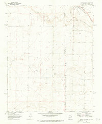
 1970 Texline North1973 Print · USGSThe high plains borderland at the New Mexico and Texas line is captured here in the early seventies as a hub of rail and ranching life. Researchers can trace the junction of the Ft Worth and Denver railroad near Texline and locate local landmarks like the Rodeo Ground and Worsham.
End of results
Showing maps 1-2 of 2
Top cities near Texline
Frequently asked questions
- What are the different types of historical maps available for Texline?
- What is the oldest map of Texline?
- Where can I purchase historical maps of Texline for my home or office?
- Where can I download high-res historical maps of Texline?
- Are there historical topographic maps available for Texline?
- Is there historical aerial imagery available for Texline?
- Where are historical maps of Texline sourced from?