1900s (20th Century) Maps of Texline, Texas
Explore 8 historic maps of Texline from the 1900s (20th Century). These maps offer a rare glimpse into what life looked like during the 1900s — showing old roads, neighborhoods, homes, and landmarks that have changed or disappeared over time.
Whether you're researching your family's past, planning a metal detecting trip, or studying how Texline's landscape evolved across the 1900s, these high-resolution maps are a powerful tool for exploring the history of this region.
- Focus on a specific era: All maps on this page are from the 1900s, giving you a focused view of this time period.
- See what’s changed: Compare century-old streets, trails, and buildings to today's modern landscape using overlays and satellite layers.
- Research with precision: Use these maps for genealogy, historical research, land use analysis, or educational projects.
- View, download, or print: Maps are fully viewable online in high resolution, and can be downloaded or printed for your own records.
Start exploring Texline's history through authentic maps from the 1900s. This is your window into the past.
Texline, TX maps
(8)- 1954 Map of Dalhart, 1967 Print
 1954 Dalhart1967 Print · USGSThe High Plains at the junction of four states come alive in the mid-fifties, showing a landscape of rail-hub towns and cattle country. Trace the Old Santa Fe Trail or locate mid-century industrial sites like the Dry ice plant and Carbon Dioxide Works.2 unique versions available
 - 1958 Map of Dalhart
 1958 Dalhart1958 Print · USGSThe High Plains of the tri-state border region come alive in this mid-century survey of the ranching and rail territory around the Texas Panhandle. Genealogists and historians can trace the paths of the Atchison Topeka & Santa Fe Ry, military outposts like Dalhart Air Force No 1, and early settlements such as Pasamonte and Texline.2 unique versions available
 - 1962 Map of Dalhart
 1962 Dalhart1962 Print · USGSThe High Plains and volcanic peaks of the tri-state area are shown in detail during the early sixties. Genealogists and historians can trace the rail corridors of the Fort Worth and Denver and find industrial sites like the Cactus Ordnance Works or the Beaver Meade & Englewood Grain Elevator.
 - 1970 Map of Texline South, 1973 Print
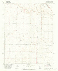 1970 Texline South1973 Print · USGSThe high plains of the New Mexico and Texas border come alive in this early 1970s survey of the railroad town of Texline. Genealogists and researchers can trace rural infrastructure along the Fort Worth and Denver rail line, Perico Creek, and Carrizo Creek.
 - 1970 Map of Texline North, 1973 Print
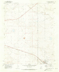 1970 Texline North1973 Print · USGSThe high plains borderland at the New Mexico and Texas line is captured here in the early seventies as a hub of rail and ranching life. Researchers can trace the junction of the Ft Worth and Denver railroad near Texline and locate local landmarks like the Rodeo Ground and Worsham.
 - 1982 Map of Clayton, 1983 Print
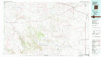 1982 Clayton1983 Print · USGSThe high plains of northeast New Mexico and the Texas panhandle appear here in the early eighties, centered on the ranching hub of Clayton. Genealogists and historians can trace the paths of the Colorado and Southern railroad or locate remote settlements like Miera, Beenham, and Sofia.
 - 1998 Map of Texline South, 2001 Print
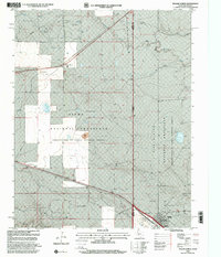
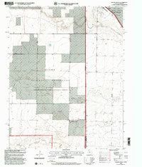 1998 Texline South2001 Print · USGSThe Texas-New Mexico borderlands in the late nineties are captured here as a landscape of wide-open ranching and federal conservation. Genealogists and researchers can trace local landmarks like the Texline town site, the Circle H Farms Ltd Airport, and the Cem near the state line.
 - 1998 Map of Texline North, 2001 Print
 1998 Texline North2001 Print · USGSThe High Plains of the late nineties come alive at the meeting point of Texas and New Mexico in this detailed survey. Genealogists and historians can trace the foundations of this cattle-ranching region through the Texline townsite, the Clayton Livestock Research Center, and local landmarks like the Rodeo Ground.
End of results
Showing maps 1-8 of 8
Top cities near Texline
Frequently asked questions
- What are the different types of historical maps available for Texline?
- What is the oldest map of Texline?
- Where can I purchase historical maps of Texline for my home or office?
- Where can I download high-res historical maps of Texline?
- Are there historical topographic maps available for Texline?
- Is there historical aerial imagery available for Texline?
- Where are historical maps of Texline sourced from?