1980s Maps of Deaf Smith County, Texas
Explore 7 historic maps of Deaf Smith County from the 1980s. These maps offer a rare glimpse into what life looked like during the 1980s — showing old roads, neighborhoods, homes, and landmarks that have changed or disappeared over time.
Whether you're researching your family's past, planning a metal detecting trip, or studying how Deaf Smith County's landscape evolved across the 1980s, these high-resolution maps are a powerful tool for exploring the history of this region.
- Focus on a specific era: All maps on this page are from the 1980s, giving you a focused view of this time period.
- See what’s changed: Compare century-old streets, trails, and buildings to today's modern landscape using overlays and satellite layers.
- Research with precision: Use these maps for genealogy, historical research, land use analysis, or educational projects.
- View, download, or print: Maps are fully viewable online in high resolution, and can be downloaded or printed for your own records.
Start exploring Deaf Smith County's history through authentic maps from the 1980s. This is your window into the past.
Deaf Smith County, TX maps
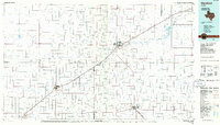
(7)- 1984 Map of Dawn
 1984 Dawn1984 Print · USGSThe High Plains of the Texas Panhandle are captured here in the mid-eighties, centered on the railroad settlement of Dawn. Genealogists and researchers can trace the path of the Atchison Topeka and Santa Fe railroad or locate the Buffalo Lake shoreline within its National Wildlife Refuge.
 - 1984 Map of Wildorado
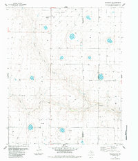
 1984 Wildorado1984 Print · USGSWildorado and the surrounding High Plains are captured here during the early eighties, showcasing the intersection of four Texas counties. Researchers can trace land use through the Feedlot and Elevator, or locate landmarks like Highland School and Ida Lake.
 - 1984 Map of Wildorado SW
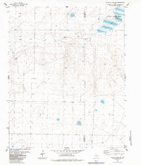
 1984 Wildorado SW1984 Print · USGSDeaf Smith County in the mid-1980s reveals a functional agricultural landscape defined by the Texas Panhandle's ranching and utility networks. Genealogists and local historians can trace the Palo Duro Wildorado Cemetery, a rural Elevator, and the path of North Palo Duro Creek.
 - 1984 Map of Buffalo Lake SW
 1984 Buffalo Lake SW1984 Print · USGSThe Texas Panhandle in the early eighties shows a landscape of managed water and wildlife conservation. Genealogists and historians can trace the Deaf Smith and Randall county line across Buffalo Lake and the National Wildlife Refuge.
 - 1985 Map of Pleasant Hill NE
 1985 Pleasant Hill NE1985 Print · USGSThe High Plains borderlands of New Mexico and Texas come into focus during the mid-eighties, revealing a landscape of agricultural expansion. Genealogists and historians can trace the exact placement of early wells and landmarks like Frio Draw and the Radio Tower.
 - 1985 Map of Hereford
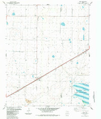
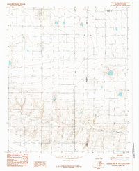
 1985 Hereford1985 Print · USGSThe High Plains of the Texas Panhandle are captured here during the mid-eighties, a period defined by vast agricultural grids and critical rail corridors. Genealogists and local historians can trace the footprint of settlements like Hereford, Dimmitt, and Bovina, alongside the Buffalo Lake National Wildlife Refuge.2 unique versions available
 - 1985 Map of Vega, 1986 Print
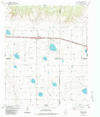
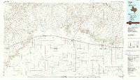 1985 Vega1986 Print · USGSThe Texas Panhandle is captured in the mid-eighties as the cattle and rail economy shaped the landscape from the Canadian River breaks to the southern plains. Researchers can trace the Atchison Topeka and Santa Fe line through Vega and Wildorado or locate landmarks like the Old Railroad Grade and Bivins Lake.2 unique versions available
End of results
Showing maps 1-7 of 7
Top cities of Deaf Smith County
Frequently asked questions
- What are the different types of historical maps available for Deaf Smith County?
- What is the oldest map of Deaf Smith County?
- Where can I purchase historical maps of Deaf Smith County for my home or office?
- Where can I download high-res historical maps of Deaf Smith County?
- Are there historical topographic maps available for Deaf Smith County?
- Is there historical aerial imagery available for Deaf Smith County?
- Where are historical maps of Deaf Smith County sourced from?