2020s Maps of Denton, Texas
Explore 7 historic maps of Denton from the 2020s. These maps offer a rare glimpse into what life looked like during the 2020s — showing old roads, neighborhoods, homes, and landmarks that have changed or disappeared over time.
Whether you're researching your family's past, planning a metal detecting trip, or studying how Denton's landscape evolved across the 2020s, these high-resolution maps are a powerful tool for exploring the history of this region.
- Focus on a specific era: All maps on this page are from the 2020s, giving you a focused view of this time period.
- See what’s changed: Compare century-old streets, trails, and buildings to today's modern landscape using overlays and satellite layers.
- Research with precision: Use these maps for genealogy, historical research, land use analysis, or educational projects.
- View, download, or print: Maps are fully viewable online in high resolution, and can be downloaded or printed for your own records.
Start exploring Denton's history through authentic maps from the 2020s. This is your window into the past.
Denton, TX maps
(7)- 2022 Map of Sanger, 2022 Print
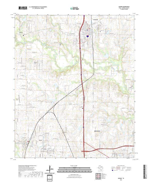 2022 Sanger2022 Print · USGSNorth Texas farm-to-market roads and the BNSF corridor define this area during a period of modern growth. Genealogists can locate family sites at Sanger Cem, Bolivar Cem, and Duck Creek Cem, or trace the old settlement at Bolivar.
 - 2022 Map of Lewisville West, 2022 Print
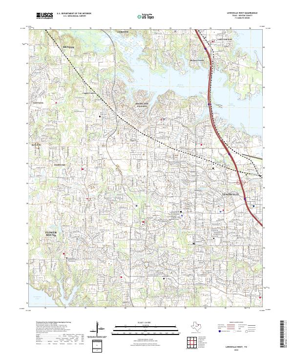 2022 Lewisville West2022 Print · USGSSuburban growth meets the shores of Lake Lewisville in this recent look at Denton County's evolving landscape. Genealogists and local historians can trace family markers at Chinns Chapel Cem, Old Hall Cem, or the Fox - Hembry Cem.
 - 2022 Map of Ponder, 2022 Print
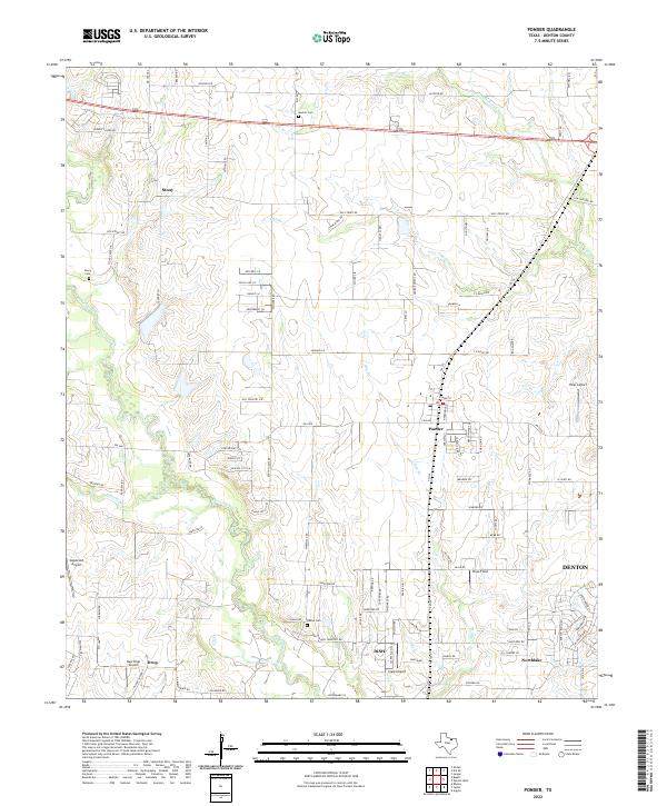 2022 Ponder2022 Print · USGSThe prairie landscape west of Denton is captured here in the early twenty-first century as suburban growth meets rural ranchland. Genealogists can trace family sites near Stony and Drop, or locate the Eakins Cem and Hicks Airport.
 - 2022 Map of Denton West, 2022 Print
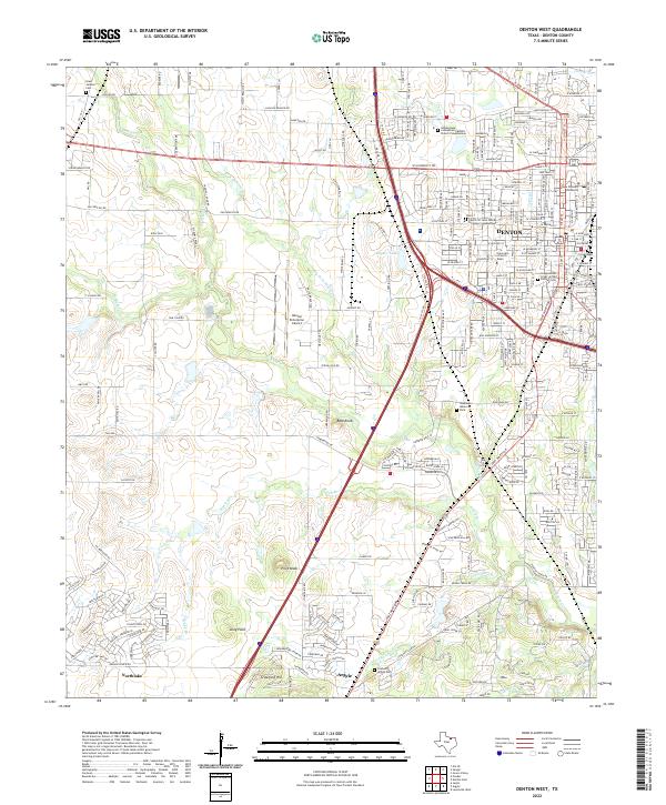 2022 Denton West2022 Print · USGSDenton and its southern neighbors Argyle and Northlake are shown in this modern survey during a period of rapid development. Genealogists and researchers can trace local landmarks like Graham Argyle Cem, Pilot Knob, and the campuses of the University of North Texas and Texas Woman's University.
 - 2022 Map of Denton East, 2022 Print
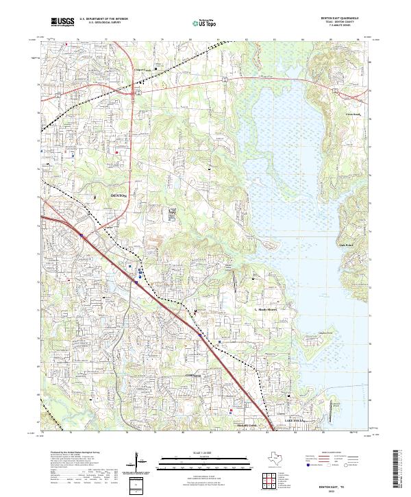 2022 Denton East2022 Print · USGSThe rapid development of North Texas meets the shores of the Trinity River in this contemporary survey of the eastern Denton area. Local historians can trace established cemeteries like Old Alton Cemetery and Shiloh Cemetery alongside modern landmarks like Hidden Valley Airpark.
 - 2022 Map of Green Valley, 2022 Print
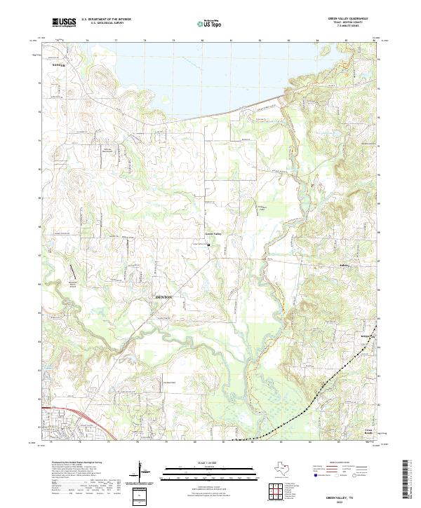 2022 Green Valley2022 Print · USGSNorthern Denton County comes alive in this 2020s survey, showing the expansion of Denton toward the shores of Ray Roberts Lake. Genealogists can find Green Valley Cem while researchers trace numerous private airfields like Hartlee Field.
 - 2022 Map of Argyle, 2022 Print
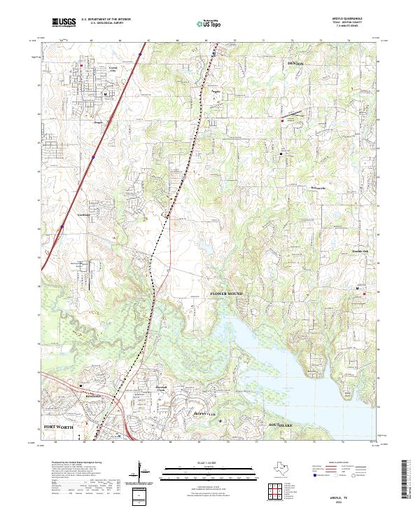 2022 Argyle2022 Print · USGSDenton County at the start of the 2020s shows the continued growth of suburban communities along the northern shores of the lake. Researchers can locate early family landmarks like the Jeter Family Cem and Prairie Mound Cem or trace the drainage of Denton Creek.
End of results
Showing maps 1-7 of 7
Top cities near Denton
- Dallas historical maps
- Fort Worth historical maps
- Frisco historical maps
- Carrollton historical maps
- Lewisville historical maps
- Flower Mound historical maps
See more
Top neighborhoods of Denton
- Cooper Creek historical maps
- Mayhill historical maps
- Denton historical maps
- Jagoe historical maps
- Minchin historical maps
- Green Valley historical maps
See more
Frequently asked questions
- What are the different types of historical maps available for Denton?
- What is the oldest map of Denton?
- Where can I purchase historical maps of Denton for my home or office?
- Where can I download high-res historical maps of Denton?
- Are there historical topographic maps available for Denton?
- Is there historical aerial imagery available for Denton?
- Where are historical maps of Denton sourced from?