1950s Maps of Socorro, Texas
Explore 6 historic maps of Socorro from the 1950s. These maps offer a rare glimpse into what life looked like during the 1950s — showing old roads, neighborhoods, homes, and landmarks that have changed or disappeared over time.
Whether you're researching your family's past, planning a metal detecting trip, or studying how Socorro's landscape evolved across the 1950s, these high-resolution maps are a powerful tool for exploring the history of this region.
- Focus on a specific era: All maps on this page are from the 1950s, giving you a focused view of this time period.
- See what’s changed: Compare century-old streets, trails, and buildings to today's modern landscape using overlays and satellite layers.
- Research with precision: Use these maps for genealogy, historical research, land use analysis, or educational projects.
- View, download, or print: Maps are fully viewable online in high resolution, and can be downloaded or printed for your own records.
Start exploring Socorro's history through authentic maps from the 1950s. This is your window into the past.
Socorro, TX maps
(6)- 1953 Map of El Paso
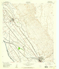
 1953 El Paso1953 Print · USGSEl Paso and the border region are shown here in the early fifties, documenting a landscape of shared river life and rising military presence. Genealogists and historians can trace rail-tied communities like Smeltertown, San Elizario, and the grounds of Fort Bliss.
 - 1955 Map of Clint, 1959 Print
 1955 Clint1959 Print · USGSThe El Paso County borderlands are captured here in the mid-1950s, showing the agricultural transformation of San Elizario Island. Genealogists and historians can trace rail-side life in Clint and Fabens, alongside landmarks like San Lorenzo Cemetery and the early Fabens Airfield.2 unique versions available
 - 1955 Map of Clint NW, 1959 Print
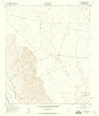 1955 Clint NW1959 Print · USGSThe arid El Paso County desert meets early irrigation infrastructure in the mid-fifties. Researchers can trace the ranching life of the era through isolated landmarks like Joint Well and the Ysleta Lateral.3 unique versions available
 - 1955 Map of San Elizario, 1959 Print
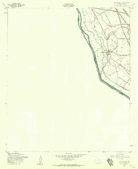 1955 San Elizario1959 Print · USGSSan Elizario in the mid-fifties sat at the heart of a vital irrigation network along the Mexican border. Researchers can trace ancestral property and local infrastructure through named ditches like the Barrial Lateral or historic routes like the Old Spanish Trail.4 unique versions available
 - 1955 Map of Ysleta, 1959 Print
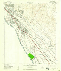 1955 Ysleta1959 Print · USGSThe Rio Grande valley southeast of El Paso comes to life in the mid-fifties, showing the intersection of international transit and desert irrigation. Genealogists can trace family landmarks like the Ysleta Jesuit Cem or search for historic sites like the Bracero Reception Center and Socorro Sch.3 unique versions available
 - 1959 Map of El Paso, 1968 Print
 1959 El Paso1968 Print · USGSEl Paso and the international borderlands come alive in this mid-century survey of the Chihuahuan Desert. Genealogists and historians can trace rail-side settlements like Columbus and Fabens, locate the sprawling Fort Bliss, and explore the geologically unique Kilbourne Hole.2 unique versions available
End of results
Showing maps 1-6 of 6
Top cities near Socorro
- El Paso historical maps
- Horizon City historical maps
- San Elizario historical maps
- Fabens historical maps
- Tornillo historical maps
- Clint historical maps
Top neighborhoods of Socorro
- Aljo Estates Colonia historical maps
- Mesa Verde Colonia historical maps
- Bejar Estates Colonia historical maps
- Cotton Valley Estates Colonia historical maps
- La Fuente Colonia historical maps
- Rancho Miraval Estates Colonia historical maps
See more
Frequently asked questions
- What are the different types of historical maps available for Socorro?
- What is the oldest map of Socorro?
- Where can I purchase historical maps of Socorro for my home or office?
- Where can I download high-res historical maps of Socorro?
- Are there historical topographic maps available for Socorro?
- Is there historical aerial imagery available for Socorro?
- Where are historical maps of Socorro sourced from?