2020s Maps of Socorro, Texas
Explore 4 historic maps of Socorro from the 2020s. These maps offer a rare glimpse into what life looked like during the 2020s — showing old roads, neighborhoods, homes, and landmarks that have changed or disappeared over time.
Whether you're researching your family's past, planning a metal detecting trip, or studying how Socorro's landscape evolved across the 2020s, these high-resolution maps are a powerful tool for exploring the history of this region.
- Focus on a specific era: All maps on this page are from the 2020s, giving you a focused view of this time period.
- See what’s changed: Compare century-old streets, trails, and buildings to today's modern landscape using overlays and satellite layers.
- Research with precision: Use these maps for genealogy, historical research, land use analysis, or educational projects.
- View, download, or print: Maps are fully viewable online in high resolution, and can be downloaded or printed for your own records.
Start exploring Socorro's history through authentic maps from the 2020s. This is your window into the past.
Socorro, TX maps
(4)- 2022 Map of San Elizario, 2022 Print
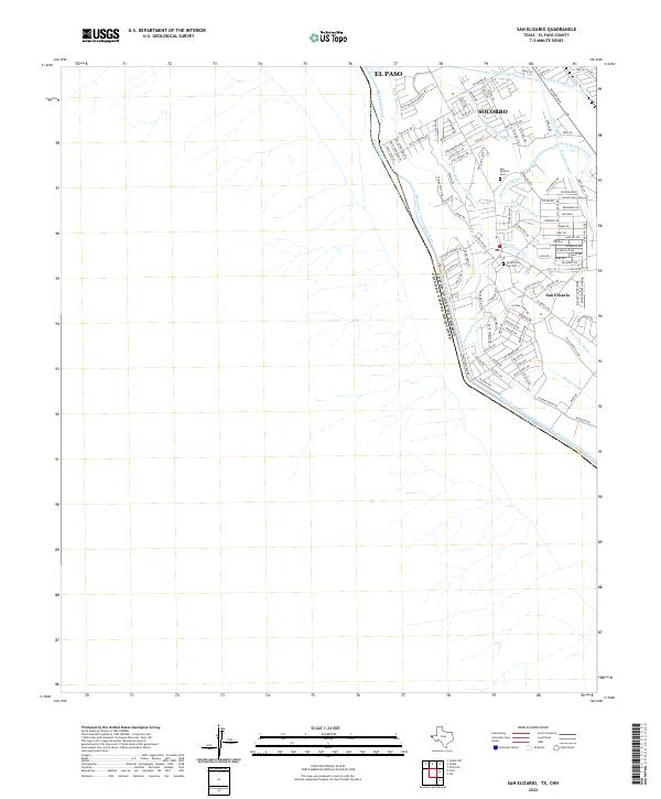 2022 San Elizario2022 Print · USGSThe international boundary at the Rio Grande and the historic settlement of San Elizario are captured here in the early 2020s. Genealogists can locate family sites at the San Elizario Cem Old and trace the complex irrigation of the Riverside Canal.
 - 2022 Map of Ysleta, 2022 Print
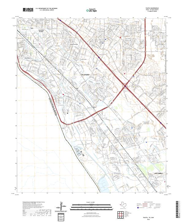 2022 Ysleta2022 Print · USGSSoutheast El Paso and the historic valley communities appear here in the early twenty-first century as the city meets the Mexican border. Researchers can trace the layout of ancestral sites like Ysleta and Socorro alongside landmarks like Mount Carmel Cem.
 - 2022 Map of Clint, 2022 Print
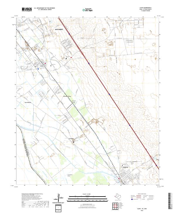 2022 Clint2022 Print · USGSThe El Paso Valley at the start of the 2020s shows a landscape woven with irrigation canals and borderland settlements. Researchers can trace local heritage through sites like Old Clint Cem, San Elizario, and the Lee-Moore-Intercepting-Drain.
 - 2022 Map of Clint NW, 2022 Print
 2022 Clint NW2022 Print · USGSEl Paso County's eastern outskirts show rapid suburban growth and desert development in the early 2020s. Researchers can trace the modern layout of Horizon City and Agua Dulce alongside historic canals like the Mesa Spur Drain.
End of results
Showing maps 1-4 of 4
Top cities near Socorro
- El Paso historical maps
- Horizon City historical maps
- San Elizario historical maps
- Fabens historical maps
- Tornillo historical maps
- Clint historical maps
Top neighborhoods of Socorro
- El Campestre Colonia historical maps
- El Gran Valle Colonia historical maps
- El Gran Valle Number 2 Colonia historical maps
- Angie Colonia historical maps
- Lewis Colonia historical maps
- Friedman Estates Number 1 Colonia historical maps
See more
Frequently asked questions
- What are the different types of historical maps available for Socorro?
- What is the oldest map of Socorro?
- Where can I purchase historical maps of Socorro for my home or office?
- Where can I download high-res historical maps of Socorro?
- Are there historical topographic maps available for Socorro?
- Is there historical aerial imagery available for Socorro?
- Where are historical maps of Socorro sourced from?