1960s Maps of Erath County, Texas
Explore 22 historic maps of Erath County from the 1960s. These maps offer a rare glimpse into what life looked like during the 1960s — showing old roads, neighborhoods, homes, and landmarks that have changed or disappeared over time.
Whether you're researching your family's past, planning a metal detecting trip, or studying how Erath County's landscape evolved across the 1960s, these high-resolution maps are a powerful tool for exploring the history of this region.
- Focus on a specific era: All maps on this page are from the 1960s, giving you a focused view of this time period.
- See what’s changed: Compare century-old streets, trails, and buildings to today's modern landscape using overlays and satellite layers.
- Research with precision: Use these maps for genealogy, historical research, land use analysis, or educational projects.
- View, download, or print: Maps are fully viewable online in high resolution, and can be downloaded or printed for your own records.
Start exploring Erath County's history through authentic maps from the 1960s. This is your window into the past.
Erath County, TX maps
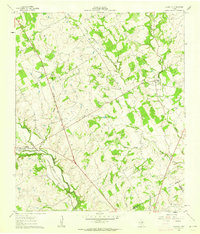
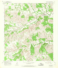
(22)- 1961 Map of Johnsville, 1962 Print
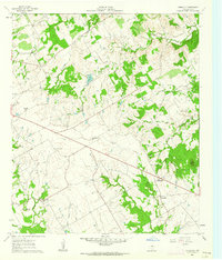 1961 Johnsville1962 Print · USGSErath County in the early sixties was a landscape of quiet rural settlements and winding creek valleys. Researchers can trace family history through sites like Aycock Cem and Johnsville or locate old community hubs at Pony Creek Ch.2 unique versions available
 - 1961 Map of Alexander, 1962 Print
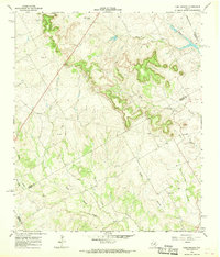
 1961 Alexander1962 Print · USGSCentral Texas ranching and river country comes to life in the early sixties, centered on the Alexander rail crossing. Genealogists can trace family names at the Bowman Ridge Cem and Hancock Cem, or follow the Old Railroad Grade.
 - 1961 Map of Knob Hill, 1963 Print
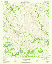
 1961 Knob Hill1963 Print · USGSErath County in the early sixties shows a rural landscape shaped by the North Paluxy River and the arriving modern era. Researchers can trace family roots at Smith Springs Cem, visit the Center Grove Sch, or follow the Gulf Colorado and Santa Fe rail line.3 unique versions available
 - 1961 Map of Paluxy, 1963 Print
 1961 Paluxy1963 Print · USGSIn the early 1960s, the rural borderlands of Hood and Somervell Counties were defined by the winding Paluxy River and a network of family-named creeks. Genealogists can trace early homesteads and community hubs like Elm Grove Ch, Glenn Cem, and the settlement of Paluxy.2 unique versions available
 - 1961 Map of Clairette, 1963 Print
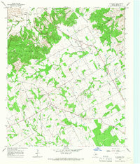
 1961 Clairette1963 Print · USGSCentral Texas during the early sixties reveals a landscape shaped by the Missouri-Kansas-Texas railroad and the Bosque River. Researchers can locate family landmarks like Duffau Cem, Millerville Cem, and the old roadside park.
 - 1961 Map of Stephenville, 1963 Print
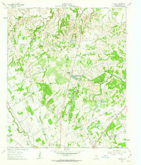
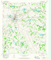
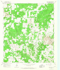
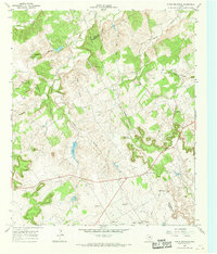
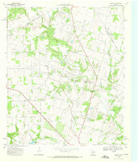
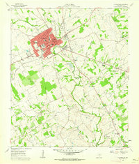 1961 Stephenville1963 Print · USGSStephenville and the surrounding Erath County countryside are documented here during a period of mid-century expansion. Genealogists and local historians can trace legacy sites from Tarleton State College to rural landmarks like Johnson Cemetery and Provident Church.4 unique versions available
 - 1965 Map of Huckabay SW, 1967 Print
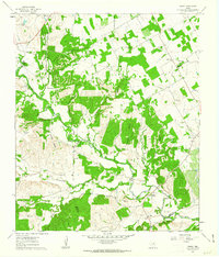
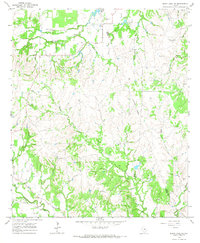
 1965 Huckabay SW1967 Print · USGSErath County's ranching landscape is captured here in the mid-sixties, showing the rugged drainage basins of the Blue Hills. Genealogists and historians can locate old family burial sites like Old School Hill Cem, School Hill Cem, and Lowell Cem.
 - 1965 Map of Lingleville, 1967 Print
 1965 Lingleville1967 Print · USGSLingleville and the rolling ranchlands of the Erath and Comanche County border are captured here in the mid-1960s. Researchers can trace the path of the Old Railroad Grade or locate family sites near Bethel Cem and Highland Ch.2 unique versions available
 - 1965 Map of Dublin, 1967 Print
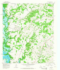
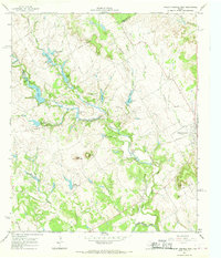
 1965 Dublin1967 Print · USGSDublin is shown as a thriving rail hub in the mid-sixties at the junction of two major western railroads. Researchers can trace the local landscape through landmarks like Memorial Stadium, the Live Oak Cem, and the community of Alexander.
 - 1965 Map of Bluff Dale NE, 1967 Print
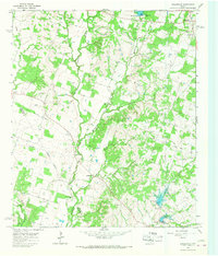
 1965 Bluff Dale NE1967 Print · USGSErath and Hood counties were still primarily rural ranching territory in the mid-1960s. Researchers can trace land use and family holdings through landmarks like the Houston Ranch, Bishop Cem, and the winding North Paluxy River.
 - 1965 Map of Bunyan, 1967 Print
 1965 Bunyan1967 Print · USGSErath County agriculture and water management are at the forefront during the mid-sixties as the region modernized its rural infrastructure. Researchers can trace family history through sites like Corinth Ch, Lone Oak Ch, and the Lower Green Creek Cem while mapping the path of the Atchison Topeka and Santa Fe railroad.
 - 1965 Map of Reddy Mountain, 1967 Print
 1965 Reddy Mountain1967 Print · USGSThe Erath and Eastland County line in the mid-1960s shows a landscape balancing cattle country with natural gas extraction. Genealogists and historians can locate rural burial grounds like Tudor Cem or trace the industrial footprint of the X Ray Gas Field and the Old Railroad Grade.
 - 1965 Map of Huckabay, 1967 Print
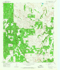
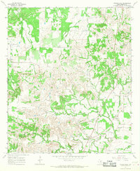
 1965 Huckabay1967 Print · USGSThe rolling ranchlands of Erath County are documented here in the mid-1960s, showing the early rural character of the Blue Hills region. Researchers can locate the Hannibal Cem, the Mt Pleasant Cem, and various Gravel Pits along the North Fork Bosque River.2 unique versions available
 - 1965 Map of Bluff Dale, 1967 Print
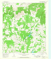
 1965 Bluff Dale1967 Print · USGSThe rural community of Bluff Dale and the surrounding Erath County countryside are captured here in the mid-sixties, centered on the Paluxy River forks. Researchers can trace historic family sites like the Triangle Ranch and several local landmarks including Wesley Chapel Cem and Pilot Knob.3 unique versions available
 - 1965 Map of Turkey Creek, 1967 Print
 1965 Turkey Creek1967 Print · USGSErath County in the mid-1960s is shown here as a landscape of wooded ridges and winding creek beds. Researchers can locate family landmarks like X Ray Cem and Russel Chapel Cem or trace the drainage of Barton Creek and Sunday Creek.
 - 1965 Map of Comyn, 1967 Print
 1965 Comyn1967 Print · USGSThe Comanche and Erath County line in the mid-sixties reveals a landscape defined by new water projects and established rail corridors. Researchers can trace the heritage of Comyn and Roch alongside rural landmarks like Pleasant Home Ch and several early cemeteries.2 unique versions available
 - 1965 Map of Morgan Mill, 1968 Print
 1965 Morgan Mill1968 Print · USGSErath County in the mid-sixties reveals a rural landscape defined by the winding North Paluxy River and traditional ranching terrain. Genealogists and local historians can locate family-named sites like McClenny, the Hightower Cem, and the community of Morgan Mill.
 - 1966 Map of Chalk Mountain, 1968 Print
 1966 Chalk Mountain1968 Print · USGSThe borderlands of Erath and Somervell counties come into focus during the mid-sixties, revealing a rural landscape of winding creeks and limestone hills. Genealogists can trace family landmarks and community centers like Chalk Mountain Ch, Plainview Ch, and Lesley Lake.2 unique versions available
 - 1966 Map of Camp Branch, 1968 Print
 1966 Camp Branch1968 Print · USGSThe Texas ranchlands at the Erath and Bosque county line are captured here in the mid-sixties, showing a landscape defined by cattle country and river forks. Genealogists and land researchers can locate the Flanary Cem, Surprise Valley Ranch, and the winding course of Duffau Creek.
 - 1966 Map of Walnut Springs West, 1968 Print
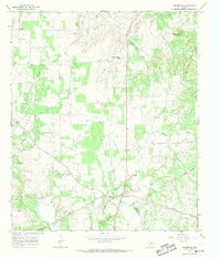
 1966 Walnut Springs West1968 Print · USGSNorthwest Bosque County in the mid-1960s shows a landscape of established cattle ranching and shifting transportation lines. You can trace the footprint of the Flat Top Ranch, locate the Fulton Cem, and see the abandoned rail line at Walnut Springs.
 - 1966 Map of Desdemona, 1969 Print
 1966 Desdemona1969 Print · USGSDesdemona and the surrounding ranch lands of Eastland and Erath counties appear here in the mid-sixties as the local oil and gas industry matured. Genealogists and historians can trace the Old Railroad Grade, locate the Howard Cem, and find old landmarks like Mockingbird Hill.
 - 1968 Map of Rucker, 1972 Print
 1968 Rucker1972 Print · USGSComanche County during the late sixties shows a rural landscape in transition, where the Texas Central and an Old Railroad Grade trace the area's history. Genealogists can locate family landmarks such as Oliver Springs Ch, Liberty Ch, and the settlement of Rucker.
End of results
Showing maps 1-22 of 22
Top cities of Erath County
- Stephenville historical maps
- Dublin historical maps
- Stephenville Country Club Lake historical maps
- Thurber historical maps
Frequently asked questions
- What are the different types of historical maps available for Erath County?
- What is the oldest map of Erath County?
- Where can I purchase historical maps of Erath County for my home or office?
- Where can I download high-res historical maps of Erath County?
- Are there historical topographic maps available for Erath County?
- Is there historical aerial imagery available for Erath County?
- Where are historical maps of Erath County sourced from?