Old Maps of Erath County, Texas for Metal Detecting
Plan your next treasure hunt with 197 historic maps of Erath County. Find old homesites, ghost towns, trails, and gathering spots that may be lost to time — perfect for identifying promising metal detecting locations.
- Locate forgotten sites: Uncover places like long-lost settlements, abandoned rail lines, or gathering spots.
- Plan better hunts: Use map overlays combined with LiDAR or satellite views to narrow in on historically rich areas.
- Made for detectorists: Thousands of hobbyists use these maps to discover relics, coins, and hidden history.
Use these historic maps to boost your research and find new opportunities beneath the surface of Erath County.
Erath County, TX maps
(197)- 1888 Map of Hamilton
 1888 Hamilton1888 Print · USGSCentral Texas during the 1880s is captured here at a moment of early frontier growth and agricultural settlement. Researchers can trace the original locations of rural centers like Gentry Mill, Pottsville, and the remote post office at Indian Gap.
 - 1889 Map of Granbury
 1889 Granbury1889 Print · USGSIn the late 1880s, the Brazos River dictated the life and travel of North Texas, carving deep bends through Hood and Somervell counties. Genealogists and historians can trace early settlements like Fort Spunky and Glenrose or the routes of the Texas Central Railroad.6 unique versions available
 - 1890 Map of Stephenville
 1890 Stephenville1890 Print · USGSErath County at the close of the frontier era centers on the rising trade hub of Stephenville and its surrounding hill country. Researchers can trace the original Texas Central Railroad corridor through Dublin and find vanished locales like Duffau Wells.5 unique versions available
 - 1891 Map of Palo Pinto
 1891 Palo Pinto1891 Print · USGSNorth Texas in the late nineteenth century was a landscape of winding river bends and emerging coal towns. Genealogists and historians can trace early river crossings at Oaks Ferry, the path of the Texas and Pacific Railroad, and the Coal Mines at Coalville.7 unique versions available
 - 1894 Map of Hamilton
 1894 Hamilton1894 Print · USGSCentral Texas ranching and farming communities are captured here in the 1890s, just after the initial frontier period. Genealogists can locate family-named landmarks and early settlements like Gentry Mill, Indian Gap, and Hazle Dell along the Leon River.5 unique versions available
 - 1894 Map of Eastland
 1894 Eastland1894 Print · USGSEastland County and its neighbors are captured here in the late nineteenth century during the expansion of the rail-and-ranching economy. Researchers can locate early town sites like Desdimonia and Merriman or trace the Texas Central Railroad through Carbon.6 unique versions available
 - 1918 Map of Palo Pinto
 1918 Palo Pinto1918 Print · USGSPalo Pinto County and the Brazos River valley appear here in the final year of the Great War, showing a landscape shaped by coal and steam. Genealogists and historians can locate defunct river crossings like Oaks Ferry, early rural education at Marsden School, and the extensive Coal Mines that once powered the regional economy.
 - 1920 Map of Stephenville
 1920 Stephenville1920 Print · USGSErath County thrived at the intersection of three major railroads during the early twentieth century. Genealogists and historians can trace the foundations of Stephenville and Dublin, alongside rural landmarks like Morgan Mill and Tanner School.
 - 1931 Map of Santo
 1931 Santo1931 Print · USGSPalo Pinto County in the mid-1920s was a land of winding river valleys and rural schoolhouse communities. Genealogists and historians can trace the early rail-and-river economy through the Texas and Pacific line and the Brazos River, while locating family homesteads near Village Bend Sch or New Hope Sch.3 unique versions available
 - 1931 Map of Tolar
 1931 Tolar1931 Print · USGSThe Brazos River valley of Hood County comes alive in this early 1930s survey of the Granbury area. Trace the early layout of Granbury, the route of the Fort Worth and Rio Grande, and rural landmarks like Comanche Peak.2 unique versions available
 - 1954 Map of Brownwood, 1955 Print
 1954 Brownwood1955 Print · USGSCentral Texas in the early fifties shows a landscape of rail-linked cattle towns and winding river valleys before modern highway expansion. Genealogists and historians can trace family-named peaks and vanished rail stops like Trickham, Santa Anna, and the Brady Mountains.3 unique versions available
 - 1954 Map of Dallas, 1963 Print
 1954 Dallas1963 Print · USGSNorth Texas in the mid-fifties and early sixties reveals a landscape of rapid urban growth and water management. Genealogists and historians can trace the evolution of the metroplex through landmarks like Hensley Field, Boles Orphan Home, and the Texas & Pacific RR.4 unique versions available
 - 1954 Map of Abilene, 1966 Print
 1954 Abilene1966 Print · USGSThe Texas Big Country comes into focus in the mid-1950s as petroleum and new water projects reshape the landscape. Local historians can trace the Butterfield Trail, find the Fort Phantom Hill Ruins, and locate numerous small communities along the Texas & Pacific line.2 unique versions available
 - 1956 Map of Gustine
 1956 Gustine1956 Print · USGSMid-century Comanche County is seen here just as the highway network was being formalized around the Leon River valley. Genealogists can trace family names through numerous rural sites like Graham Chapel Cem, Energy Sch, and the town of Gustine.
 - 1956 Map of Hico, 1957 Print
 1956 Hico1957 Print · USGSThe Bosque River valley and the railroad town of Hico are shown here in the mid-fifties, capturing a landscape of small farming communities and historic routes. Genealogists can locate numerous rural burial sites like Tillinghouse Cem and the Springtown (Site of).2 unique versions available
 - 1956 Map of Edna Hill, 1957 Print
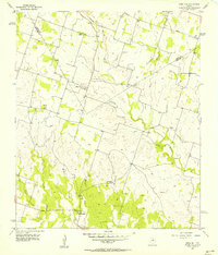 1956 Edna Hill1957 Print · USGSTexas ranching country along the Erath and Comanche county line comes to life in the mid-1950s. Researchers can locate the settlement and church at Hazeldell, find family burials at Barbee Cemetery, and trace the winding paths of Resley Creek and Joplin Creek.2 unique versions available
 - 1956 Map of Carlton, 1957 Print
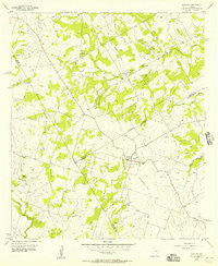 1956 Carlton1957 Print · USGSThe rural landscape of the Hamilton and Comanche County borders is captured here in the mid-fifties, centered on the community of Carlton. Genealogists and historians can trace family-named sites like Turnbow Cemetery, the local High Sch, and the path of an Old Railroad Grade.3 unique versions available
 - 1956 Map of Hico, 1957 Print
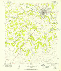 1956 Hico1957 Print · USGSHico and the surrounding North Texas ranching country are captured here in the mid-1950s, highlighting the intersection of rail and river commerce. Family historians can locate several rural burial sites like Honey Creek Cem and Dry Fork Cem, or trace the path of the Texas and Missouri Kansas railroad.2 unique versions available
 - 1958 Map of Dallas
 1958 Dallas1958 Print · USGSNorth Texas in the late fifties shows the dramatic expansion of the Metroplex as it absorbs surrounding farm towns. Genealogists and historians can trace old rail lines like the Missouri-Kansas-Texas and locate early lakefront developments at Eagle Mountain Lake and Lake Worth Village.
 - 1958 Map of Abilene
 1958 Abilene1958 Print · USGSMid-century West Texas comes alive in this survey of the Abilene and Stephenville region during a period of steady oil expansion and military growth. Genealogists and local historians can trace the paths of the Texas & Pacific RR through historic towns, locate the Fort Griffin Ruins, and find smaller settlements like Desdemona and Lueders.
 - 1959 Map of Lipan, 1960 Print
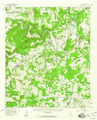 1959 Lipan1960 Print · USGSNear the intersection of four Texas counties in the late fifties, this survey captures the rural character and winding river bends of the Brazos valley. Researchers can locate family landmarks like Evergreen Cem, Dobbs Valley Ch, and the remote Progress Sch.3 unique versions available
 - 1959 Map of Gordon, 1960 Print
 1959 Gordon1960 Print · USGSThe Palo Pinto hills in the late fifties show a landscape defined by the Texas and Pacific railroad and active coal and oil extraction. Local researchers can trace the locations of family burial sites like Thurber Cem and landmarks like Metcalf Gap.2 unique versions available
 - 1961 Map of Johnsville, 1962 Print
 1961 Johnsville1962 Print · USGSErath County in the early sixties was a landscape of quiet rural settlements and winding creek valleys. Researchers can trace family history through sites like Aycock Cem and Johnsville or locate old community hubs at Pony Creek Ch.2 unique versions available
 - 1961 Map of Alexander, 1962 Print
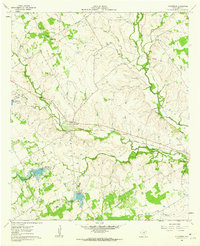 1961 Alexander1962 Print · USGSCentral Texas ranching and river country comes to life in the early sixties, centered on the Alexander rail crossing. Genealogists can trace family names at the Bowman Ridge Cem and Hancock Cem, or follow the Old Railroad Grade.
 - 1961 Map of Knob Hill, 1963 Print
 1961 Knob Hill1963 Print · USGSErath County in the early sixties shows a rural landscape shaped by the North Paluxy River and the arriving modern era. Researchers can trace family roots at Smith Springs Cem, visit the Center Grove Sch, or follow the Gulf Colorado and Santa Fe rail line.3 unique versions available
Showing maps 1-25 of 197
Top cities of Erath County
- Stephenville historical maps
- Dublin historical maps
- Stephenville Country Club Lake historical maps
- Thurber historical maps
Frequently asked questions
- What are the different types of historical maps available for Erath County?
- What is the oldest map of Erath County?
- Where can I purchase historical maps of Erath County for my home or office?
- Where can I download high-res historical maps of Erath County?
- Are there historical topographic maps available for Erath County?
- Is there historical aerial imagery available for Erath County?
- Where are historical maps of Erath County sourced from?