1960s Maps of Fisher County, Texas
Explore 18 historic maps of Fisher County from the 1960s. These maps offer a rare glimpse into what life looked like during the 1960s — showing old roads, neighborhoods, homes, and landmarks that have changed or disappeared over time.
Whether you're researching your family's past, planning a metal detecting trip, or studying how Fisher County's landscape evolved across the 1960s, these high-resolution maps are a powerful tool for exploring the history of this region.
- Focus on a specific era: All maps on this page are from the 1960s, giving you a focused view of this time period.
- See what’s changed: Compare century-old streets, trails, and buildings to today's modern landscape using overlays and satellite layers.
- Research with precision: Use these maps for genealogy, historical research, land use analysis, or educational projects.
- View, download, or print: Maps are fully viewable online in high resolution, and can be downloaded or printed for your own records.
Start exploring Fisher County's history through authentic maps from the 1960s. This is your window into the past.
Fisher County, TX maps
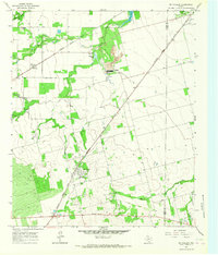
(18)- 1965 Map of Hamlin NW, 1967 Print
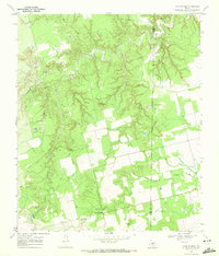
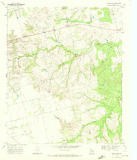
 1965 Hamlin NW1967 Print · USGSFisher and Stonewall Counties in the mid-sixties reveal a landscape defined by petroleum production and rural community life. Researchers can trace family history at Afton Cem or locate vanished landmarks like Pardue Camp and Hitson.
 - 1965 Map of McCaulley, 1967 Print
 1965 McCaulley1967 Print · USGSFisher County and Jones County intersect in this mid-1960s survey of a rural Texas rail and mining corridor. Researchers can trace the industrial footprint of the Celotex plant and Strip Mine or locate family graves at the Swedonia Cem.2 unique versions available
 - 1969 Map of White Canyon, 1972 Print
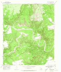
 1969 White Canyon1972 Print · USGSFisher and Stonewall counties in the late sixties were centers of extraction and rural community life. Genealogists and historians can trace the Double Mountain Fork Brazos River past family landmarks like McWhirter, the Highland Home Ch, and Dowell Cem.
 - 1969 Map of Poke Mountain, 1972 Print
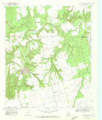
 1969 Poke Mountain1972 Print · USGSThe rugged breaks of the Brazos River frontier in West Texas are captured here at the close of the 1960s. Genealogists and historians can locate family landmarks like Mount Zion Cem, Sacred Heart Ch, and the sprawling Crescent Ranch.2 unique versions available
 - 1969 Map of Camp Springs, 1972 Print
 1969 Camp Springs1972 Print · USGSThe ranching and oil country of the Scurry and Fisher county line is documented here in the late sixties. Researchers can trace family history at Camp Springs Cem or locate early water sources like Dripping Spring and Spring Creek.
 - 1969 Map of Rotan, 1972 Print
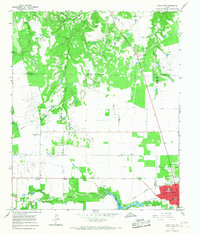
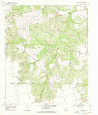
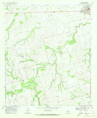
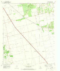
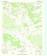
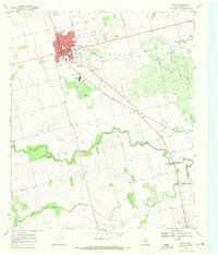 1969 Rotan1972 Print · USGSFisher County as it appeared in the late sixties reveals a landscape of industrial gypsum production and rail-fed commerce. Genealogists and historians can trace old property lines near Rotan Cem, the settlement of Sardis, and the Clear Fork Brazos River.2 unique versions available
 - 1969 Map of Busby, 1972 Print
 1969 Busby1972 Print · USGSThe Texas rail-and-ranching landscape of the late 1960s comes into focus along the Atchison Topeka and Santa Fe line. Researchers can trace the small sidings of Capitola and Gannon or locate family landmarks near Ray Jones Spring and Wasp Peak.
 - 1969 Map of Bull Creek, 1972 Print
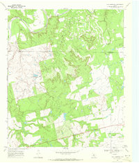
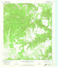
 1969 Bull Creek1972 Print · USGSFisher County land and industry are captured here during the late sixties, showing the intersection of ranching country and the Claytonville Oil Field. Genealogists and researchers can locate the Bethel Ch, the settlement of Tutt, and landmarks along Bull Creek.
 - 1969 Map of Inadale NW, 1972 Print
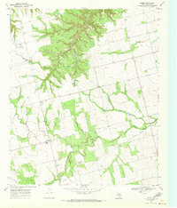
 1969 Inadale NW1972 Print · USGSScurry County's rural landscape is captured here in the late sixties as the local economy balanced ranching with utility infrastructure. Genealogists and researchers can locate the Hermleigh Cem or trace the path of the Clear Fork Brazos River and the Snyder Rotan Aqueduct.
 - 1969 Map of Hudd, 1972 Print
 1969 Hudd1972 Print · USGSScurry County ranching and river breaks are documented here in the late sixties, showing the transition from canyonlands to agricultural flats. Researchers can locate the Cottonwood Flat Cem, Criswell Ranch, and landmarks like Sugar Loaf.
 - 1969 Map of Bernecker, 1972 Print
 1969 Bernecker1972 Print · USGSFisher and Nolan Counties in the late sixties reveal a landscape shaped by ranching and rail. Genealogists and historians can trace the Round Mtn Cem, the settlement of Claytonville, and the path of the Atchison Topeka and Santa Fe railroad.
 - 1969 Map of Hobbs, 1972 Print
 1969 Hobbs1972 Print · USGSFisher County in the late sixties reveals a landscape of isolated farm corners and emerging infrastructure. Genealogists and historians can locate Hobbs Cem, the small Phillips Landing Field, and crossings at Scotts Corner.
 - 1969 Map of Tige Canyon, 1972 Print
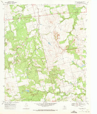
 1969 Tige Canyon1972 Print · USGSThe West Texas ranchlands and oil fields of Fisher, Kent, and Stonewall counties are revealed here in the late sixties. Genealogists and land researchers can trace the winding Double Mountain Fork Brazos River and find isolated landmarks like Devils Backbone and Tige Canyon.
 - 1969 Map of Roby, 1972 Print
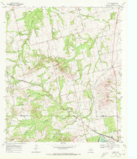
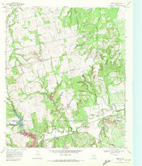
 1969 Roby1972 Print · USGSFisher County at the end of the sixties reveals a landscape shaped by ranching and the rising oil industry. Genealogists can trace family footprints near Roby, the Rodeo Ground, or rural landmarks like El Paso Ch and Liberty Ch.
 - 1969 Map of Eskota, 1972 Print
 1969 Eskota1972 Print · USGSFisher County ranchlands and rail corridors are captured here in the late sixties as the region's transport network matured. Genealogists and historians can trace the small settlement at Palava, its local Cem, and the busy rail lines of the Texas Pacific.2 unique versions available
 - 1969 Map of Longworth, 1973 Print
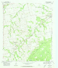 1969 Longworth1973 Print · USGSFisher County ranching and rail activity are captured here in the late sixties as the local economy balanced cattle and oil. Trace family history in Longworth and Sylvester, or follow the Atchison Topeka and Santa Fe line past the Sylvester Cem.
 - 1969 Map of Inadale, 1973 Print
 1969 Inadale1973 Print · USGSWest Texas rail junctions and agricultural boundaries are captured here in the late sixties as the region's economy relied on heavy rail transport. Trace the routes of the Roscoe Snyder and Pacific and locate family burial sites at Pyron Cem or Lone Wolf Cem.
 - 1969 Map of Royston, 1973 Print
 1969 Royston1973 Print · USGSFisher County in the late 1960s shows a landscape shaped by petroleum and the winding Clear Fork Brazos River. Researchers can trace the path of the Missouri Kansas Texas railroad and find local landmarks like the Roby Cem and Kyle Spring.2 unique versions available
End of results
Showing maps 1-18 of 18
Top cities of Fisher County
Frequently asked questions
- What are the different types of historical maps available for Fisher County?
- What is the oldest map of Fisher County?
- Where can I purchase historical maps of Fisher County for my home or office?
- Where can I download high-res historical maps of Fisher County?
- Are there historical topographic maps available for Fisher County?
- Is there historical aerial imagery available for Fisher County?
- Where are historical maps of Fisher County sourced from?