Old Maps of Fisher County, Texas for Academic Research
Study the evolution of Fisher County with 129 high-resolution historic maps. Whether you're teaching, researching, or modeling changes in land use, these maps provide essential visual documentation of urban, environmental, and geographic change.
- Analyze long-term change: Track patterns in development, transportation, and natural features.
- Ideal for environmental or urban studies: Support academic projects with primary historical map data.
- Use in the classroom or lab: Educators and researchers rely on these maps to bring historical context to life.
These maps are a powerful tool for teaching, research, and visualizing how Fisher County has changed over the decades.
Fisher County, TX maps
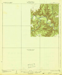
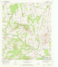
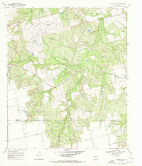
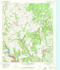
(129)- 1893 Map of Roby
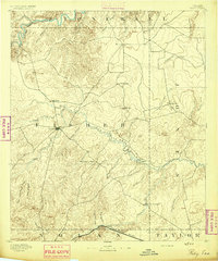 1893 Roby1893 Print · USGSFisher and Jones Counties come alive in the 1890s as early ranching settlements and rail sidings begin to dot the West Texas plains. Researchers can trace the early layout of Roby and locate lost community sites like Swedonia, Taopi, or the Winters Chapel congregation.4 unique versions available
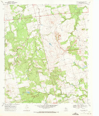
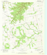
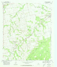
 - 1926 Map of Snyder 1-a
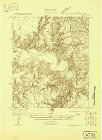 1926 Snyder 1-a1926 Print · USGSWest Texas ranching country and the Brazos watershed are captured here in the mid-twenties, showing where three counties converge. Researchers can trace early roads like the Canadian Highway and locate rural landmarks such as the County Line School.
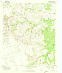
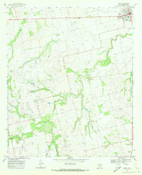
 - 1926 Map of Roby 2-b
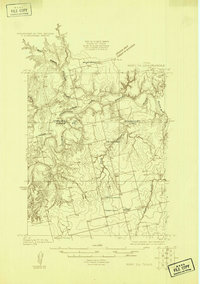 1926 Roby 2-b1926 Print · USGSFisher and Stonewall Counties in the late 1920s are defined by the winding forks of the Brazos River and the remote schoolhouses of the West Texas plains. Researchers can locate family landmarks like the Dowell Cemetery, Wright School, and the rural Dowell Church.
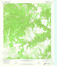
 - 1931 Map of Rotan
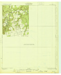 1931 Rotan1931 Print · USGSNorthwest Texas cattle and farming country comes into focus in the early 1930s as regional highways began to trace the hills. Genealogists can locate family landmarks like Dowell Ch and the neighboring Dorras Sch near the Stonewall and Fisher County line.2 unique versions available
 - 1932 Map of Camp Springs
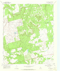
 1932 Camp Springs1932 Print · USGSIn the 1930s, the borderlands of Kent and Fisher Counties featured a deeply dissected landscape carved by the Double Mountain Fork Brazos River. Local historians can trace the rural landscape of the era through landmarks like the County Line Sch and the expanse of Longhorn Valley.2 unique versions available
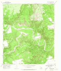
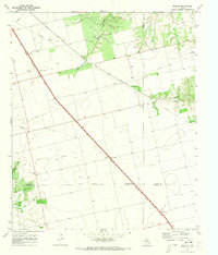
 - 1954 Map of Big Spring, 1965 Print
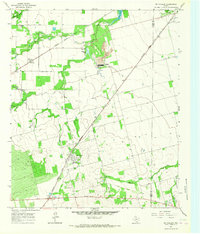
 1954 Big Spring1965 Print · USGSWest Texas in the mid-1950s shows a landscape of growing oil towns and vital rail links along the Texas and Pacific RR. Researchers can trace the development of Big Spring, find smaller settlements like Knott and Lomax, or locate landmarks such as Boyds Chapel and Signal Mountain.4 unique versions available
 - 1957 Map of Noodle, 1958 Print
 1957 Noodle1958 Print · USGSJones and Fisher Counties appear here during a mid-century period of active oil exploration and railroad transport. Researchers can trace the rural infrastructure of Noodle and Sylvester, alongside landmarks like Newman Ch and the Raven Oil Field.
 - 1958 Map of Big Spring
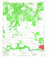
 1958 Big Spring1958 Print · USGSThe West Texas oil boom was in full swing during the late fifties, transforming the landscape around Howard and Mitchell counties. Genealogists and historians can trace the growth of Big Spring and Snyder alongside industrial landmarks like the Kelly-Snyder Oil Field and the Santa Fe rail lines.
 - 1965 Map of Hamlin NW, 1967 Print
 1965 Hamlin NW1967 Print · USGSFisher and Stonewall Counties in the mid-sixties reveal a landscape defined by petroleum production and rural community life. Researchers can trace family history at Afton Cem or locate vanished landmarks like Pardue Camp and Hitson.
 - 1965 Map of McCaulley, 1967 Print
 1965 McCaulley1967 Print · USGSFisher County and Jones County intersect in this mid-1960s survey of a rural Texas rail and mining corridor. Researchers can trace the industrial footprint of the Celotex plant and Strip Mine or locate family graves at the Swedonia Cem.2 unique versions available
 - 1969 Map of White Canyon, 1972 Print
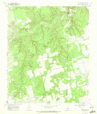
 1969 White Canyon1972 Print · USGSFisher and Stonewall counties in the late sixties were centers of extraction and rural community life. Genealogists and historians can trace the Double Mountain Fork Brazos River past family landmarks like McWhirter, the Highland Home Ch, and Dowell Cem.
 - 1969 Map of Poke Mountain, 1972 Print
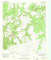
 1969 Poke Mountain1972 Print · USGSThe rugged breaks of the Brazos River frontier in West Texas are captured here at the close of the 1960s. Genealogists and historians can locate family landmarks like Mount Zion Cem, Sacred Heart Ch, and the sprawling Crescent Ranch.2 unique versions available
 - 1969 Map of Camp Springs, 1972 Print
 1969 Camp Springs1972 Print · USGSThe ranching and oil country of the Scurry and Fisher county line is documented here in the late sixties. Researchers can trace family history at Camp Springs Cem or locate early water sources like Dripping Spring and Spring Creek.
 - 1969 Map of Rotan, 1972 Print
 1969 Rotan1972 Print · USGSFisher County as it appeared in the late sixties reveals a landscape of industrial gypsum production and rail-fed commerce. Genealogists and historians can trace old property lines near Rotan Cem, the settlement of Sardis, and the Clear Fork Brazos River.2 unique versions available
 - 1969 Map of Busby, 1972 Print
 1969 Busby1972 Print · USGSThe Texas rail-and-ranching landscape of the late 1960s comes into focus along the Atchison Topeka and Santa Fe line. Researchers can trace the small sidings of Capitola and Gannon or locate family landmarks near Ray Jones Spring and Wasp Peak.
 - 1969 Map of Bull Creek, 1972 Print
 1969 Bull Creek1972 Print · USGSFisher County land and industry are captured here during the late sixties, showing the intersection of ranching country and the Claytonville Oil Field. Genealogists and researchers can locate the Bethel Ch, the settlement of Tutt, and landmarks along Bull Creek.
 - 1969 Map of Inadale NW, 1972 Print
 1969 Inadale NW1972 Print · USGSScurry County's rural landscape is captured here in the late sixties as the local economy balanced ranching with utility infrastructure. Genealogists and researchers can locate the Hermleigh Cem or trace the path of the Clear Fork Brazos River and the Snyder Rotan Aqueduct.
 - 1969 Map of Hudd, 1972 Print
 1969 Hudd1972 Print · USGSScurry County ranching and river breaks are documented here in the late sixties, showing the transition from canyonlands to agricultural flats. Researchers can locate the Cottonwood Flat Cem, Criswell Ranch, and landmarks like Sugar Loaf.
 - 1969 Map of Bernecker, 1972 Print
 1969 Bernecker1972 Print · USGSFisher and Nolan Counties in the late sixties reveal a landscape shaped by ranching and rail. Genealogists and historians can trace the Round Mtn Cem, the settlement of Claytonville, and the path of the Atchison Topeka and Santa Fe railroad.
 - 1969 Map of Hobbs, 1972 Print
 1969 Hobbs1972 Print · USGSFisher County in the late sixties reveals a landscape of isolated farm corners and emerging infrastructure. Genealogists and historians can locate Hobbs Cem, the small Phillips Landing Field, and crossings at Scotts Corner.
 - 1969 Map of Tige Canyon, 1972 Print
 1969 Tige Canyon1972 Print · USGSThe West Texas ranchlands and oil fields of Fisher, Kent, and Stonewall counties are revealed here in the late sixties. Genealogists and land researchers can trace the winding Double Mountain Fork Brazos River and find isolated landmarks like Devils Backbone and Tige Canyon.
 - 1969 Map of Roby, 1972 Print
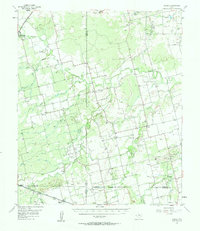
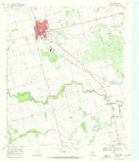
 1969 Roby1972 Print · USGSFisher County at the end of the sixties reveals a landscape shaped by ranching and the rising oil industry. Genealogists can trace family footprints near Roby, the Rodeo Ground, or rural landmarks like El Paso Ch and Liberty Ch.
 - 1969 Map of Eskota, 1972 Print
 1969 Eskota1972 Print · USGSFisher County ranchlands and rail corridors are captured here in the late sixties as the region's transport network matured. Genealogists and historians can trace the small settlement at Palava, its local Cem, and the busy rail lines of the Texas Pacific.2 unique versions available
 - 1969 Map of Longworth, 1973 Print
 1969 Longworth1973 Print · USGSFisher County ranching and rail activity are captured here in the late sixties as the local economy balanced cattle and oil. Trace family history in Longworth and Sylvester, or follow the Atchison Topeka and Santa Fe line past the Sylvester Cem.
 - 1969 Map of Inadale, 1973 Print
 1969 Inadale1973 Print · USGSWest Texas rail junctions and agricultural boundaries are captured here in the late sixties as the region's economy relied on heavy rail transport. Trace the routes of the Roscoe Snyder and Pacific and locate family burial sites at Pyron Cem or Lone Wolf Cem.
Showing maps 1-25 of 129
Top cities of Fisher County
Frequently asked questions
- What are the different types of historical maps available for Fisher County?
- What is the oldest map of Fisher County?
- Where can I purchase historical maps of Fisher County for my home or office?
- Where can I download high-res historical maps of Fisher County?
- Are there historical topographic maps available for Fisher County?
- Is there historical aerial imagery available for Fisher County?
- Where are historical maps of Fisher County sourced from?