Old Maps of Floyd County, Texas for Genealogy
Trace your family roots with 155 historic maps of Floyd County. These high-res maps reveal old neighborhoods, homesites, landmarks, and streets — helping you uncover where your ancestors lived and how the area evolved over time.
- Explore historic neighborhoods: Identify where your relatives may have lived in the 1800s or 1900s.
- Compare maps over time: Trace the changes in streets, buildings, and landmarks for multi-generational research.
- Perfect for genealogy & ancestry research: Used by family historians and researchers to map out lineage and migration.
These maps are an incredible resource for exploring your personal connection to Floyd County's past.
Floyd County, TX maps
(155)- 1954 Map of Lubbock, 1958 Print
 1954 Lubbock1958 Print · USGSThe High Plains and Caprock region of West Texas come alive in the mid-1950s, showing a landscape defined by oil discovery and the Brazos River headwaters. Genealogists and historians can trace rail-connected towns like Roaring Springs, find the Pleasant Valley church, or locate family-named landmarks such as Soldier Mound.4 unique versions available
 - 1954 Map of Plainview, 1966 Print
 1954 Plainview1966 Print · USGSThe Texas Panhandle and the rugged Caprock Escarpment appear in detail as the region's agricultural and rail networks reached their mid-century peak. Trace family roots and old land patterns through the canyons and plains near Plainview, Palo Duro State Park, and Childress.3 unique versions available
 - 1958 Map of Plainview
 1958 Plainview1958 Print · USGSThe High Plains and Caprock Escarpment meet in the late fifties, showcasing the ranching and rail networks of the Texas Panhandle. Trace family roots and vanished stops along the Panhandle and Santa Fe railroad through Plainview, Silverton, and Matador.
 - 1965 Map of Petersburg, 1966 Print
 1965 Petersburg1966 Print · USGSThe South Plains of West Texas appear in the mid-1960s as a landscape of rural town centers and rail-side industry. Genealogists and historians can trace the Petersburg townsite and Estacado settlement, or locate the local Cemetery and the Fort Worth and Denver railroad.
 - 1965 Map of Whiteley, 1967 Print
 1965 Whiteley1967 Print · USGSBriscoe and Floyd Counties are captured in the mid-sixties, showing a landscape shaped by the rail and ranching economy. Researchers can trace the path of the Fort Worth and Denver railroad and locate the small settlements at Whiteley and Howard.
 - 1965 Map of Lockney SE, 1967 Print
 1965 Lockney SE1967 Print · USGSThe Texas High Plains of Floyd County come into focus in the mid-sixties, showing a landscape defined by groundwater wells and industrial rail. Genealogists and local historians can trace the Atchison Topeka and Santa Fe line past Muncy or locate the Floydada Cemetery.
 - 1965 Map of Silverton SW, 1967 Print
 1965 Silverton SW1967 Print · USGSThe High Plains of the Texas Panhandle come into focus during the mid-sixties at the junction of Briscoe, Swisher, and Floyd counties. Local researchers can trace the course of Quitaque Creek, locate the community of Lone Star, and follow the Fort Worth and Denver rail line.
 - 1965 Map of Cone, 1968 Print
 1965 Cone1968 Print · USGSThe High Plains along the Crosby and Floyd county line come into focus during the mid-sixties, revealing a landscape of grid-aligned farms and small hamlets. Genealogists can locate the Cone Cem, Cone Elem Sch, and the quiet settlements of Farmer and Mc Coy.
 - 1965 Map of Floydada, 1968 Print
 1965 Floydada1968 Print · USGSFloydada during the mid-sixties shows a thriving High Plains hub centered on the AT&SF and Quanah Acme and Pacific rail lines. Local historians can trace the foundations of Peoples Hospital, the Della Plain Sch, and the unique topography of BLANCO CANYON.2 unique versions available
 - 1965 Map of Lockney, 1968 Print
 1965 Lockney1968 Print · USGSLockney and the surrounding Floyd County plains are captured in the mid-1960s, showing a landscape defined by industrial agriculture and competing railroads. Genealogists can trace the rail sidings of the Fort Worth and Denver or locate the Fairground and Muncy station.
 - 1965 Map of Floydada SE, 1968 Print
 1965 Floydada SE1968 Print · USGSThe High Plains of the Texas Panhandle meet the deep breaks of the Blanco Canyon in the mid-sixties. Local historians can trace family-named outposts like Montgomery Ranch and the Lakeview Cem near the White River.
 - 1965 Map of Wake, 1968 Print
 1965 Wake1968 Print · USGSCrosby County and its neighbors meet on the edge of the Caprock in the mid-1960s, showing a landscape defined by ranching and groundwater. Genealogists and local historians can locate the Wake settlement, trace the Rustler Creek breaks, and find Antelope Cem.
 - 1965 Map of Boothe, 1968 Print
 1965 Boothe1968 Print · USGSThe High Plains of Floyd County are captured in the mid-1960s, defined by the path of the QUANAH ACME AND PACIFIC railroad. Researchers can locate the small community of Boothe and the nearby settlement of Dougherty among dozens of distinct playa lakes.
 - 1965 Map of Sandhill, 1968 Print
 1965 Sandhill1968 Print · USGSFloyd County during the mid-1960s reveals a high plains landscape where agricultural plateaus meet the deep cuts of Blanco Canyon. Researchers can locate the settlement of Sandhill and trace early industrial sites like the local Quarries and Claypits near the White River.
 - 1966 Map of Sterley, 1967 Print
 1966 Sterley1967 Print · USGSFloyd County at the height of the mid-century agricultural era shows a landscape shaped by the intersection of two vital railroads. Genealogists and historians can locate the Prairie Chapel Sch, a local Cemetery, and the rail-side industrial activity of Lockney.
 - 1966 Map of South Plains, 1967 Print
 1966 South Plains1967 Print · USGSThe high plateau of Floyd County is captured in the mid-1960s as a bustling center of Texas cotton production. Researchers can trace the path of the Fort Worth and Denver railroad or locate the industrial footprint of the Cedar Hill Cotton Gin.
 - 1966 Map of Lockney 4 SW, 1968 Print
 1966 Lockney 4 SW1968 Print · USGSFloyd County's agricultural High Plains come into focus during the late sixties, showcasing a landscape of section lines and prairie sinks. Researchers can locate the Rushing Chapel and Cem, as well as the Irwin Landing Area and numerous local Wells.2 unique versions available
 - 1966 Map of Mount Blanco, 1968 Print
 1966 Mount Blanco1968 Print · USGSTexas High Plains and canyon country meet in the mid-1960s as cattle ranching and early irrigation define the border of Floyd and Crosby Counties. Researchers can trace the winding Blanco Canyon to find Mount Blanco, Heim, and the Meadow Windmill.
 - 1967 Map of Quitaque, 1969 Print
 1967 Quitaque1969 Print · USGSQuitaque stood as a vital rail and ranching hub in the late sixties, where the plains meet the rugged breaks of the Caprock. Genealogists and local historians can trace the diagonal Fort Worth and Denver line, the remote Gray Mule Cem, and the quiet settlement of Fairmont.
 - 1967 Map of Quitaque Peaks, 1969 Print
 1967 Quitaque Peaks1969 Print · USGSFloyd and Motley Counties are captured in the late sixties as the high plains transition into deep canyon country. Genealogists and hikers can locate the isolated Keeter Graves or trace the many forks of the North Pease River and Brushy Creek.
 - 1967 Map of Dick Moore Canyon, 1969 Print
 1967 Dick Moore Canyon1969 Print · USGSFloyd and Motley counties are captured here in the late sixties as the cattle and water economy shaped the West Texas plains. Trace ranching landmarks like Mott Camp and Waybourn Windmill alongside the rugged path of Dick Moore Canyon.
 - 1967 Map of Edgemon Lake, 1969 Print
 1967 Edgemon Lake1969 Print · USGSThe Caprock breaks in the late 1960s reveal a landscape of sharp escarpments and hidden water sources along the Briscoe and Floyd County line. Researchers can trace the rugged drainage of Los Lingos Creek to Lingos Falls or locate the remote Red Rock Spring.
 - 1967 Map of Wilson Creek, 1969 Print
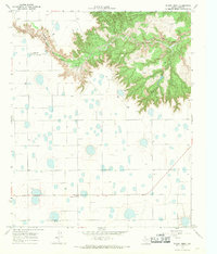 1967 Wilson Creek1969 Print · USGSThe Caprock breaks of Floyd County are captured here in the late sixties, where the High Plains drop into the canyonlands. Genealogists and historians can trace the Fort Worth and Denver line through Johnfarris and locate the community of Cedar Hill.
 - 1968 Map of Barwise, 1970 Print
 1968 Barwise1970 Print · USGSThe High Plains of West Texas are captured in the late sixties as the agricultural and oil industries reshaped the Hale and Floyd county line. Genealogists can locate family landmarks like Carrs Chapel, Harmony, and the Fort Worth and Denver rail line.
 - 1968 Map of Plainview SE, 1970 Print
 1968 Plainview SE1970 Print · USGSThe West Texas High Plains at the close of the 1960s reveal a landscape of intensive irrigation and rail transport. Genealogy and local history researchers can trace family landmarks like Arick Cem, the Snead Landing Strip, and the path of the Fort Worth and Denver railroad.
Showing maps 1-25 of 155
Top cities of Floyd County
Frequently asked questions
- What are the different types of historical maps available for Floyd County?
- What is the oldest map of Floyd County?
- Where can I purchase historical maps of Floyd County for my home or office?
- Where can I download high-res historical maps of Floyd County?
- Are there historical topographic maps available for Floyd County?
- Is there historical aerial imagery available for Floyd County?
- Where are historical maps of Floyd County sourced from?