
1967 Map of Quitaque Peaks
USGS Topo · Published 1969About this map
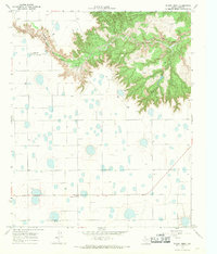
The Quitaque Peaks dominate this landscape on the border of Floyd and Motley Counties, where the high plains break into a network of steep canyons and drainage basins. During the late 1960s, this area remained largely undeveloped, characterized by a series of watering Wells and remote Gravel Pit operations scattered across the plateau. The complex hydrology of the region is evident in the confluence of numerous streams like Turkey Creek, Smith Creek, and Hall Creek, all feeding toward the North Pease River in the southeast corner. A single family landmark, Keeter Graves, sits near a gravel site on the eastern edge, serving as a rare genealogical marker in a terrain otherwise defined by its sharp topography and hydraulic infrastructure, including a Gaging Sta on the upper Quitaque Creek.
Find a feature on this map
20 named features on this map. Tap any name to fly to it.
Don’t see what you’re looking for? This feature index may not catch every label — zoom into the map to look around manually.
Map Details
Editions of this 1967 Quitaque Peaks Map
This is the sole edition of this map. No revisions or reprints were ever made.
Other maps of this area

1954 · Plainview
USGS Topo · 1:250,000

1958 · Plainview
USGS Topo · 1:250,000

1966 · Lockney 4 SW
USGS Topo · 1:24,000

1967 · Quitaque
USGS Topo · 1:24,000

1967 · Dick Moore Canyon
USGS Topo · 1:24,000

1967 · Edgemon Lake
USGS Topo · 1:24,000

1967 · Flomot
USGS Topo · 1:24,000
1967 · Wilson Creek
USGS Topo · 1:24,000

1967 · Whiteflat
USGS Topo · 1:24,000
1967 · Folley
USGS Topo · 1:24,000