
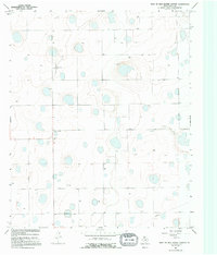
1966 Map of Lockney 4 SW
USGS Topo · Published 1968About this map
The High Plains of Floyd County are defined here by a dense distribution of ephemeral lakes and sinkholes, characteristic of the Llano Estacado region in the mid-1960s. This agricultural landscape is anchored by the small community of Rushing, where local life centered on the Rushing Chapel and an adjacent Cem. The map reveals a land heavily utilized for resource extraction, evidenced by the numerous Wells scattered across the gridded section lines. A notable industrial feature is the Pipeline cutting across the southeastern corner of the quadrangle. For those interested in aviation history or local land use, the Irwin Landing Area provides a specific point of interest in this predominantly rural territory. The topographical detail highlights the subtle depressions of the plains, which served as vital drainage points in an otherwise flat expanse of West Texas farmland.
Find a feature on this map
7 named features on this map. Tap any name to fly to it.
Don’t see what you’re looking for? This feature index may not catch every label — zoom into the map to look around manually.
Map Details
Editions of this 1966 Lockney 4 SW Map
2 editions found
Other maps of this area

1954 · Lubbock
USGS Topo · 1:250,000

1954 · Plainview
USGS Topo · 1:250,000

1958 · Plainview
USGS Topo · 1:250,000

1965 · Lockney SE
USGS Topo · 1:24,000

1965 · Floydada
USGS Topo · 1:24,000

1965 · Boothe
USGS Topo · 1:24,000

1966 · South Plains
USGS Topo · 1:24,000

1967 · Quitaque Peaks
USGS Topo · 1:24,000

1967 · Dick Moore Canyon
USGS Topo · 1:24,000
1967 · Wilson Creek
USGS Topo · 1:24,000