1900s (20th Century) Maps of Freestone County, Texas
Explore 42 historic maps of Freestone County from the 1900s (20th Century). These maps offer a rare glimpse into what life looked like during the 1900s — showing old roads, neighborhoods, homes, and landmarks that have changed or disappeared over time.
Whether you're researching your family's past, planning a metal detecting trip, or studying how Freestone County's landscape evolved across the 1900s, these high-resolution maps are a powerful tool for exploring the history of this region.
- Focus on a specific era: All maps on this page are from the 1900s, giving you a focused view of this time period.
- See what’s changed: Compare century-old streets, trails, and buildings to today's modern landscape using overlays and satellite layers.
- Research with precision: Use these maps for genealogy, historical research, land use analysis, or educational projects.
- View, download, or print: Maps are fully viewable online in high resolution, and can be downloaded or printed for your own records.
Start exploring Freestone County's history through authentic maps from the 1900s. This is your window into the past.
Freestone County, TX maps
(42)- 1919 Map of Fairfield, 1956 Print
 1919 Fairfield1956 Print · USGSFreestone County is captured here after the Great War, showing a network of rural post offices and schoolhouses linked by early wagon roads. You can trace the Trinity and Brazos Valley Railway near Freestone P.O. or locate old community centers like Dew and Turlington P.O..
 - 1920 Map of Mexia
 1920 Mexia1920 Print · USGSLimestone and Freestone counties are shown here just after the Great War, during a period of significant railway expansion and rural settlement. Researchers can trace the routes of the Houston and Texas Central and locate sites like Cotton Gin, Pt. Enterprise, and Duck Lake.
 - 1949 Map of Tennessee Colony, 1967 Print
 1949 Tennessee Colony1967 Print · USGSAnderson County in the late 1940s shows a landscape of river-bottom lakes and rural communities at the height of the oil boom. Genealogists can locate family landmarks like Judson Cem, Gosman Sch, and the Blackfoot Oil Field.2 unique versions available
 - 1950 Map of Tennessee Colony
 1950 Tennessee Colony1950 Print · USGSMid-century Anderson County is captured here just as the oil industry began to shape the Trinity River basin. Trace old family sites and community roots through landmarks like Tennessee Colony, the historic Tyler Ferry crossing, and rural centers like New Bethel Ch.2 unique versions available
 - 1953 Map of Palestine, 1964 Print
 1953 Palestine1964 Print · USGSEast Texas was defined by its deep pine forests and burgeoning energy sector in the mid-1950s. Genealogists and historians can trace the rail-and-river economy through settlements like Tennessee Colony and Pollok or explore the early footprints of the Cayuga Oil Field and Davy Crockett National Forest.2 unique versions available
 - 1954 Map of Dallas, 1963 Print
 1954 Dallas1963 Print · USGSNorth Texas in the mid-fifties and early sixties reveals a landscape of rapid urban growth and water management. Genealogists and historians can trace the evolution of the metroplex through landmarks like Hensley Field, Boles Orphan Home, and the Texas & Pacific RR.4 unique versions available
 - 1954 Map of Waco, 1964 Print
 1954 Waco1964 Print · USGSCentral Texas during the mid-fifties shows a landscape defined by the expansion of Fort Hood Military Reservation and the Brazos river system. Trace the rail lines and early airfields like James Connally Air Force Base and settlements like Temple or McGregor.2 unique versions available
 - 1955 Map of Waco
 1955 Waco1955 Print · USGSCentral Texas at the peak of the Cold War reveals a landscape defined by military expansion and major water projects. Researchers can trace the footprints of Fort Hood, the waters of Lake Waco, and regional hubs like Temple or Mexia.
 - 1956 Map of Jewett
 1956 Jewett1956 Print · USGSLeon and Freestone counties emerge as a vital rail and mining hub in this early twentieth-century survey. Genealogists and historians can trace the growth of settlements like Jewett and Buffalo, or locate defunct stops such as Newly and the Evansville Coal Spur.
 - 1957 Map of Palestine
 1957 Palestine1957 Print · USGSEast Texas in the mid-fifties reveals a landscape of deep pine forests and winding river valleys before the era of massive reservoir construction. Researchers can trace the legacy of the timber and rail industries through labels for the Missouri Pacific RR, Davy Crockett National Forest, and Nacogdoches.
 - 1958 Map of Dallas
 1958 Dallas1958 Print · USGSNorth Texas in the late fifties shows the dramatic expansion of the Metroplex as it absorbs surrounding farm towns. Genealogists and historians can trace old rail lines like the Missouri-Kansas-Texas and locate early lakefront developments at Eagle Mountain Lake and Lake Worth Village.
 - 1960 Map of Winkler, 1961 Print
 1960 Winkler1961 Print · USGSNavarro and Freestone Counties appear here in the early sixties as a network of creek-side settlements and rural churches. Genealogists and researchers can trace local roots at Winkler, St Elmo, and the Sweetman Cem.4 unique versions available
 - 1960 Map of Streetman, 1961 Print
 1960 Streetman1961 Print · USGSThe Navarro and Freestone county line comes alive in the early sixties, showing a landscape of rail-connected farming communities. Genealogists can locate family landmarks like Birdston Cem, Johnson Cem, and rural churches such as Friendship Ch.4 unique versions available
 - 1960 Map of Creslenn Ranch, 1961 Print
 1960 Creslenn Ranch1961 Print · USGSThe Trinity River bottoms and the Cayuga oil country are captured here at the start of the 1960s. Genealogists and local historians can trace the Princeton Cem, the remote Creslenn Ranch, and landmarks like Hall Lake and Trinidad.3 unique versions available
 - 1960 Map of Roustabout Camp, 1961 Print
 1960 Roustabout Camp1961 Print · USGSThe Trinity River bottoms at the Freestone and Anderson county line show a busy mid-century landscape of energy production and river-fed agriculture. Genealogists and historians can trace industrial camps like Roustabout Camp and Amerada Camp or local landmarks such as Harp Ch.4 unique versions available
 - 1961 Map of Young, 1962 Print
 1961 Young1962 Print · USGSFreestone County's rural landscape is captured here in the early sixties, showing the intersection of local agriculture and the petroleum industry. Researchers can find generational landmarks like Rehoboth Cem, Hodge Lodge, and the Stewards Mill Oil Field.3 unique versions available
 - 1963 Map of Wortham, 1966 Print
 1963 Wortham1966 Print · USGSThe community of Wortham sits at the heart of the Texas oil patch in the early sixties. Genealogists and researchers can trace the Southern Pacific rail line between Currie and Gude, and locate family sites like Miller Cem or Red Cem.2 unique versions available
 - 1963 Map of Teague North, 1966 Print
 1963 Teague North1966 Print · USGSThe railroad hub at Teague and the nearby settlements of Cotton Gin and Simsboro are captured here in the early sixties. Genealogists and local historians can trace rural congregations and schools such as Wesley Ch, Union Prim Ch, and the Furney-Richardson School.2 unique versions available
 - 1963 Map of Kirvin, 1966 Print
 1963 Kirvin1966 Print · USGSFreestone County in the early sixties maintains its rural character through a series of small settlements and church communities. You can trace family roots at St Session Cemetery or explore the rail corridor of the Chicago Rock Island and Pacific.2 unique versions available
 - 1963 Map of Stewards Mill, 1966 Print
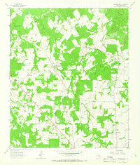 1963 Stewards Mill1966 Print · USGSFreestone County, Texas, was a patchwork of small communities and family farms in the early sixties. Researchers can trace rural heritage through a high concentration of cemeteries and churches like Old Antioch Cem, Union Chapel, and the namesake Stewards Mill.2 unique versions available
 - 1963 Map of Mexia, 1966 Print
 1963 Mexia1966 Print · USGSThe city of Mexia is captured here in the early 1960s, a time of established oil production and rail-driven growth. Genealogists can trace family names across New Home Cem and Spillers Cem, or locate local landmarks like Dunbar High Sch.2 unique versions available
 - 1964 Map of Long Lake, 1967 Print
 1964 Long Lake1967 Print · USGSAnderson County during the mid-1960s was a landscape defined by the winding Trinity River and a burgeoning energy sector. Genealogists and local historians can pinpoint Mt Pilgrim Ch, the Green Bay High Sch, and the rail infrastructure of the Missouri Pacific.3 unique versions available
 - 1964 Map of Oakwood, 1967 Print
 1964 Oakwood1967 Print · USGSOakwood and the rural fringes of Leon County are captured here in the mid-1960s, centered on the Missouri Pacific rail corridor. Researchers can trace family roots through landmarks like Dunbar High Sch, Mount Pisgah Cem, and the Sand Flats settlement.
 - 1964 Map of Keechi, 1967 Print
 1964 Keechi1967 Print · USGSThe Freestone and Leon County line comes alive in the mid-1960s, showing a landscape defined by the Missouri Pacific rail line and local creek networks. Genealogists and historians can locate the Trahan Sch, Keechi Cem, and the specialized Oakwood Dome Oil Field.2 unique versions available
 - 1964 Map of Butler, 1967 Print
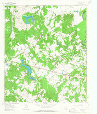 1964 Butler1967 Print · USGSThe rural communities of Freestone County are captured here in the mid-1960s, just as the regional landscape was being reshaped by large ponds and reservoirs. You can trace family histories through numerous landmarks like Butler High School, the Maze Cemetery, and the Daniel Memorial WT Childrens Home.3 unique versions available
Showing maps 1-25 of 42
Top cities of Freestone County
Frequently asked questions
- What are the different types of historical maps available for Freestone County?
- What is the oldest map of Freestone County?
- Where can I purchase historical maps of Freestone County for my home or office?
- Where can I download high-res historical maps of Freestone County?
- Are there historical topographic maps available for Freestone County?
- Is there historical aerial imagery available for Freestone County?
- Where are historical maps of Freestone County sourced from?