1960s Maps of Freestone County, Texas
Explore 23 historic maps of Freestone County from the 1960s. These maps offer a rare glimpse into what life looked like during the 1960s — showing old roads, neighborhoods, homes, and landmarks that have changed or disappeared over time.
Whether you're researching your family's past, planning a metal detecting trip, or studying how Freestone County's landscape evolved across the 1960s, these high-resolution maps are a powerful tool for exploring the history of this region.
- Focus on a specific era: All maps on this page are from the 1960s, giving you a focused view of this time period.
- See what’s changed: Compare century-old streets, trails, and buildings to today's modern landscape using overlays and satellite layers.
- Research with precision: Use these maps for genealogy, historical research, land use analysis, or educational projects.
- View, download, or print: Maps are fully viewable online in high resolution, and can be downloaded or printed for your own records.
Start exploring Freestone County's history through authentic maps from the 1960s. This is your window into the past.
Freestone County, TX maps
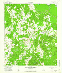
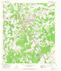
(23)- 1960 Map of Winkler, 1961 Print
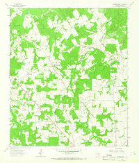
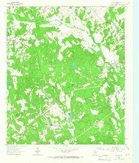
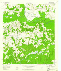 1960 Winkler1961 Print · USGSNavarro and Freestone Counties appear here in the early sixties as a network of creek-side settlements and rural churches. Genealogists and researchers can trace local roots at Winkler, St Elmo, and the Sweetman Cem.4 unique versions available
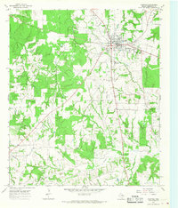
 - 1960 Map of Streetman, 1961 Print
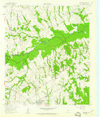 1960 Streetman1961 Print · USGSThe Navarro and Freestone county line comes alive in the early sixties, showing a landscape of rail-connected farming communities. Genealogists can locate family landmarks like Birdston Cem, Johnson Cem, and rural churches such as Friendship Ch.4 unique versions available
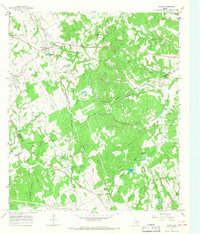
 - 1960 Map of Creslenn Ranch, 1961 Print
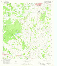
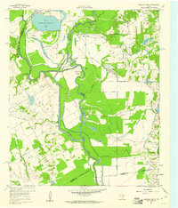 1960 Creslenn Ranch1961 Print · USGSThe Trinity River bottoms and the Cayuga oil country are captured here at the start of the 1960s. Genealogists and local historians can trace the Princeton Cem, the remote Creslenn Ranch, and landmarks like Hall Lake and Trinidad.3 unique versions available
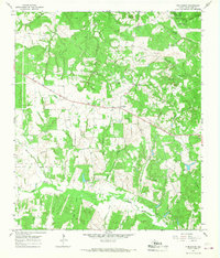
 - 1960 Map of Roustabout Camp, 1961 Print
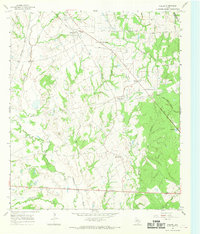
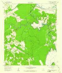 1960 Roustabout Camp1961 Print · USGSThe Trinity River bottoms at the Freestone and Anderson county line show a busy mid-century landscape of energy production and river-fed agriculture. Genealogists and historians can trace industrial camps like Roustabout Camp and Amerada Camp or local landmarks such as Harp Ch.4 unique versions available
 - 1961 Map of Young, 1962 Print
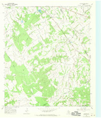
 1961 Young1962 Print · USGSFreestone County's rural landscape is captured here in the early sixties, showing the intersection of local agriculture and the petroleum industry. Researchers can find generational landmarks like Rehoboth Cem, Hodge Lodge, and the Stewards Mill Oil Field.3 unique versions available
 - 1963 Map of Wortham, 1966 Print
 1963 Wortham1966 Print · USGSThe community of Wortham sits at the heart of the Texas oil patch in the early sixties. Genealogists and researchers can trace the Southern Pacific rail line between Currie and Gude, and locate family sites like Miller Cem or Red Cem.2 unique versions available
 - 1963 Map of Teague North, 1966 Print
 1963 Teague North1966 Print · USGSThe railroad hub at Teague and the nearby settlements of Cotton Gin and Simsboro are captured here in the early sixties. Genealogists and local historians can trace rural congregations and schools such as Wesley Ch, Union Prim Ch, and the Furney-Richardson School.2 unique versions available
 - 1963 Map of Kirvin, 1966 Print
 1963 Kirvin1966 Print · USGSFreestone County in the early sixties maintains its rural character through a series of small settlements and church communities. You can trace family roots at St Session Cemetery or explore the rail corridor of the Chicago Rock Island and Pacific.2 unique versions available
 - 1963 Map of Stewards Mill, 1966 Print
 1963 Stewards Mill1966 Print · USGSFreestone County, Texas, was a patchwork of small communities and family farms in the early sixties. Researchers can trace rural heritage through a high concentration of cemeteries and churches like Old Antioch Cem, Union Chapel, and the namesake Stewards Mill.2 unique versions available
 - 1963 Map of Mexia, 1966 Print
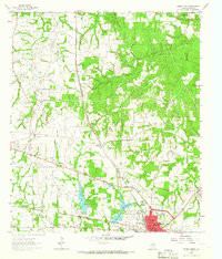
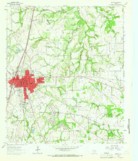 1963 Mexia1966 Print · USGSThe city of Mexia is captured here in the early 1960s, a time of established oil production and rail-driven growth. Genealogists can trace family names across New Home Cem and Spillers Cem, or locate local landmarks like Dunbar High Sch.2 unique versions available
 - 1964 Map of Long Lake, 1967 Print
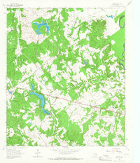
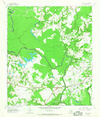 1964 Long Lake1967 Print · USGSAnderson County during the mid-1960s was a landscape defined by the winding Trinity River and a burgeoning energy sector. Genealogists and local historians can pinpoint Mt Pilgrim Ch, the Green Bay High Sch, and the rail infrastructure of the Missouri Pacific.3 unique versions available
 - 1964 Map of Oakwood, 1967 Print
 1964 Oakwood1967 Print · USGSOakwood and the rural fringes of Leon County are captured here in the mid-1960s, centered on the Missouri Pacific rail corridor. Researchers can trace family roots through landmarks like Dunbar High Sch, Mount Pisgah Cem, and the Sand Flats settlement.
 - 1964 Map of Keechi, 1967 Print
 1964 Keechi1967 Print · USGSThe Freestone and Leon County line comes alive in the mid-1960s, showing a landscape defined by the Missouri Pacific rail line and local creek networks. Genealogists and historians can locate the Trahan Sch, Keechi Cem, and the specialized Oakwood Dome Oil Field.2 unique versions available
 - 1964 Map of Butler, 1967 Print
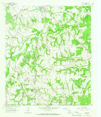
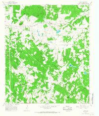
 1964 Butler1967 Print · USGSThe rural communities of Freestone County are captured here in the mid-1960s, just as the regional landscape was being reshaped by large ponds and reservoirs. You can trace family histories through numerous landmarks like Butler High School, the Maze Cemetery, and the Daniel Memorial WT Childrens Home.3 unique versions available
 - 1965 Map of Dew, 1967 Print
 1965 Dew1967 Print · USGSFreestone County in the mid-sixties remains a landscape of traditional Texas farmsteads and prairie openings. Genealogists and local historians can trace family roots through several named cemeteries and churches like Philpott Cem and Salem Ch, or follow the Chicago Rock Island and Pacific rail line.2 unique versions available
 - 1965 Map of Lanely, 1967 Print
 1965 Lanely1967 Print · USGSFreestone and Leon Counties appear here in the mid-1960s, showing a rural landscape of creek bottoms and scattered homesteads. Genealogists can trace family landmarks like Harrison Chapel Cem, Holly Grove Cem, and Little Star Ch.2 unique versions available
 - 1965 Map of Buffalo, 1967 Print
 1965 Buffalo1967 Print · USGSBuffalo was a bustling Leon County crossroads in the mid-sixties, where the rail line and highways met amidst a landscape of family-named creeks. Genealogists can trace local roots through landmarks like Sand Hill Cem, Bennett Sch, and Davis Chapel.2 unique versions available
 - 1965 Map of Fairfield, 1968 Print
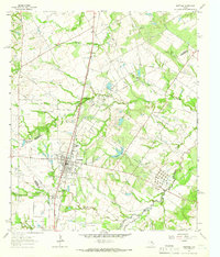
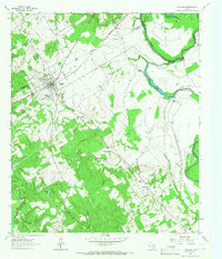
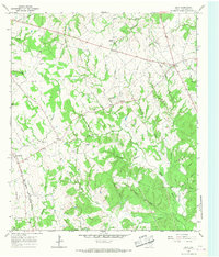
 1965 Fairfield1968 Print · USGSFairfield and the surrounding Freestone County countryside are captured here in the mid-sixties, showcasing a thriving Texas county seat. Researchers can find old landmarks like Dogan High School, the local Drive-in Theater, and rural cemeteries including George Cem and Driver Cem.2 unique versions available
 - 1965 Map of Donie, 1968 Print
 1965 Donie1968 Print · USGSDonie and the surrounding Leon County countryside are captured here in the mid-1960s, showing a landscape defined by timber, water, and the rail line. Genealogists and local historians can locate long-standing landmarks such as Wilson Chapel, Post Oak Cem, and the waters of Thundering Springs.2 unique versions available
 - 1965 Map of Turlington, 1968 Print
 1965 Turlington1968 Print · USGSFreestone County's rural landscape is captured here in the mid-sixties, a time when traditional ranching coexisted with a growing network of energy pipelines. Researchers can locate the Turlington crossroads, family burial sites at Day Cem, and the timbered bottoms of Upper Keechi Creek.2 unique versions available
 - 1966 Map of Teague South, 1968 Print
 1966 Teague South1968 Print · USGSFreestone and Limestone counties are captured in the mid-1960s as the rail-centered economy of Teague meets the rural crossroads of Personville. Researchers can trace family history at Greenwood Cem or locate the old Salem Ch and Union Ch amid the Bear Branch and Holman Creek bottoms.2 unique versions available
 - 1966 Map of Fallon, 1969 Print
 1966 Fallon1969 Print · USGSLimestone County in the mid-sixties remained a rural expanse of winding river bottoms and small community hubs. Local historians can trace the old rail networks and family burial sites like Doyle Cem, Box Car Center, and the crossing at Long Bridge.2 unique versions available
 - 1966 Map of Farrar, 1970 Print
 1966 Farrar1970 Print · USGSLimestone and Freestone counties are shown in the mid-1960s as the rural landscape centered on cattle and quiet communities. Researchers can trace family ties at Oaks Cem or locate the small crossroads of Farrar and New Hope.2 unique versions available
End of results
Showing maps 1-23 of 23
Top cities of Freestone County
Frequently asked questions
- What are the different types of historical maps available for Freestone County?
- What is the oldest map of Freestone County?
- Where can I purchase historical maps of Freestone County for my home or office?
- Where can I download high-res historical maps of Freestone County?
- Are there historical topographic maps available for Freestone County?
- Is there historical aerial imagery available for Freestone County?
- Where are historical maps of Freestone County sourced from?