
1960 Map of Winkler
USGS Topo · Published 1961About this map
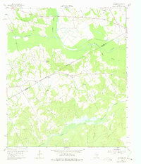
The Navarro Co Freestone Co boundary cuts across this landscape, dividing the agricultural and wooded bottomlands where Richland Creek and Chambers Creek converge. The topography is defined by the complex drainage systems of Tehuacana Creek and Hogpen Slough, with small settlements like Winkler and St Elmo serving as local hubs. This 1960 survey illustrates a rural Texas social fabric tied closely to community landmarks, including New Hope Ch, Greenbriar Ch, and Petersburg Ch. Family history is preserved in the location of Sweetman Cem and Lee Cem, while the inclusion of a Radio Tower and Pipeline suggests the mid-century infrastructure and utility expansions beginning to cross these traditional farming counties.
Find a feature on this map
24 named features on this map. Tap any name to fly to it.
Don’t see what you’re looking for? This feature index may not catch every label — zoom into the map to look around manually.
Map Details
Editions of this 1960 Winkler Map
4 editions found
Other maps of this area

1954 · Dallas
USGS Topo · 1:250,000

1954 · Waco
USGS Topo · 1:250,000

1955 · Waco
USGS Topo · 1:250,000

1958 · Dallas
USGS Topo · 1:250,000

1959 · Powell
USGS Topo · 1:24,000

1960 · Streetman
USGS Topo · 1:24,000

1960 · Creslenn Ranch
USGS Topo · 1:24,000

1960 · Goodlow Park
USGS Topo · 1:24,000

1960 · Roustabout Camp
USGS Topo · 1:24,000

1961 · Young
USGS Topo · 1:24,000