
1960 Map of Streetman
USGS Topo · Published 1961About this map
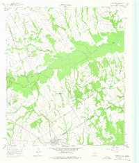
Streetman sits at the southern edge of this 1960 survey, serving as a hub where the Fort Worth and Denver railroad meets the border of Navarro and Freestone counties. The landscape is defined by the broad, wooded floodplain of Richland Creek, which meanders through the center of the map. This area preserves a mid-century rural Texan layout of scattered family settlements and community landmarks, such as Birdston Valley and Cheneyboro. The map is particularly valuable for genealogists, as it meticulously identifies numerous local burial grounds and places of worship, including Hopewell Cem, Handcock Cem, and Silent Grove Ch. The presence of several distinct rail lines, such as the Chicago Rock Island and Pacific, underscores the region's historical reliance on rail transport for its agricultural economy.
Find a feature on this map
23 named features on this map. Tap any name to fly to it.
Don’t see what you’re looking for? This feature index may not catch every label — zoom into the map to look around manually.
Map Details
Editions of this 1960 Streetman Map
4 editions found
Other maps of this area

1954 · Dallas
USGS Topo · 1:250,000

1954 · Waco
USGS Topo · 1:250,000

1955 · Waco
USGS Topo · 1:250,000

1958 · Dallas
USGS Topo · 1:250,000

1959 · Powell
USGS Topo · 1:24,000

1960 · Winkler
USGS Topo · 1:24,000

1960 · Goodlow Park
USGS Topo · 1:24,000

1963 · Richland
USGS Topo · 1:24,000

1963 · Wortham
USGS Topo · 1:24,000

1963 · Kirvin
USGS Topo · 1:24,000