
1959 Map of Powell
USGS Topo · Published 1961About this map
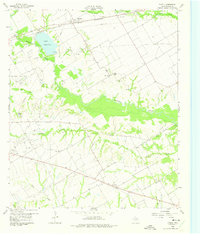
The St Louis Southwestern railroad corridor defines the northern edge of this late 1950s landscape, passing through the settlement of Powell. This region of Navarro County shows a distinct transition between agricultural prairie and industrial extraction, most notably within the Corsicana Oil Field where numerous Oil Wells are scattered across the terrain. Water management is a central theme of the map, anchored by the reservoir at Lake Corsicana and the winding course of Chambers Creek, which is spanned by the Anderson Bridge. Rural community life is well-documented through small settlements like Eureka and Elm Flat, each accompanied by their respective burial grounds, Eureka Cem and Elm Flat Cem. These locations, along with Providence Ch, provide a clear picture of the mid-century social fabric in this part of Texas.
Find a feature on this map
23 named features on this map. Tap any name to fly to it.
Don’t see what you’re looking for? This feature index may not catch every label — zoom into the map to look around manually.
Map Details
Editions of this 1959 Powell Map
2 editions found
Other maps of this area

1954 · Dallas
USGS Topo · 1:250,000

1954 · Waco
USGS Topo · 1:250,000

1955 · Waco
USGS Topo · 1:250,000

1958 · Dallas
USGS Topo · 1:250,000

1960 · Winkler
USGS Topo · 1:24,000

1960 · Streetman
USGS Topo · 1:24,000

1960 · Goodlow Park
USGS Topo · 1:24,000

1961 · Kerens
USGS Topo · 1:24,000

1961 · Chatfield
USGS Topo · 1:24,000

1962 · Bazette
USGS Topo · 1:24,000