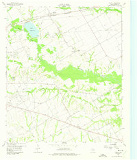
1959 Map of Powell
USGS Topo · Published 1975About this map
The Corsicana Oil Field dominates this central Navarro County landscape, where pump jacks and drill sites share the rolling plains with traditional cattle ranching. In the late 1950s, the community of Powell served as a key hub along the St Louis Southwestern railroad, supported by nearby rural settlements like Elm Flat and Eureka. To the northwest, the waters of Lake Corsicana are held back by a prominent Spillway, providing recreation at Camp Wanica and a steady water supply for the region.
Find a feature on this map
24 named features on this map. Tap any name to fly to it.
Don’t see what you’re looking for? This feature index may not catch every label — zoom into the map to look around manually.
Map Details
Editions of this 1959 Powell Map
2 editions found
Other maps of this area

1954 · Dallas
USGS Topo · 1:250,000

1954 · Waco
USGS Topo · 1:250,000

1955 · Waco
USGS Topo · 1:250,000

1958 · Dallas
USGS Topo · 1:250,000

1959 · Powell
USGS Topo · 1:24,000

1960 · Winkler
USGS Topo · 1:24,000

1960 · Streetman
USGS Topo · 1:24,000

1960 · Goodlow Park
USGS Topo · 1:24,000

1961 · Kerens
USGS Topo · 1:24,000

1961 · Chatfield
USGS Topo · 1:24,000