
1963 Map of Kirvin
USGS Topo · Published 1966About this map
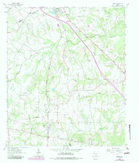
Kirvin and the surrounding Freestone County countryside are defined by a network of rural churches and family-oriented landmarks in the early 1960s. The settlement pattern is anchored by small communities such as Streetman near the northern boundary and Sloan, connected by the Chicago Rock Island and Pacific and Fort Worth and Denver railroad. Local social and spiritual life is evident through the many houses of worship that dot the landscape, including Cade Chapel, Tehuacana Grove Church, and Lebanon Church.
Find a feature on this map
24 named features on this map. Tap any name to fly to it.
Don’t see what you’re looking for? This feature index may not catch every label — zoom into the map to look around manually.
Map Details
Editions of this 1963 Kirvin Map
2 editions found
Other maps of this area

1919 · Fairfield
USGS Topo · 1:62,500

1920 · Mexia
USGS Topo · 1:62,500

1954 · Waco
USGS Topo · 1:250,000

1955 · Waco
USGS Topo · 1:250,000

1960 · Winkler
USGS Topo · 1:24,000

1960 · Streetman
USGS Topo · 1:24,000

1963 · Richland
USGS Topo · 1:24,000

1963 · Wortham
USGS Topo · 1:24,000

1963 · Teague North
USGS Topo · 1:24,000
1963 · Stewards Mill
USGS Topo · 1:24,000