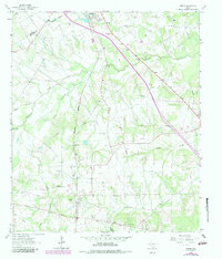
1963 Map of Kirvin
USGS Topo · Published 1983About this map
The railroad community of Kirvin and the surrounding Freestone County countryside are documented here during a period of infrastructure modernization. The Burlington Northern railroad corridor serves as the primary north-south axis, connecting local interests with the regional shipping network. The map reveals a landscape defined by an extensive network of small rural churches and family cemeteries, which provide critical data for genealogical research. Notable sites include Cade Chapel, Tehuacana Grove Ch, and the Cedar Grove Cem. The hydrology of the region is dominated by Tehuacana Creek and its many tributaries, including Little Tehuacana Creek and Grindstone Creek, which carve through the terrain. Evidence of local industry is sparse but present, such as the Gravel Pit located near the center of the survey area.
Find a feature on this map
24 named features on this map. Tap any name to fly to it.
Don’t see what you’re looking for? This feature index may not catch every label — zoom into the map to look around manually.
Map Details
Editions of this 1963 Kirvin Map
2 editions found
Other maps of this area

1919 · Fairfield
USGS Topo · 1:62,500

1920 · Mexia
USGS Topo · 1:62,500

1954 · Waco
USGS Topo · 1:250,000

1955 · Waco
USGS Topo · 1:250,000

1960 · Winkler
USGS Topo · 1:24,000

1960 · Streetman
USGS Topo · 1:24,000

1963 · Richland
USGS Topo · 1:24,000

1963 · Wortham
USGS Topo · 1:24,000

1963 · Teague North
USGS Topo · 1:24,000

1963 · Kirvin
USGS Topo · 1:24,000