
1960 Map of Roustabout Camp
USGS Topo · Published 1961About this map
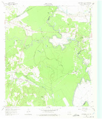
The Trinity River wind through a complex landscape of backwater sloughs and industrial activity at the junction of Freestone, Navarro, and Anderson Counties. This 1960 field-checked survey reveals an area defined by its river-bottom topography and emerging oil infrastructure. Large bends in the river create a network of oxbows and marshy features including Pea Patch Lake, Snag Lake, and Lost Lake. The confluence of Richland Creek and Tehuacana Creek further complicates the drainage patterns, creating a dense environment of sloughs like Hillside Slough and Enloe Slough.
Find a feature on this map
37 named features on this map. Tap any name to fly to it.
Don’t see what you’re looking for? This feature index may not catch every label — zoom into the map to look around manually.
Map Details
Editions of this 1960 Roustabout Camp Map
4 editions found
Other maps of this area

1949 · Athens
USGS Topo · 1:62,500

1949 · Tennessee Colony
USGS Topo · 1:62,500

1950 · Athens
USGS Topo · 1:62,500

1950 · Tennessee Colony
USGS Topo · 1:62,500

1953 · Palestine
USGS Topo · 1:250,000

1954 · Dallas
USGS Topo · 1:250,000

1954 · Waco
USGS Topo · 1:250,000

1955 · Waco
USGS Topo · 1:250,000

1956 · Tyler
USGS Topo · 1:250,000

1957 · Palestine
USGS Topo · 1:250,000