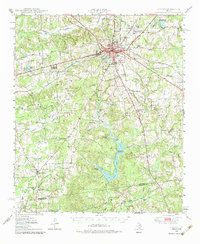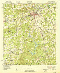
1950 Map of Athens
USGS Topo · Published 1950About this map
Athens serves as the focal point of this Henderson County landscape, shown here at the transition from the late 1940s into the 1950s. The town is a concentrated hub of commerce and education, featuring the Junior College, High Sch, and the broadcast tower for Radio Sta KBUD. Two major rail lines, the St Louis Southwestern and Southern Pacific, intersect in the town center, underscoring the area's importance as a regional transportation junction. Outside the city limits, the terrain is defined by a dense network of rural communities such as Dauphin, Midway, and Cross Roads.
Find a feature on this map
77 named features on this map. Tap any name to fly to it.
Don’t see what you’re looking for? This feature index may not catch every label — zoom into the map to look around manually.
Map Details
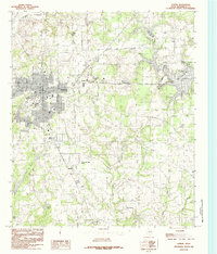
Editions of this 1950 Athens Map
This is the sole edition of this map. No revisions or reprints were ever made.
Historical Maps of Athens Through Time
8 maps found