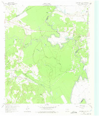
1960 Map of Roustabout Camp
USGS Topo · Published 1975About this map
Trinity River and its meandering oxbows dominate this landscape at the intersection of Freestone, Navarro, and Anderson counties. The map captures a high concentration of energy and utility infrastructure, characterized by numerous Oil Wells, Gas Wells, and Pipelines that traverse the bottomlands and bluffs. Settlement patterns here are distinct, revolving around specialized work centers such as Roustabout Camp, Big Camp, and Amerada Camp, rather than traditional town squares.
Find a feature on this map
41 named features on this map. Tap any name to fly to it.
Don’t see what you’re looking for? This feature index may not catch every label — zoom into the map to look around manually.
Map Details
Editions of this 1960 Roustabout Camp Map
4 editions found

Other maps of this area

1949 · Athens
USGS Topo · 1:62,500

1949 · Tennessee Colony
USGS Topo · 1:62,500

1950 · Athens
USGS Topo · 1:62,500

1950 · Tennessee Colony
USGS Topo · 1:62,500

1953 · Palestine
USGS Topo · 1:250,000

1954 · Dallas
USGS Topo · 1:250,000

1954 · Waco
USGS Topo · 1:250,000

1955 · Waco
USGS Topo · 1:250,000

1956 · Tyler
USGS Topo · 1:250,000

1957 · Palestine
USGS Topo · 1:250,000