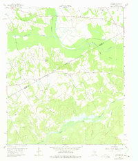
1960 Map of Winkler
USGS Topo · Published 1975About this map
Chambers Creek and Richland Creek converge in this corner of North Central Texas, where the terrain is marked by a mix of agricultural bottomlands and industrial development. The survey, field-checked in 1960, documents a landscape where rural community life and natural resource extraction exist side-by-side. The presence of the Reka Oil Field and Stewards Mill Oil Field indicates the importance of petroleum to the local economy during the mid-twentieth century. Scattered settlements like Winkler and St Elmo are centered around small country churches and family burial grounds. Local genealogists will find several notable sites including Pleasant Hill Ch, Sweatman Cem, and the community of Petersburg, which includes both Petersburg Ch and Petersburg Cem. The map's detailed fencing and field lines provide a clear view of the land partitions across the Navarro Co Freestone Co line.
Find a feature on this map
32 named features on this map. Tap any name to fly to it.
Don’t see what you’re looking for? This feature index may not catch every label — zoom into the map to look around manually.
Map Details
Editions of this 1960 Winkler Map
4 editions found
Other maps of this area

1954 · Dallas
USGS Topo · 1:250,000

1954 · Waco
USGS Topo · 1:250,000

1955 · Waco
USGS Topo · 1:250,000

1958 · Dallas
USGS Topo · 1:250,000

1959 · Powell
USGS Topo · 1:24,000

1960 · Winkler
USGS Topo · 1:24,000

1960 · Streetman
USGS Topo · 1:24,000

1960 · Creslenn Ranch
USGS Topo · 1:24,000

1960 · Goodlow Park
USGS Topo · 1:24,000

1960 · Roustabout Camp
USGS Topo · 1:24,000