
1961 Map of Young
USGS Topo · Published 1962About this map
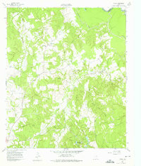
Young and the surrounding Freestone County countryside are documented here during a period of transition between traditional agricultural life and emerging energy extraction. The Stewards Mill Oil Field and a prominent Pipeline cutting through the southwest indicate the industrial footprint of the early 1960s, while numerous country churches like Round Prairie Ch and Mt Zion Ch remain the social anchors of the rural landscape. The terrain is defined by a dense network of drainage systems including Tehuacana Creek, Big Brown Creek, and Oak Creek, which feed toward the Trinity River at the northeastern boundary near the Anderson Co line. For genealogists, the map preserves the exact locations of family-named landmarks such as Rehoboth Cem, Chancellor Cem, and Hodge Lodge, offering a precise spatial record of the community's mid-century settlement pattern.
Find a feature on this map
26 named features on this map. Tap any name to fly to it.
Don’t see what you’re looking for? This feature index may not catch every label — zoom into the map to look around manually.
Map Details
Editions of this 1961 Young Map
3 editions found
Other maps of this area

1919 · Fairfield
USGS Topo · 1:62,500

1949 · Tennessee Colony
USGS Topo · 1:62,500

1950 · Tennessee Colony
USGS Topo · 1:62,500

1953 · Palestine
USGS Topo · 1:250,000

1954 · Waco
USGS Topo · 1:250,000

1955 · Waco
USGS Topo · 1:250,000

1957 · Palestine
USGS Topo · 1:250,000

1960 · Winkler
USGS Topo · 1:24,000

1960 · Roustabout Camp
USGS Topo · 1:24,000
1963 · Stewards Mill
USGS Topo · 1:24,000