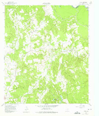
1961 Map of Young
USGS Topo · Published 1975About this map
Young and its surrounding countryside are defined by a complex network of waterways that eventually feed the Trinity River along the northeast boundary of Freestone County. In the early 1960s, this rural landscape was marked by small community anchors, particularly churches that often shared grounds with local burial sites, such as Rehobath Cem Ch and Round Prairie Ch. The presence of the Stewards Mill Oil Field in the northwest and a Gravel Pit near Bethel Ch suggests a landscape where traditional agriculture and newer resource extraction overlapped.
Find a feature on this map
29 named features on this map. Tap any name to fly to it.
Don’t see what you’re looking for? This feature index may not catch every label — zoom into the map to look around manually.
Map Details
Editions of this 1961 Young Map
3 editions found
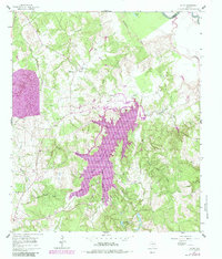
Other maps of this area

1919 · Fairfield
USGS Topo · 1:62,500

1949 · Tennessee Colony
USGS Topo · 1:62,500

1950 · Tennessee Colony
USGS Topo · 1:62,500

1953 · Palestine
USGS Topo · 1:250,000

1954 · Waco
USGS Topo · 1:250,000

1955 · Waco
USGS Topo · 1:250,000

1957 · Palestine
USGS Topo · 1:250,000

1960 · Winkler
USGS Topo · 1:24,000

1960 · Roustabout Camp
USGS Topo · 1:24,000

1961 · Young
USGS Topo · 1:24,000