Old Maps of Gaines County, Texas for Metal Detecting
Plan your next treasure hunt with 197 historic maps of Gaines County. Find old homesites, ghost towns, trails, and gathering spots that may be lost to time — perfect for identifying promising metal detecting locations.
- Locate forgotten sites: Uncover places like long-lost settlements, abandoned rail lines, or gathering spots.
- Plan better hunts: Use map overlays combined with LiDAR or satellite views to narrow in on historically rich areas.
- Made for detectorists: Thousands of hobbyists use these maps to discover relics, coins, and hidden history.
Use these historic maps to boost your research and find new opportunities beneath the surface of Gaines County.
Gaines County, TX maps
(197)- 1954 Map of Hobbs, 1963 Print
 1954 Hobbs1963 Print · USGSThe High Plains and Permian Basin transition is captured here at the height of the mid-century energy boom. Genealogists and industrial historians can trace the foundations of Humble City, locate the Potash Mine and Plant, and follow the Texas-New Mexico RR.2 unique versions available
 - 1958 Map of Hobbs
 1958 Hobbs1958 Print · USGSThe High Plains of the Texas-New Mexico border are shown here during the height of the mid-century oil boom. Genealogists and historians can trace the development of Hobbs, Lovington, and Jal, alongside ranching landmarks like James Ranch and the early Texas-New Mexico Railway.
 - 1969 Map of Loop, 1971 Print
 1969 Loop1971 Print · USGSThe West Texas plains near Loop are captured in the late sixties, showing a landscape defined by ranching and energy. Genealogists and researchers can trace local land divisions via fence lines and locate industrial features like Gas Wells and the Atchison Topeka and Santa Fe railroad.
 - 1969 Map of Ashmore, 1971 Print
 1969 Ashmore1971 Print · USGSThe South Plains oil economy is on full display in the late sixties along the Gaines and Terry county line. Researchers can trace the infrastructure of the Adair Oil Field, the central Refinery, and small rural outposts like Ashmore and Adair.2 unique versions available
 - 1969 Map of Welch SW, 1971 Print
 1969 Welch SW1971 Print · USGSThe West Texas oil boom of the late sixties is on full display here along the Gaines Co Dawson Co line. Researchers can trace the intensive development of the Cedar Lake Oil Field and locate industrial landmarks like the Substation and Cedar Lake.
 - 1969 Map of Welch West, 1971 Print
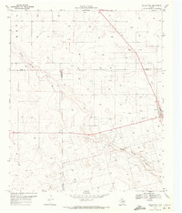 1969 Welch West1971 Print · USGSDawson County and its neighbors are captured here in the late sixties at the height of the local petroleum boom. You can trace the sprawling infrastructure of the Welch Oil Field, the streets of Welch, and the natural path of Sulphur Springs Draw.
 - 1969 Map of Hobbs East, 1972 Print
 1969 Hobbs East1972 Print · USGSThe Texas-New Mexico border near Hobbs thrived during the late sixties as the energy sector shaped the landscape. Genealogists and local historians can trace civic growth through Highland Jr High Sch, find family sites at Prairie Haven Cem, and locate the historic East Hobbs Oil Field.3 unique versions available
 - 1969 Map of Humble City NE, 1972 Print
 1969 Humble City NE1972 Print · USGSThe Texas-New Mexico borderlands in the late sixties reveal a landscape of expanding energy production and cattle ranching. Researchers can trace the development of the Texpac Oil Field or locate the site of the Airport (Abandoned) and Waits Ranch.4 unique versions available
 - 1969 Map of Hobbs SE, 1972 Print
 1969 Hobbs SE1972 Print · USGSThe high plains of the Texas-New Mexico border come into focus in the late 1960s as ranching and oil exploration intersect. Trace the industrial footprint across Monument Draw through its networks of pipelines and sites like Kornegay Ranch.2 unique versions available
 - 1969 Map of Humble City SE, 1972 Print
 1969 Humble City SE1972 Print · USGSThe high plains of the Texas-New Mexico border are captured here in the late sixties as the petroleum industry reshaped the landscape. Researchers can trace early oil infrastructure through numerous Oil Wells and Pipelines near Johnson Draw.
 - 1969 Map of Seminole SW, 1973 Print
 1969 Seminole SW1973 Print · USGSThe West Texas oil boom of the late sixties is frozen in time across these Gaines and Andrews County lines. Researchers can trace the massive footprint of the Doss Robertson Oil Field and Flanagan Harris Field through their complex web of Oil Wells and infrastructure.
 - 1970 Map of Seagraves SW, 1973 Print
 1970 Seagraves SW1973 Print · USGSGaines County in the early 1970s is a landscape defined by the West Texas petroleum industry. Researchers can trace the extensive pipeline networks of the O D C Oil Field or locate the Sulfur Plant, Refinery, and the County Memorial Cem.
 - 1970 Map of Seminole NE, 1973 Print
 1970 Seminole NE1973 Print · USGSGaines County oil production was in full swing by the early seventies. Genealogists and historians can trace the development of Seminole East Oil Field and Wescott Oil Field, or locate the Fairview settlement.
 - 1970 Map of Cedar Point Ranch, 1973 Print
 1970 Cedar Point Ranch1973 Print · USGSGaines County ranching and oil production meet in the early seventies along the Gaines Co Andrews Co border. Researchers can map the footprint of the McFarland Oil Field and Arrow Field alongside the Cedar Point Ranch and Seminole Draw.
 - 1970 Map of Patricia SW, 1973 Print
 1970 Patricia SW1973 Print · USGSThe West Texas plains at the start of the 1970s are defined here by petroleum exploration and the intersection of four county lines. Researchers can trace land use through Oil Wells, McKenzie Draw, and the isolated Mill in the Flat Pond.
 - 1970 Map of Seagraves SE, 1973 Print
 1970 Seagraves SE1973 Print · USGSGaines County was a landscape of intensive energy production in the early seventies, dominated by the Permian Basin's industrial footprint. Researchers can trace the sprawling Oil Field, Gas Field, and the winding course of McKenzie Draw.
 - 1970 Map of McKenzie Lake NW, 1973 Print
 1970 McKenzie Lake NW1973 Print · USGSGaines County enters a period of intensive energy production in the early seventies as the petroleum industry reshapes the High Plains. You can trace the footprint of the Huat Oil Field or locate landmarks like the Cedar Point Windmill and the winding Seminole Draw.
 - 1970 Map of Seminole SE, 1973 Print
 1970 Seminole SE1973 Print · USGSThe Permian Basin oil fields of Gaines and Andrews County appear in high detail during the early 1970s. Trace the industrial footprint of the Means North Field and Nolley Oil Field alongside Telephone Road and local Roadside Parks.2 unique versions available
 - 1970 Map of Seagraves, 1973 Print
 1970 Seagraves1973 Print · USGSSeagraves is captured in the early 1970s at the meeting of Yoakum, Terry, and Gaines counties during a period of steady industrial and oil production. Researchers can locate specific family sites near Webb Cem, trace the ATCHISON TOPEKA AND SANTA FE rail lines, or find the Rodeo Ground.
 - 1970 Map of McKenzie Lake SE, 1973 Print
 1970 McKenzie Lake SE1973 Print · USGSThe Permian Basin oil industry is in full swing on the Gaines and Andrews County line during the early seventies. Trace the industrial footprint of the Glasco Oil Field through its network of Oil Wells and the Florey Pumping Sta.
 - 1970 Map of Loop SW, 1973 Print
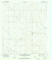 1970 Loop SW1973 Print · USGSGaines County enters the early seventies as a hub of energy production and rugged West Texas prairie. Genealogists and industrial historians can trace the network of an early Pipeline and numerous extraction sites like Gas Well and McKenzie Draw.
 - 1970 Map of Sand, 1973 Print
 1970 Sand1973 Print · USGSThe West Texas plains at the start of the 1970s reveal a landscape shaped by the energy industry and the quiet crossing of McKenzie Draw. Researchers can trace the industrial footprint of the era through numerous Oil Wells, a Pumping Sta, and the community of Sand.
 - 1970 Map of McKenzie Lake, 1974 Print
 1970 McKenzie Lake1974 Print · USGSGaines County ranching and water sources are documented here in the early 1970s, showcasing the landscape before modern developments. Researchers can locate named landmarks like Twin Windmills, the Good Water Well, and the seasonal McKenzie Lake.
 - 1970 Map of Cedar Point, 1974 Print
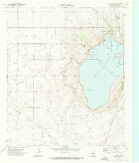 1970 Cedar Point1974 Print · USGSGaines County was a hub of mineral extraction and agriculture in the early seventies, centered around the alkaline waters of the High Plains. Researchers can trace the industrial footprint of the Cedar Lake Oil Field, a local Cotton Gin, and the Salt Evaporator works.
 - 1970 Map of Seagraves NW, 1974 Print
 1970 Seagraves NW1974 Print · USGSThe West Texas plains in the early seventies reveal an intensive landscape of petroleum extraction along the Yoakum Co and Gaines Co line. Researchers can trace the layout of the O D C Oil Field, the Plains Gas Plant, and geographic markers along McKenzie Draw.
Showing maps 1-25 of 197
Top cities of Gaines County
Frequently asked questions
- What are the different types of historical maps available for Gaines County?
- What is the oldest map of Gaines County?
- Where can I purchase historical maps of Gaines County for my home or office?
- Where can I download high-res historical maps of Gaines County?
- Are there historical topographic maps available for Gaines County?
- Is there historical aerial imagery available for Gaines County?
- Where are historical maps of Gaines County sourced from?