Old Maps of Pointe San Luis, Galveston for Academic Research
Study the evolution of Pointe San Luis with 13 high-resolution historic maps. Whether you're teaching, researching, or modeling changes in land use, these maps provide essential visual documentation of urban, environmental, and geographic change.
- Analyze long-term change: Track patterns in development, transportation, and natural features.
- Ideal for environmental or urban studies: Support academic projects with primary historical map data.
- Use in the classroom or lab: Educators and researchers rely on these maps to bring historical context to life.
These maps are a powerful tool for teaching, research, and visualizing how Pointe San Luis has changed over the decades.
Pointe San Luis, Galveston maps
(13)- 1933 Map of San Luis Pass
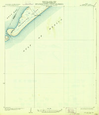 1933 San Luis Pass1933 Print · USGSThe southwestern tip of Galveston Island is captured in the early 1930s, showing the maritime landscape before modern bridge connections. Trace the coastal defenses and tidal inlets of the era, from the San Luis Coast Guard station to the waters of West Bay.2 unique versions available
 - 1943 Map of San Luis Pass
 1943 San Luis Pass1943 Print · USGSCoastal Galveston during the war years focused on maritime defense and navigation at the mouth of the bay. Researchers can trace the early layout of West Beach and the location of the San Luis Coast Guard Station at San Luis Pass.3 unique versions available
 - 1950 Map of Houston, 1953 Print
 1950 Houston1953 Print · USGSCoastal Texas in the early fifties reveals a landscape of massive civil engineering and industrial transit. Genealogists and researchers can trace the growth of the Houston suburbs and the maritime infrastructure of Galveston Bay, including the Gulf Freeway and the Texas City Dike.
 - 1956 Map of Houston, 1963 Print
 1956 Houston1963 Print · USGSSoutheast Texas in the mid-fifties is captured here as a powerhouse of oil and maritime trade. Genealogists and historians can trace the foundations of Houston and its ports, alongside landmarks like the Rice Institute and the Spindletop Oil Field.2 unique versions available
 - 1963 Map of San Luis Pass, 1966 Print
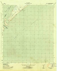
 1963 San Luis Pass1966 Print · USGSThe southwestern tip of Galveston Island and the waters of San Luis Pass are captured here in the early 1960s. Genealogists and coastal historians can trace early island life near Bay Harbor and along West Beach.2 unique versions available
 - 1975 Map of Houston, 1977 Print
 1975 Houston1977 Print · USGSThe Texas Gulf Coast in the mid-seventies shows a sprawling Houston metropolis linked to the sea by the massive Houston Ship Channel. Researchers can trace the mid-century industrial landscape from the Astrodome to the Lyndon B. Johnson Space Center.2 unique versions available
 - 1984 Map of Angleton
 1984 Angleton1984 Print · USGSThe Texas Gulf Coast in the mid-eighties shows a landscape of salt domes and bayous at the height of its oil-and-river economy. Researchers can trace land use through the Damon Mound Oil Field and the sprawling State Department of Corrections (Retrieve Unit).2 unique versions available
 - 2010 Map of San Luis Pass, 2010 Print
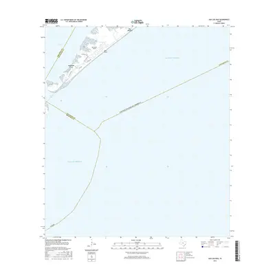
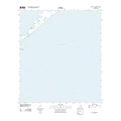 2010 San Luis Pass2010 Print · USGSCovers Pointe San Luis, including Galveston, Alvin, and other nearby areas
 - 2013 Map of San Luis Pass, 2013 Print
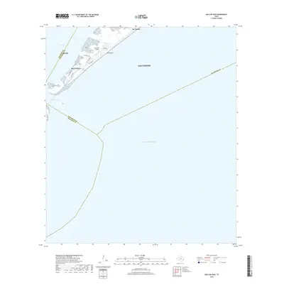
 2013 San Luis Pass2013 Print · USGSCovers Pointe San Luis, including Galveston, Alvin, and other nearby areas
 - 2016 Map of San Luis Pass, 2016 Print
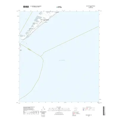
 2016 San Luis Pass2016 Print · USGSCovers Pointe San Luis, including Galveston, Alvin, and other nearby areas
 - 2019 Map of San Luis Pass, 2019 Print
 2019 San Luis Pass2019 Print · USGSCovers Pointe San Luis, including Galveston, Alvin, and other nearby areas
 - 2022 Map of San Luis Pass, 2022 Print
 2022 San Luis Pass2022 Print · USGSCovers Pointe San Luis, including Galveston, Alvin, and other nearby areas
 - 2025 Map of San Luis Pass, 2025 Print
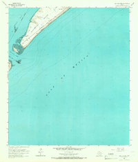
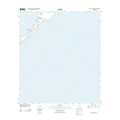
 2025 San Luis Pass2025 Print · USGSThe southwestern tip of Galveston Island comes into focus in this contemporary study of the Texas coast. Researchers can trace development in Bay Harbor and West Beach or locate property near Red Fish Cove and San Luis Pass.
End of results
Showing maps 1-13 of 13
Frequently asked questions
- What are the different types of historical maps available for Pointe San Luis?
- What is the oldest map of Pointe San Luis?
- Where can I purchase historical maps of Pointe San Luis for my home or office?
- Where can I download high-res historical maps of Pointe San Luis?
- Are there historical topographic maps available for Pointe San Luis?
- Is there historical aerial imagery available for Pointe San Luis?
- Where are historical maps of Pointe San Luis sourced from?