1950s Maps of Gonzales County, Texas
Explore 8 historic maps of Gonzales County from the 1950s. These maps offer a rare glimpse into what life looked like during the 1950s — showing old roads, neighborhoods, homes, and landmarks that have changed or disappeared over time.
Whether you're researching your family's past, planning a metal detecting trip, or studying how Gonzales County's landscape evolved across the 1950s, these high-resolution maps are a powerful tool for exploring the history of this region.
- Focus on a specific era: All maps on this page are from the 1950s, giving you a focused view of this time period.
- See what’s changed: Compare century-old streets, trails, and buildings to today's modern landscape using overlays and satellite layers.
- Research with precision: Use these maps for genealogy, historical research, land use analysis, or educational projects.
- View, download, or print: Maps are fully viewable online in high resolution, and can be downloaded or printed for your own records.
Start exploring Gonzales County's history through authentic maps from the 1950s. This is your window into the past.
Gonzales County, TX maps
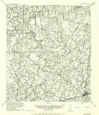
(8)- 1953 Map of Seguin, 1965 Print
 1953 Seguin1965 Print · USGSSouth Texas in the early fifties shows a thriving river-and-rail economy across the Guadalupe and Colorado basins. Genealogists and historians can trace rail routes like the Southern Pacific through Seguin, locate oil wells, or find the Gary AAF near San Marcos.4 unique versions available
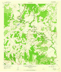
 - 1956 Map of Dewville
 1956 Dewville1956 Print · USGSGuadalupe and Wilson counties are captured here in the mid-1930s, showing a landscape defined by cattle ranching and rural schools. Genealogists can trace family homesteads like Joe Cliff Ranch and Ballard and Place Ranch or find ancestral sites at Zion Hill Church.
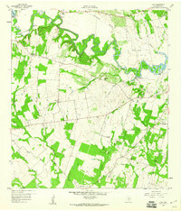
 - 1958 Map of Seguin
 1958 Seguin1958 Print · USGSSouth Texas in the late fifties was a network of river-valley settlements and active oilfields tied together by major rail lines. Genealogists and historians can trace family-named sites across Rabb Prairie, locate the Behring Store, or follow the Southern Pacific through Schulenburg.
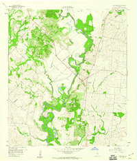
 - 1959 Map of Ottine, 1960 Print
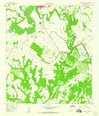
 1959 Ottine1960 Print · USGSThe river valleys of Gonzales County come into sharp focus in the late fifties, centered on the unique subtropical landscape near Ottine. Genealogists and historians can trace the Randle Cem, find the Princeville Sch, and locate the Old Railroad Grade.2 unique versions available
 - 1959 Map of Cost, 1960 Print
 1959 Cost1960 Print · USGSGonzales County's revolutionary history is preserved in this late 1950s survey of the Guadalupe River valley. Researchers can pinpoint the Historical Monument at Cost, local schools like Cost Sch, and family cemeteries including Storey Cem.3 unique versions available
 - 1959 Map of Hochheim, 1960 Print
 1959 Hochheim1960 Print · USGSThe Guadalupe River valley in the late fifties was a landscape of winding oxbows and rural crossings at the DeWitt-Gonzales county line. Researchers can locate family landmarks like Ebenezer Ch, the community of Dreyer, and several Gravel Pits.3 unique versions available
 - 1959 Map of Gonzales South, 1960 Print
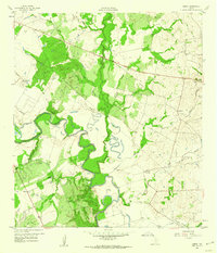
 1959 Gonzales South1960 Print · USGSThe river-bend country south of Gonzales comes into focus in the late 1950s, showing the winding paths of the Guadalupe River and San Marcos River. Researchers can trace old family burial grounds like De Witt Cem and Watson Cem alongside the early development of Santa Anna.3 unique versions available
 - 1959 Map of Hamon, 1960 Print
 1959 Hamon1960 Print · USGSThe Guadalupe River valley in Gonzales County appears here in the late fifties, during a period of shifting rural settlements. Researchers can locate the Hamon (Original Townsite), find the Hamon Ch, and trace old industrial sites like the local Clay Pits.2 unique versions available
End of results
Showing maps 1-8 of 8
Top cities of Gonzales County
Frequently asked questions
- What are the different types of historical maps available for Gonzales County?
- What is the oldest map of Gonzales County?
- Where can I purchase historical maps of Gonzales County for my home or office?
- Where can I download high-res historical maps of Gonzales County?
- Are there historical topographic maps available for Gonzales County?
- Is there historical aerial imagery available for Gonzales County?
- Where are historical maps of Gonzales County sourced from?