Old Maps of Gonzales County, Texas for Metal Detecting
Plan your next treasure hunt with 187 historic maps of Gonzales County. Find old homesites, ghost towns, trails, and gathering spots that may be lost to time — perfect for identifying promising metal detecting locations.
- Locate forgotten sites: Uncover places like long-lost settlements, abandoned rail lines, or gathering spots.
- Plan better hunts: Use map overlays combined with LiDAR or satellite views to narrow in on historically rich areas.
- Made for detectorists: Thousands of hobbyists use these maps to discover relics, coins, and hidden history.
Use these historic maps to boost your research and find new opportunities beneath the surface of Gonzales County.
Gonzales County, TX maps
(187)- 1901 Map of Flatonia
 1901 Flatonia1901 Print · USGSCentral Texas at the turn of the century shows a landscape defined by the railroad and distinct ethnic communities. Trace family roots in the Bohemian Settlement or Negro Settlement, and locate early sites like Old Redrock and Old Flatonia.2 unique versions available
 - 1911 Map of San Marcos
 1911 San Marcos1911 Print · USGSCentral Texas at the peak of the railroad era shows a landscape of small farming communities and country schools. Genealogists can trace family footprints across Comanche Flat or locate long-gone sites like Highpoint School and Bethany Church.2 unique versions available
 - 1919 Map of San Marcos
 1919 San Marcos1919 Print · USGSTexas at the close of the Great War was a landscape of river-fed farms and emerging rail corridors between San Marcos and Lockhart. Genealogists can trace family footprints through numerous rural landmarks like Clark Chapel, High Prairie School, and Larremore.
 - 1920 Map of Smiley
 1920 Smiley1920 Print · USGSSouth Texas ranching and rail life are preserved here in the era following the first World War. Genealogists can trace family roots through labeled landmarks like Willow Springs Ranch, the Southern Pacific Railroad, and the settlement at Nixon.
 - 1925 Map of San Marcos 4-c
 1925 San Marcos 4-c1925 Print · USGSRural Gonzales and Guadalupe Counties in the mid-1920s show a landscape of active small-town life along the river. Researchers can locate numerous local landmarks including Belmont, the Old Spanish Trail, and rural campuses like Roosevelt School and Mt Hope School.
 - 1925 Map of San Marcos 4-a
 1925 San Marcos 4-a1925 Print · USGSCaldwell and Gonzales counties are captured during the mid-twenties, showcasing a landscape shaped by rural school districts and diverging rail lines. Genealogists can locate family landmarks like Soda Spring, Ivy Siding, and the McNeil No 2 School.
 - 1929 Map of Luling
 1929 Luling1929 Print · USGSThe Guadalupe and San Marcos river valleys of Central Texas are captured here in the late twenties during a peak era of rail-and-river life. Genealogists can locate family landmarks like Sand Hill Sch, St James Tabernacle, and the old settlement of Belmont.2 unique versions available
 - 1942 Map of Dewville
 1942 Dewville1942 Print · USGSThe rural borderlands of South Texas are mapped here just before the mid-century, showing a landscape of family ranches and crossroads stores. Researchers can locate ancestral sites like Thomas Springs Ranch and long-standing community centers such as Bethel School and Zion Hill Church.
 - 1953 Map of Seguin, 1965 Print
 1953 Seguin1965 Print · USGSSouth Texas in the early fifties shows a thriving river-and-rail economy across the Guadalupe and Colorado basins. Genealogists and historians can trace rail routes like the Southern Pacific through Seguin, locate oil wells, or find the Gary AAF near San Marcos.4 unique versions available
 - 1956 Map of Dewville
 1956 Dewville1956 Print · USGSGuadalupe and Wilson counties are captured here in the mid-1930s, showing a landscape defined by cattle ranching and rural schools. Genealogists can trace family homesteads like Joe Cliff Ranch and Ballard and Place Ranch or find ancestral sites at Zion Hill Church.
 - 1958 Map of Seguin
 1958 Seguin1958 Print · USGSSouth Texas in the late fifties was a network of river-valley settlements and active oilfields tied together by major rail lines. Genealogists and historians can trace family-named sites across Rabb Prairie, locate the Behring Store, or follow the Southern Pacific through Schulenburg.
 - 1959 Map of Ottine, 1960 Print
 1959 Ottine1960 Print · USGSThe river valleys of Gonzales County come into sharp focus in the late fifties, centered on the unique subtropical landscape near Ottine. Genealogists and historians can trace the Randle Cem, find the Princeville Sch, and locate the Old Railroad Grade.2 unique versions available
 - 1959 Map of Cost, 1960 Print
 1959 Cost1960 Print · USGSGonzales County's revolutionary history is preserved in this late 1950s survey of the Guadalupe River valley. Researchers can pinpoint the Historical Monument at Cost, local schools like Cost Sch, and family cemeteries including Storey Cem.3 unique versions available
 - 1959 Map of Hochheim, 1960 Print
 1959 Hochheim1960 Print · USGSThe Guadalupe River valley in the late fifties was a landscape of winding oxbows and rural crossings at the DeWitt-Gonzales county line. Researchers can locate family landmarks like Ebenezer Ch, the community of Dreyer, and several Gravel Pits.3 unique versions available
 - 1959 Map of Gonzales South, 1960 Print
 1959 Gonzales South1960 Print · USGSThe river-bend country south of Gonzales comes into focus in the late 1950s, showing the winding paths of the Guadalupe River and San Marcos River. Researchers can trace old family burial grounds like De Witt Cem and Watson Cem alongside the early development of Santa Anna.3 unique versions available
 - 1959 Map of Hamon, 1960 Print
 1959 Hamon1960 Print · USGSThe Guadalupe River valley in Gonzales County appears here in the late fifties, during a period of shifting rural settlements. Researchers can locate the Hamon (Original Townsite), find the Hamon Ch, and trace old industrial sites like the local Clay Pits.2 unique versions available
 - 1960 Map of Cheapside, 1962 Print
 1960 Cheapside1962 Print · USGSThe rural landscape near the Gonzales and De Witt County line comes to life in this early 1960s survey. Genealogists and local historians can trace family ties at Mt Enon Cemetery and Rupert Cemetery or explore the geography around Cheapside and Five Mile Lake.2 unique versions available
 - 1960 Map of Westhoff, 1962 Print
 1960 Westhoff1962 Print · USGSThe rural crossing at Westhoff during the early 1960s reveals a classic South Texas landscape of family ranches and rail-side industry. Genealogists and historians can locate legacy landmarks like St Aloysius Cem, the Du Bose Ranch Headquarters, and the Texas and New Orleans rail line.2 unique versions available
 - 1961 Map of Sample, 1963 Print
 1961 Sample1963 Print · USGSThe rural borderlands of Gonzales and De Witt counties come to life in the early sixties, showing the agricultural landscape anchored by the Southern Pacific rail line. Researchers can locate the Sample settlement, family-named landmarks like Van Cleave Mound, and the Billings Cem or Sample Cem burial sites.3 unique versions available
 - 1961 Map of Nixon, 1963 Print
 1961 Nixon1963 Print · USGSThe South Texas prairie around Nixon is captured here in the early 1960s, showing a landscape shaped by the Southern Pacific railroad and local industry. Researchers can find many family landmarks, from the Claypits to rural sites like Union Valley Ch and Dewville Cem.3 unique versions available
 - 1961 Map of Pilgrim, 1963 Print
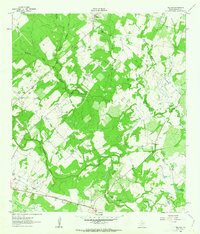 1961 Pilgrim1963 Print · USGSGonzales County’s agricultural landscape is captured here in the early sixties, showing a rural community defined by its waterways and rail connections. Researchers can locate the Clabber Town Cem and follow the Southern Pacific tracks past Pilgrim and Claybottom Lake.2 unique versions available
 - 1961 Map of New Davy, 1963 Print
 1961 New Davy1963 Print · USGSDeWitt County ranch land and rural crossroads are captured here in the early sixties at the intersection of three Texas counties. Researchers can locate family landmarks like Sand Gate Cem and trace the paths of Little Salt Creek and Fifteenmile Creek.2 unique versions available
 - 1961 Map of Gillett, 1963 Print
 1961 Gillett1963 Print · USGSSouthern Texas ranching and oil fields come into focus in the early sixties along the Wilson and Karnes County border. Researchers can trace the SOUTHERN PACIFIC line through Pandora or locate rural landmarks like the MANFORD GAS FIELD and El Negro Ranch.3 unique versions available
 - 1962 Map of Dewville, 1963 Print
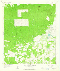 1962 Dewville1963 Print · USGSRanching and early oil exploration define this South Texas landscape in the early sixties. Researchers can trace family-named sites like Wells Ranch, the Sandy Chapel Cem, and the rural settlement of Dewville.2 unique versions available
 - 1962 Map of Dilworth, 1965 Print
 1962 Dilworth1965 Print · USGSSouth-central Texas ranching and farming lands appear here in the early 1960s, defined by the winding course of Peach Creek. Family historians can locate Little New York, St James Cemetery, and the Old Railroad Grade.2 unique versions available
Showing maps 1-25 of 187
Top cities of Gonzales County
Frequently asked questions
- What are the different types of historical maps available for Gonzales County?
- What is the oldest map of Gonzales County?
- Where can I purchase historical maps of Gonzales County for my home or office?
- Where can I download high-res historical maps of Gonzales County?
- Are there historical topographic maps available for Gonzales County?
- Is there historical aerial imagery available for Gonzales County?
- Where are historical maps of Gonzales County sourced from?